Tuesday: Mostly sunny with a slight downtick in temperatures
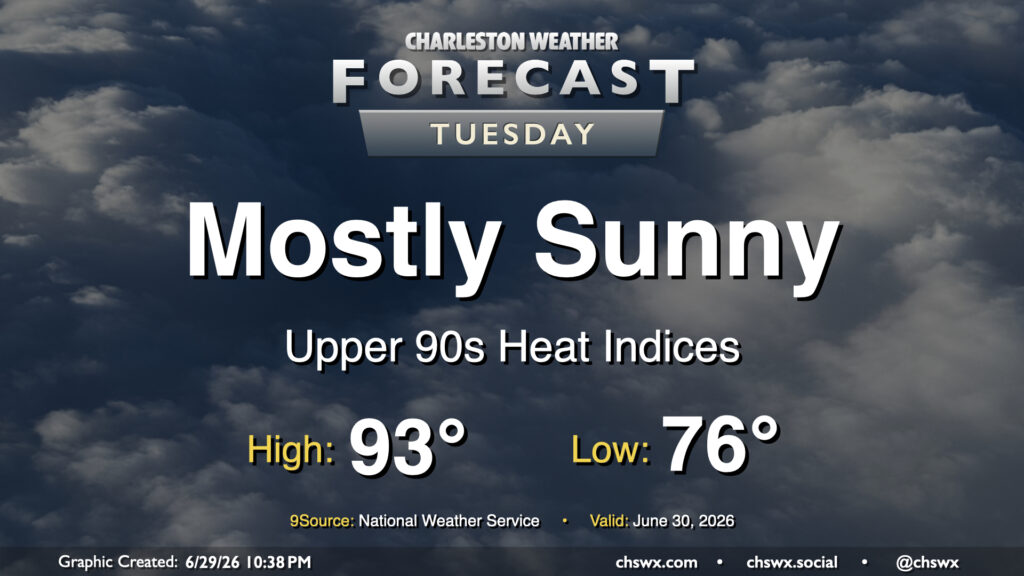
High pressure wedging southward into the Lowcountry and the resulting northeasterly flow will take a slight edge off the heat for Tuesday after another day in the mid-90s on Monday. It’ll still be a steamy start, though, and the low of 78° will get awfully close to the record warm low temperature of 79° set in 2024. We’ll warm into the low 90s in the afternoon, but dewpoints running in the low to mid-70s will drive the heat index into the upper 90s (standing in contrast to the mid-100s we’ve felt the past few days). High pressure ridging in aloft will put a lid on thunderstorm activity, though some of the convection-allowing models still try to squeeze out a few showers in the afternoon. Rain is highly unlikely, though, so don’t count on it.
Rest of the work week: Plenty of sun, seasonable warmth
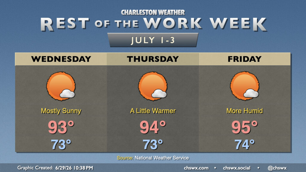
High pressure at the surface and aloft will keep things generally quiet to close out the rest of the abbreviated work week, with high temperatures running a couple clicks on the warm side of normal. The mornings will be warm and muggy, though, with mid-to-upper 70s generally the rule across the area, warmest near the coast. Expect highs in the low-to-mid-90s each day with somewhat lower dewpoints as slightly drier air mixes down. Thunderstorm chances will essentially be nil with the drier air aloft keeping a lid on aspiring air parcels. Getting into Friday, we’ll start to see surface winds go back out of the south, which will send dewpoints back up a couple ticks and make it feel a little more humid. The warming trend will continue, with solidly mid-90s temperatures on tap for Friday.
Independence Day: Turning warmer and even more humid
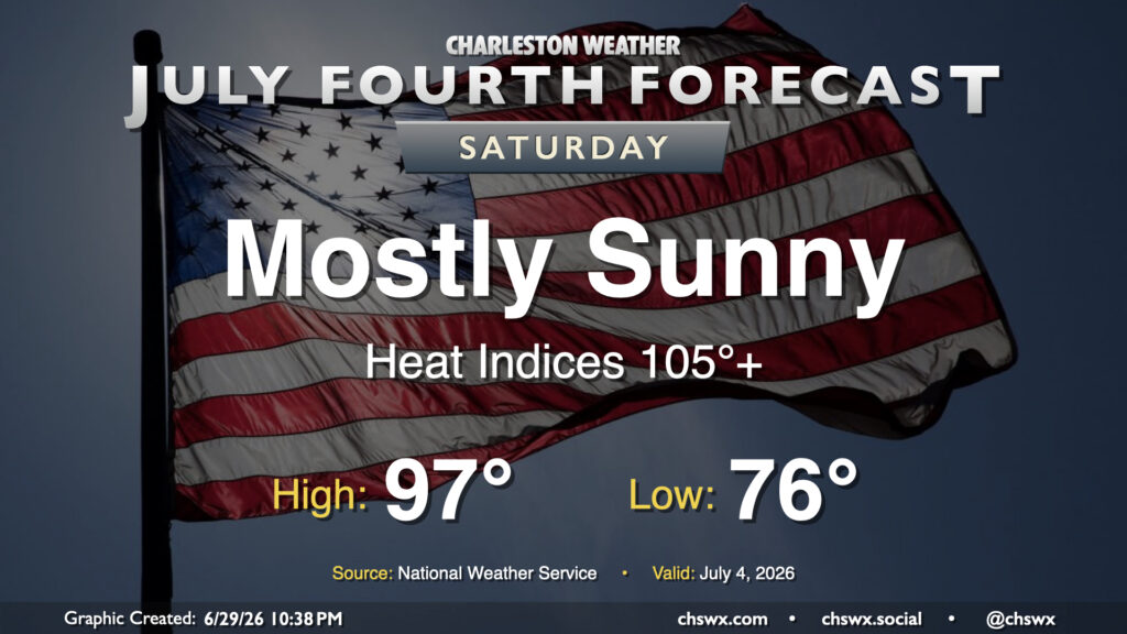
A hot one is in store for the 250th anniversary of American independence as high pressure shifts into the Atlantic. Dewpoints will continue to head up, and the more southerly wind will also turn the heat pump solidly back on. Expect lows in the mid-to-upper 70s across the area to warm to the mid-to-upper 90s in the afternoon, with heat indices running solidly in the 105-107° range. We’ll have plenty of sunshine and no real rain chances to speak of, though, with a little dry air aloft still keeping a lid on things for Saturday.
Follow my Charleston Weather updates on Mastodon, Bluesky, Instagram, Facebook, or directly in a feed reader. Do you like what you see here? Please consider supporting my independent, hype-averse weather journalism and become a supporter on Patreon for a broader look at all things #chswx!