Jared Smith founded @chswx on Twitter in 2008 as an experiment in disseminating weather data through social media. In the ensuing decade-and-a-half, @chswx has provided live coverage of tropical cyclones, tornadoes, severe weather, and even a couple bouts of winter weather to the good people of Charleston, SC.
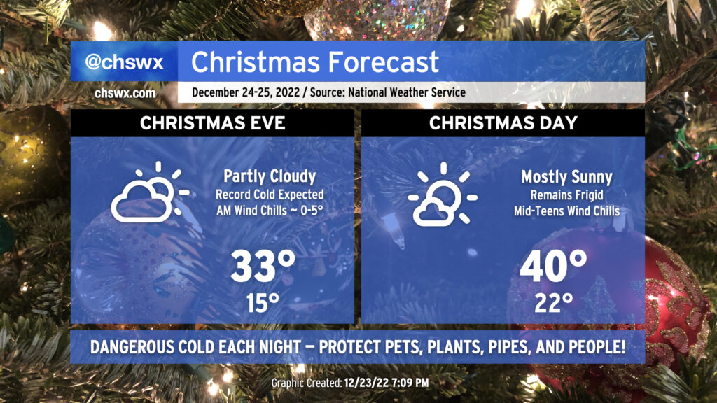
Christmas weekend has arrived, and so has that unreal shot of Arctic air. Temperatures peaked around 56° at 8:49am just before the front passed by the airport. From there, temperatures have been steadily dropping throughout the day as dewpoints headed into the low single digits, making for a very dry feel to the air.
A very potent cold front will be coming through early Friday, bringing strong, gusty winds, dangerous wind chills, and several mornings in a row of pipe-busting cold for the Christmas holiday weekend.
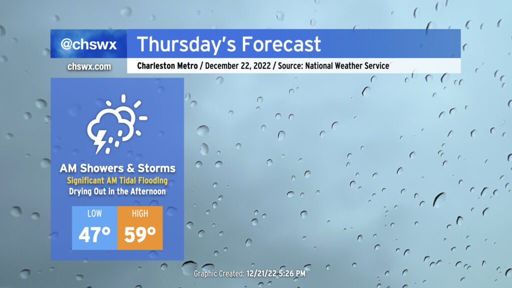
Thursday will bring somewhat complex weather to the Lowcountry with a very soggy start to the day as low pressure moves across the area, followed by a dry slot moving into the area in the afternoon to shut off the rain. Of course, we continue to monitor the progress of an incredibly potent Arctic cold front as it progresses across the country, with it expected to clear our area on Friday.
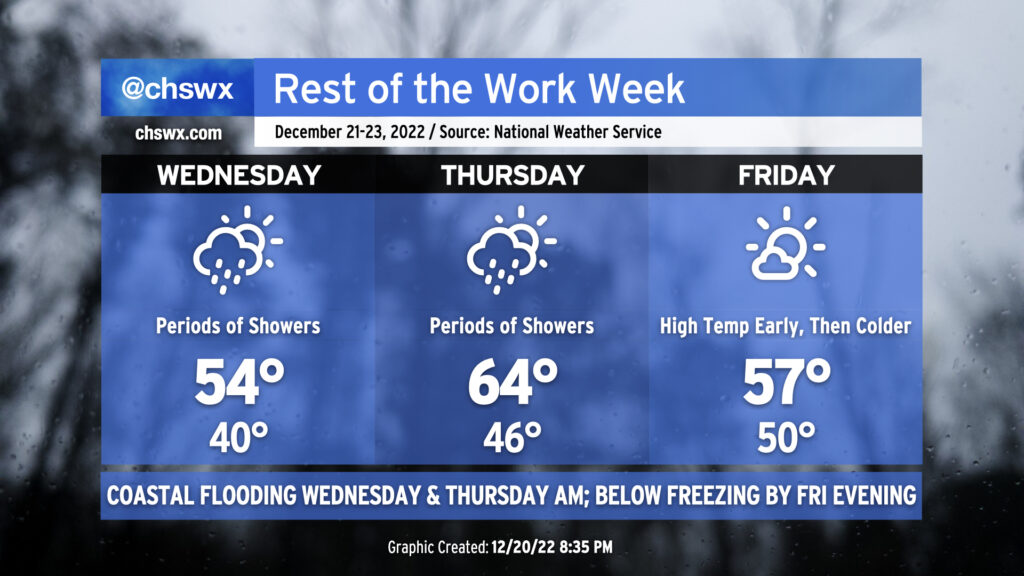
Wet weather will continue on and off through early Friday before an outbreak of Arctic air brings much colder air and strong winds to the area for Christmas weekend.
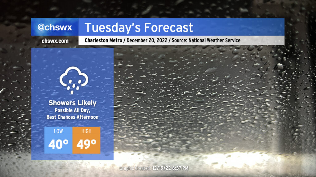
Tomorrow’s forecast, personally speaking, gives me the ick. High pressure wedging southward and moisture running atop of it thanks to low pressure to our south will help generate a chilly, cloudy, and at times rainy day in the Lowcountry tomorrow. We are already starting to see cloud cover thicken tonight primarily in the mid- and upper levels as of this writing with rain encroaching into southeast Georgia. Expect showers to build as the day goes on, with maybe ¾-1″ of rain possible before it’s all said and done.
Rain falling into the wedge will keep temperatures quite chilly tomorrow. Lows in the low 40s will struggle to the upper 40s in the afternoon at best, with the immediate coast maybe touching 50°. The northeasterly breeze will make it feel even cooler at times, with wind chills in the upper 30s falling to the mid-30s by evening. Overall, Tuesday’s a good day for soup, chili, or whatever else comforts you when the weather outside is gray and rainy.
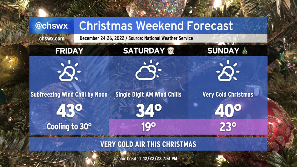
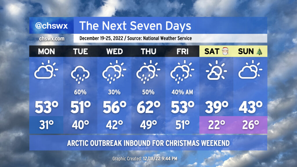
The week ahead will be primarily unsettled before an outbreak of Arctic air overspreads the area for Christmas weekend, bringing the coldest temperatures so far this season with potentially hazardous wind chills on Saturday morning.
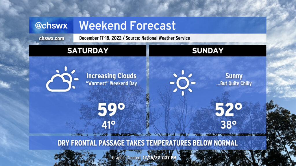
Not too much to write home about in the weather department this weekend except make sure you’ve got your hoodies and sweaters freshened up and ready to go. Saturday will be the “warmest” day of the weekend, with highs topping out around 60° after lows in the low 40s start the day. (West winds around 5 MPH will make it feel like the upper 30s.) Clouds will be on the increase as a relatively moisture-starved cold front approaches the area during the day.
Said front will pass through overnight, which will scour out cloud cover in time for Sunday. Temperatures will start a few degrees cooler — generally in the upper 30s with wind chills in the mid-30s — Sunday morning, but cold air advecting in from the northwest will keep high temperatures in the low 50s despite full sunshine.
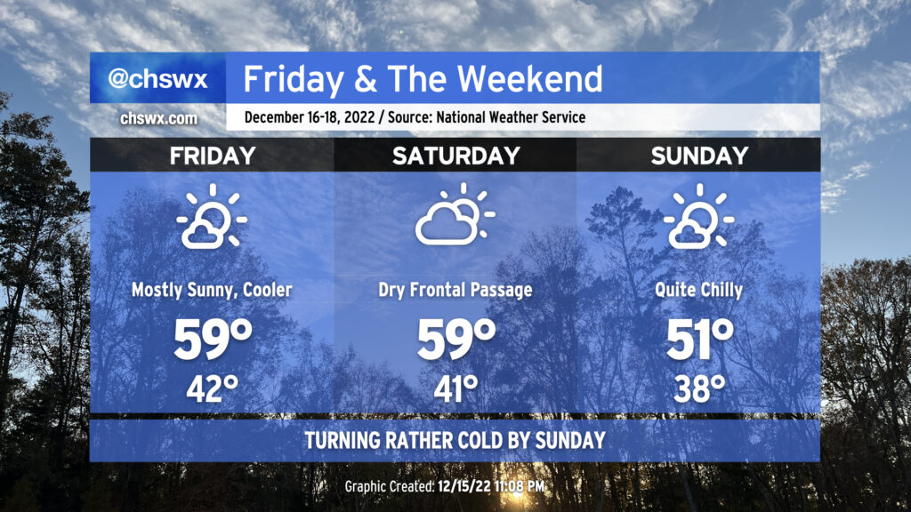
We have a rain-free Friday and the weekend on tap as high pressure generally takes control. It’ll be noticeably cooler as we start Friday in the low 40s on our way to highs in the upper 50s to around 60° with mostly sunny skies. Expect similar temperatures for Saturday with increasing cloud cover in the afternoon as a reinforcing shot of cold air pushes through the area. (There will be too much dry air for precipitation with this front, though.) That’ll lead us to a rather chilly Sunday by any measure — lows in the upper 30s run on the cold side of normal for this point in the year, but the expected high of 51° is cold for our neck of the woods by any measure, and even moreso when you consider that we’ll have almost full sunshine! Suffice to say, it’ll be an excellent weekend for hoodies and sweaters of varying degrees of ugliness.
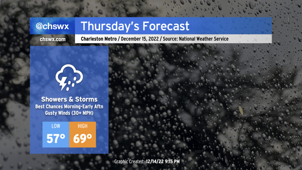
A warm front is lifting north across Georgia and South Carolina this evening, which will make for a warmer and more muggy day for Thursday ahead of a cold front. I’d anticipate that the forecast morning low of 57° will be set closer to midnight, followed by temperatures heading into the 60s by daybreak, topping out around 70° in the afternoon. Gusty winds will precede the front even outside of any thunderstorms — watch for gusts 30-35 MPH to potentially cause some havoc with Christmas decorations. We can expect a few showers and maybe even a thunderstorm or two overnight into the morning ahead of the main frontal band.
The timing of the front and the extent of morning shower activity will act as a governor on any severe weather threat that could develop. Shear looks good, but instability is the question mark. Still, a few storms with gusty straight-line winds are possible, and there’s even the risk for a few of these storms to rotate. Keep an eye on the weather Thursday, particularly mid-morning through early afternoon, for any possible watches or warnings that might need to be issued.
We should be rid of the rain by evening — some of the faster guidance coming in this evening even has it out of here by mid-afternoon, with some sunshine breaking out before the day’s over — with temperatures falling into the 50s by 8 PM as cooler and drier air moves in behind the cold front.
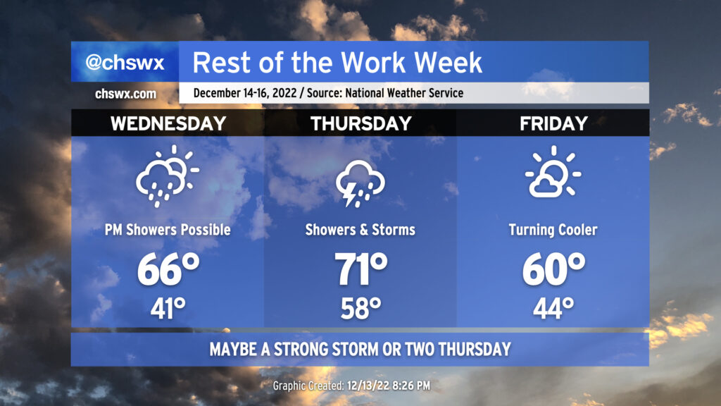
The main character in the weather story for the rest of the work week will be a potent storm system barreling across the eastern half of the country, bringing with it some showers, maybe some thunderstorms, and almost certainly some cooler air for Friday heading into the weekend.