Jared Smith founded @chswx on Twitter in 2008 as an experiment in disseminating weather data through social media. In the ensuing decade-and-a-half, @chswx has provided live coverage of tropical cyclones, tornadoes, severe weather, and even a couple bouts of winter weather to the good people of Charleston, SC.
We’re off to a very chilly start this morning in the Lowcountry as Arctic air has once again taken residence in the eastern half of the country. But as it goes in March, just wait five minutes and it’ll change.
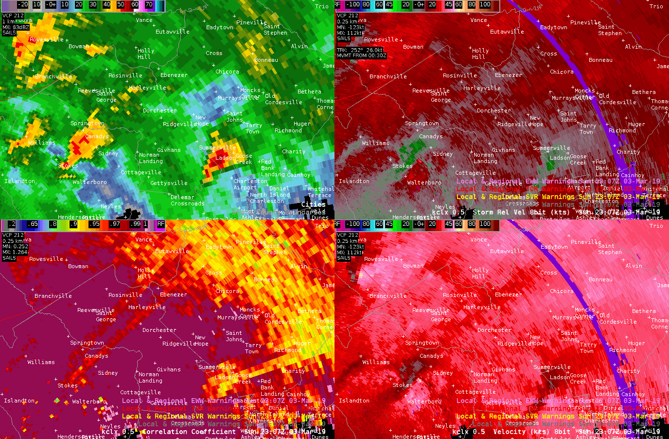
Four-panel radar view of a tornado-warned supercell that went through Ridgeville. No tornado has been confirmed as of this writing. Click for full resolution.
Today was a very bad weather day for a lot of people in Alabama, Georgia, and South Carolina. Fortunately, we return to much calmer conditions for Monday.
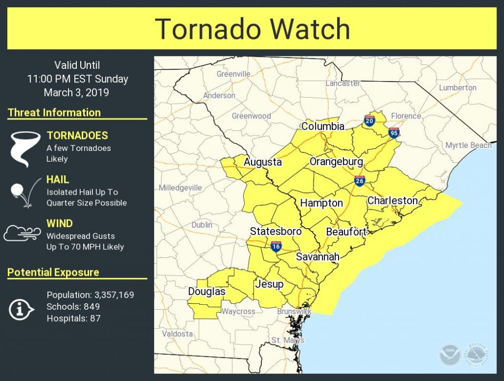
We in the Charleston weather community are watching the potential for a few damaging wind gusts and possibly tornadoes this afternoon into tonight as a cold front approaches the area.
Sunday may represent our first good shot at thunderstorms so far in 2019. However, a few of those could be on the strong side with gusty winds, especially for those of you who are a little further inland (think Berkeley and Dorchester counties). Let’s dig in…
Forecast for February 27, 2019 from the National Weather Service.
Today marks the beginning of an unsettled period for the Lowcountry, as rain chances will remain with us for much of the next seven days. This will be some much needed rain, though, as we are running a little behind for the year thus far.
Forecast for Monday, February 5, 2019. Source: National Weather Service
Welcome to a very refreshing Monday morning as we start the day in the low 40s with plentiful dry air, which will make for a very nice and sunny day in the Lowcountry. Enjoy today and tomorrow as we head back into unsettled territory to bring in March.
It’s a beautiful day for love in whatever form you express it.
We’ve got a nice Valentine’s Day coming up — at least weather-wise. (How nice your Valentine’s Day ends up being will largely be determined by other factors.) However, an unsettled pattern with periods of showers awaits us for the weekend.
Forecast for Thursday, February 7. First 80°+ day of the year!
The warmest day of #FakeSpring is upon us, with highs expected to top out in the low 80s away from the beaches, which will remain much cooler under the influence of water temperatures in the 50s. The NWS forecast high of 81° would be a new record for the date.