Jared Smith founded @chswx on Twitter in 2008 as an experiment in disseminating weather data through social media. In the ensuing decade-and-a-half, @chswx has provided live coverage of tropical cyclones, tornadoes, severe weather, and even a couple bouts of winter weather to the good people of Charleston, SC.
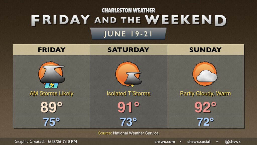
Unsettled weather continues as the remnants of short-lived Tropical Storm Arthur move across GA and South Carolina late tonight into early Friday. From there, more typical summertime weather sets in.
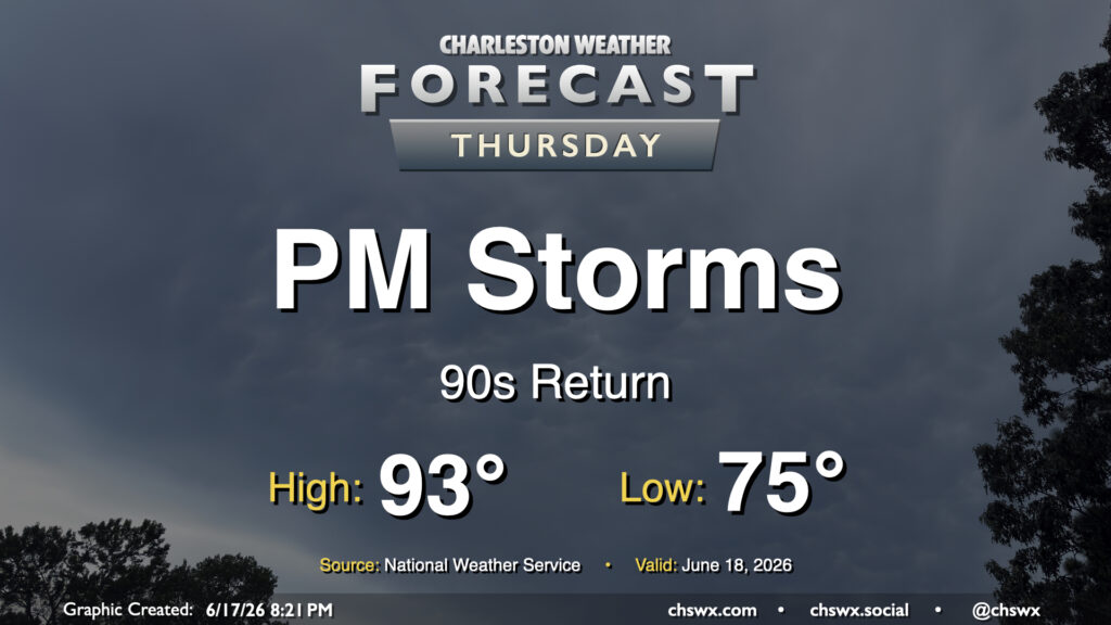
We’re back in the 90s on Thursday as we get a brief lull in between disturbances, but showers and thunderstorms will return in the afternoon and evening as a slug of moisture from what we expect will be the remnants of Tropical Storm Arthur, which was christened earlier today, There will be a risk for a storm or two to produce some damaging wind gusts, but the overall severe weather threat this far to the east is fairly marginal. Will keep an eye out, though.
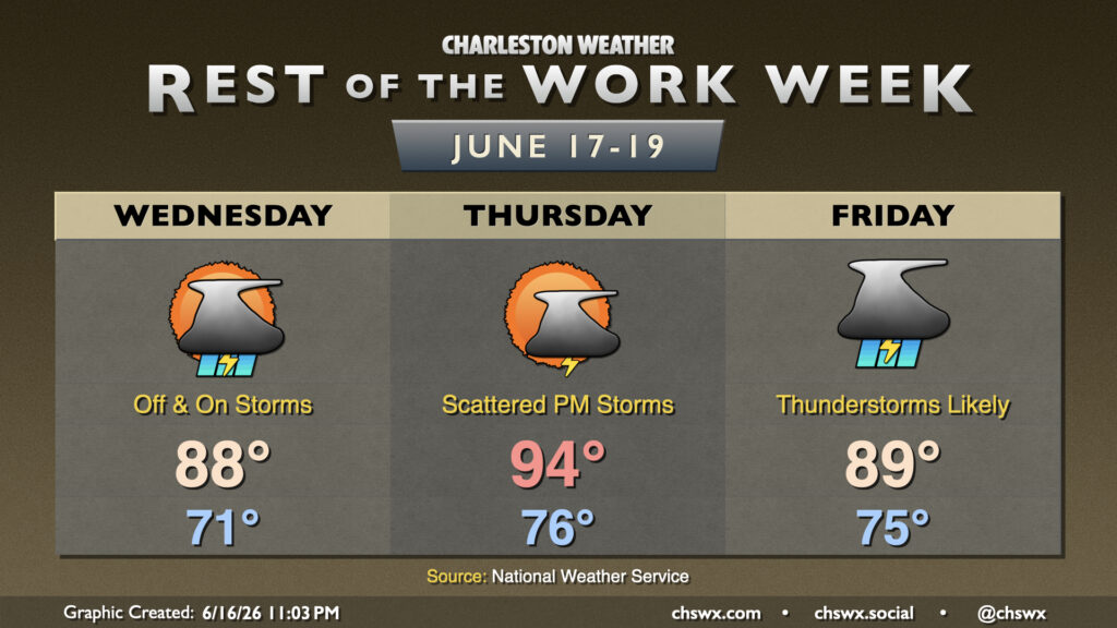
Unsettled weather sticks around for the rest of the work week as disturbances continue to move across the area, with a shot of tropical moisture enhancing rainfall heading into the weekend.
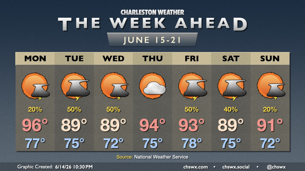
Fairly standard summertime weather continues for the week ahead, though we shouldn’t run quite as hot as we did this past weekend, with no record highs in jeopardy of being toppled this go-around.
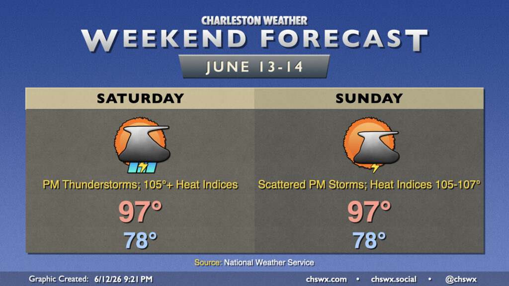
Heat, humidity, and chances for afternoon thunderstorms continue into the weekend, with the potential for not only record high temperatures but also record warm low temperatures each day.
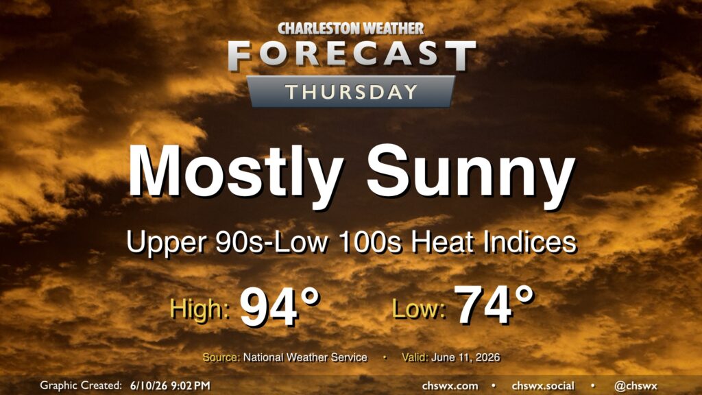
High pressure remains in control across the area, limiting afternoon thunderstorms and allowing heat to continue to build on Thursday. We’ll start in the mid-70s, warming to the mid-90s in the afternoon. Mix in dewpoints in the low-to-mid-70s and that will yield heat indices approaching or even slightly exceeding 100°. And while a brief popup sbower is never fully out of the question this time of year, the vast majority of us will stay rain-free.
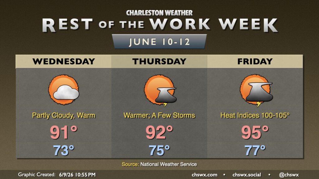
Heat and humidity will continue to build as we head down the home stretch of the work week. We’ll also start to see an uptick in shower and thunderstorm chances as well, which should bring at least a little relief.
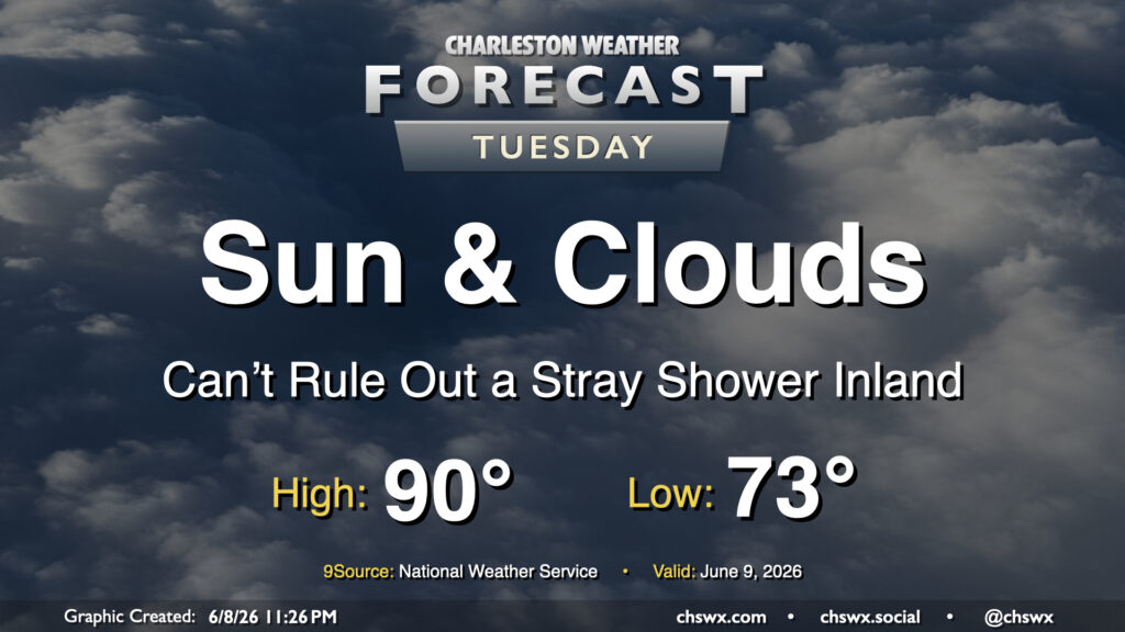
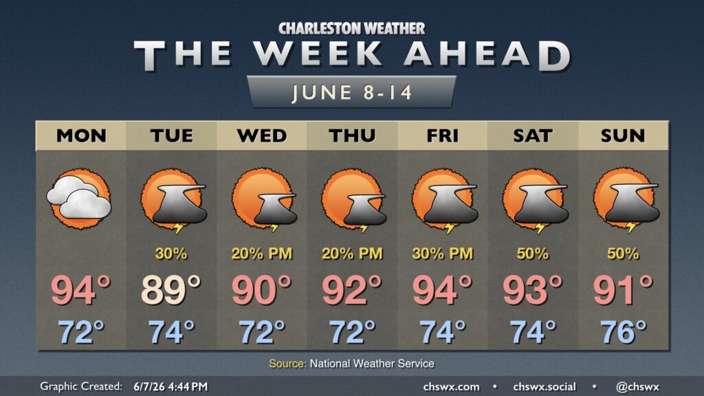
High pressure at the surface and aloft remain the main weather drivers heading into Tuesday, keeping us on the warm and humid side. We’ll start the day in the low-to-mid-70s, warming to around 90° in the afternoon. A weakening front to the north could kick up some stray showers generally for inland Berkeley, but the ridge aloft will likely keep a lid on more robust thunderstorm development. A similar setup will persist Wednesday before the ridge flattens out a bit, allowing for more shower and thunderstorm development getting into late week.
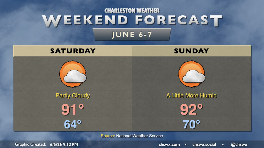
This weekend will be warm and a little more humid as surface high pressure moves into the Atlantic, sending winds more southerly behind it which turns the moisture tap back on. We should stay quiet, though, with ridging aloft and a pretty solid pocket of dry air hanging in there for a couple more days. We’ll see some clouds at times, particularly of the high variety, but otherwise expect plenty of sunshine to still break through for the weekend. Temperatures Saturday start in the mid-60s, warming to the low 90s in the afternoon, while Sunday feels much more like summer with a low around 70° and highs in the low 90s.
Rain chances gradually return as we get into the start of next week; these will generally be of the popup variety. Highs Monday top out in the mid-90s, while upper 80s to around 90° will be more common through the middle of next week.