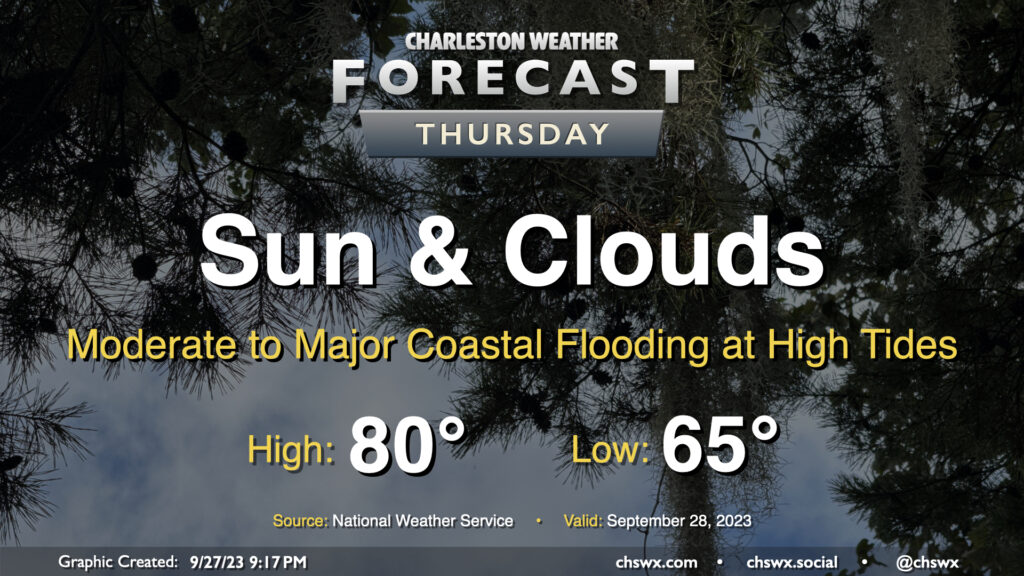
Rain will generally be a non-factor in our weather starting Thursday (except for maybe some brushes near the coast) heading into Friday and the rest of the weekend. We start the day around 65° with some cloud cover in the area. A northeasterly breeze courtesy of high pressure wedging into the area from the northeast will continue to keep temperatures down to about 80° at warmest in the afternoon with cloud cover hanging around. We should see some sun break through at times as well, though.
The main weather concern will be coastal flooding at times of high tide, and it could be somewhat disruptive to the morning commute in particular. High tide around 7:30am will top out around 7.9′, which is the high end of moderate flood stage in Charleston Harbor. The evening high tide should reach even higher, with water levels around 8.1′ expected around 8pm. Watch for road closures as you commute Thursday morning and then again a little later Thursday evening, particularly if downtown is in your plans.
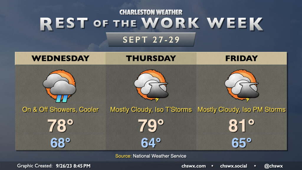
High pressure wedging into the area will keep us on the somewhat cool and cloudy side for the next few days, with shower chances peaking Wednesday before tapering off for Thursday and Friday (though cloud cover and the occasional shower or storm will linger). Highs on Wednesday and Thursday shouldn’t get out of the upper 70s, while we may trend a little warmer Friday as some drier air begins to work in and a little more sunshine becomes possible.
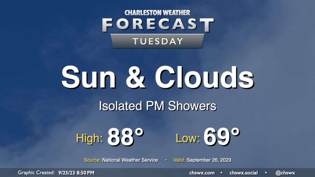
We have one more day of the upper 80s in store before changes arrive in the form of a wedge of high pressure building in from the northeast for the rest of the week. Tuesday starts in the upper 60s inland to perhaps mid-to-upper 70s closer to the coast. Highs then head into the upper 80s once more, and with dewpoints edging up into the upper 60s, it’ll feel closer to 90° or so. From there, clouds will increase and a few showers should break out in the afternoon, though nothing over-the-top is really expected. There may be a rumble of thunder late, but overall, not expecting much in the way of lightning. Shower chances continue into the evening, and really for much of the rest of the work week from there.
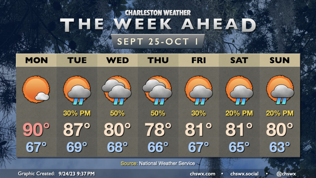
We may be past the autumnal equinox, but Monday clearly looks to have missed the memo as it brings back a bit of summer before temperatures fall back below normal later this week. Dry air will keep skies mostly clear, and a bit of shortwave ridging will help highs top out around 90° in the afternoon after starting the day in the upper 60s to around 70° at the coast. From there, though, changes will be afoot as high pressure anchored in New England starts to wedge into the area beginning Tuesday. This will drive high temperatures from the mid-80s on Tuesday to the low 80s by Wednesday, with below-normal highs lasting into the weekend. A trough developing offshore will help keep shower chances in play for much of the week, primarily in the afternoons, though it’s worth noting that we’ll likely get some sunshine in as well at times. Northeasterly winds will turn breezy as we head into the second part of the week, and this could drive some coastal flooding concerns through the weekend. Some of the guidance is spitting out some fairly high tides, but it’s also worth noting that this guidance isn’t really that awesome and often goes to extremes. Keep an ear out for Coastal Flood Advisories from the National Weather Service.
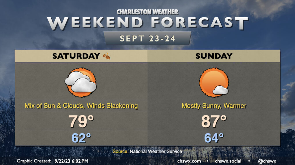
We’ll continue to deal with the fringes of Tropical Storm Ophelia on Saturday, though the weather will be gradually improving as time goes on. We’ll see a mix of sunshine and cloud cover, and northwest to westerly winds will still be a little elevated. However, as the day goes on and Ophelia moves further away, we’ll see those winds slacken and some of that cloud cover begin to break a little. The cooler and drier air wrapping around Ophelia will keep temperatures on the low side, with highs topping out in the upper 70s after a comfortable start in the low 60s.
Ophelia will have exited the weather picture on Sunday, and we’ll see much more sunshine and, overall, a warmer day as a result. Expect highs to top out in the mid-to-upper 80s after starting the day in the mid-60s. Winds will have backed down to generally light speeds, too, making for a nice day to get outside a bit. Try to take advantage, if you can!