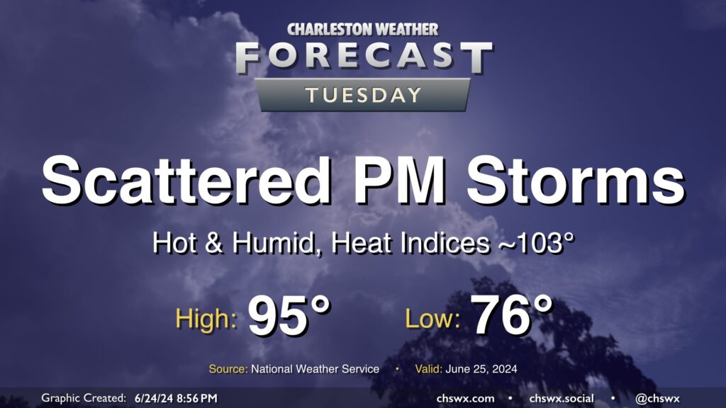
Another hot summer day lies ahead for Tuesday, with just a few of us possibly seeing some relief from thunderstorms in the afternoon. We start the day in the mid-70s, warming to the mid-90s in the afternoon. Dewpoints in the low to mid-70s will make it feel closer to 103° at times, with even warmer heat indices possible in the wake of the seabreeze.
As mentioned, a few thunderstorms will be possible with a stalled front in the area, but not everyone will see a storm. A stronger storm or two can never be ruled out this time of year, but there is not a widespread risk for severe weather.
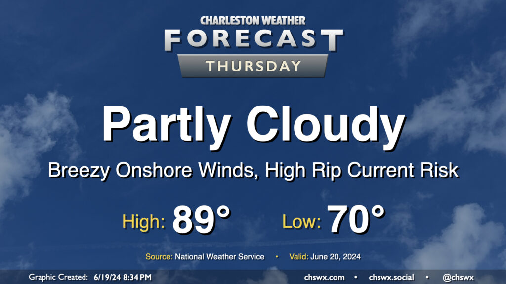
Thursday looks to remain mostly quiet over the area, though a few showers will be possible near the coast once again during the morning as showers within onshore flow reach land and dissipate in drier air. We start the day around 70° and warm to the upper 80s in the afternoon, much like the past few days. If you’ve been enjoying the somewhat lower-humidity mornings that we’ve had lately, enjoy this tomorrow morning because we’re shifting back into more traditional mid-to-late-June dewpoints starting Friday.
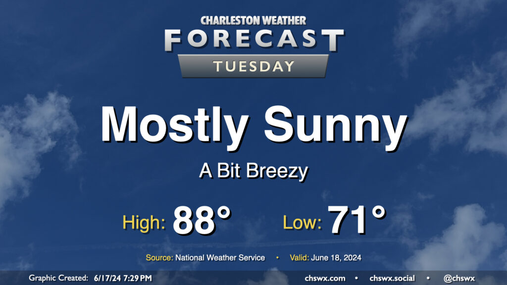
We’ve got one more generally quiet day of weather coming up for Tuesday before turning a little more unsettled heading into the second half of the week. Temperatures will remain around if not a touch below normal as a solid onshore breeze keeps us on the “cool” side. We’ll see a few clouds from time to time, but overall, expect a mostly sunny day. The only downside to the onshore flow will be a moderate risk of rip currents at the beaches, so be alert if you are going to be heading into the surf.
Thursday could feature a few showers and storms brushing the coast as low pressure tries to organize along a stationary front that’s been lingering offshore for the past few days. It’ll otherwise be a fairly standard warm June day — lows in the low 70s yielding to highs around 90° in the afternoon under a mix of sun and clouds. Dewpoints in the upper 60s will help keep heat indices from getting too far out of hand, thankfully.
It’s a low bar to clear, but Tuesday will be much quieter than Monday was weather-wise as drier air noses in from the northeast. This should be enough to keep storms, much less significant cloud cover, at bay for a day. We start the day in the upper 60s to around 70°, warming to about 90° in the afternoon under mostly sunny skies. Unfortunately, we’ll need the good weather for some cleanup after severe storms brought large hail and damaging winds to the Summerville area on Monday evening.
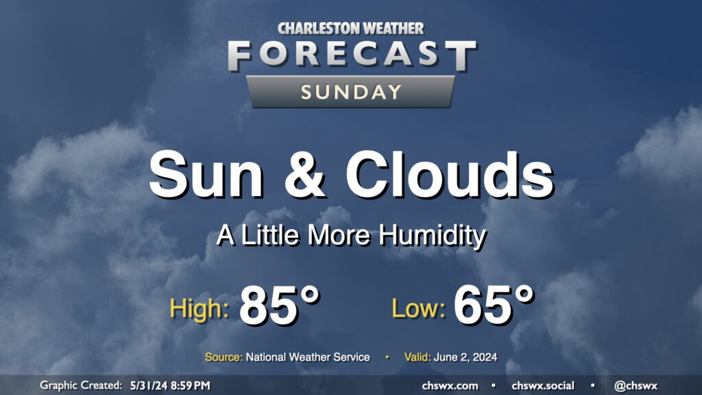
Humidity continues its slow climb on Sunday as onshore flow from the Atlantic gradually sends dewpoints higher. Most of us should stay rain-free, though some guidance does show the potential for a few showers to brush coastal areas in the morning. There’s also the risk for a few popup storms generally near I-95 in the afternoon, but the vast majority of the Charleston metro stays rain-free.
Temperatures head to the mid-80s after a mid-60s start. As alluded to earlier, dewpoints will continue to creep upward, generally remaining in the low 60s. This’ll yield relative humidity values generally in the 45-50% range — still far from horrendous, but you might notice a little more sweat.
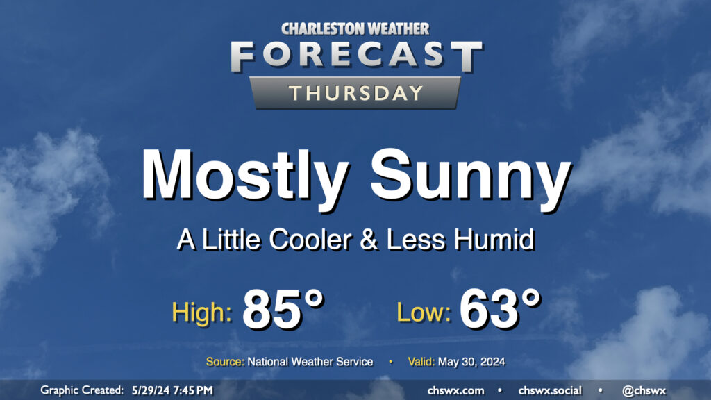
A dry front is getting through tonight, and that will open the door for a really pleasant ending to May. Temperatures start in the low-to-mid-60s, which is a few degrees below normal for May 30. We’ll warm to the mid-80s in the afternoon under mostly sunny skies, right near climatological norms for this point in the year. Dewpoints will mix out to around 50° during the day, which should keep the warmth more on the comfortable side than not.
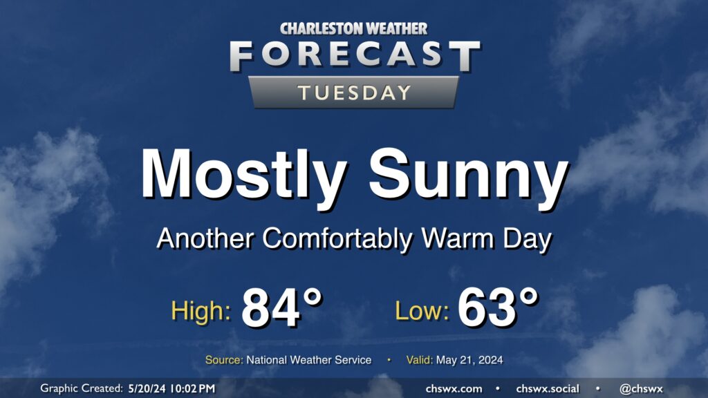
We have another nice day ahead Tuesday. We’ll start the day in the low 60s once again, with highs topping out in the low-to-mid-80s under mostly sunny skies. It’ll be a touch breezy, with winds out of the northeast once again around 10 MPH, but this is what’s keeping us a little on the cooler side, so we’ll take it.
The only weather concern will be the risk for water levels peaking in minor flood stage again with the Tuesday evening high tide. Minor coastal flooding looks probable between 7-9 PM with water levels peaking around 7.1’. It’ll be enough to cover the more vulnerable roads once again with salt water, but it won’t be a widespread issue.
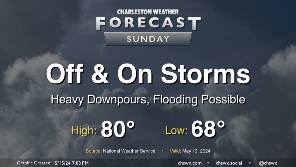
Another round of showers and thunderstorms is expected on Sunday. A stalled cold front will cut down on the surface-based instability, so severe weather is not expected, but there’s still quite a bit of moisture around and a mid-level trough hanging right overhead. This will be enough to kick up more showers and thunderstorms, with heavy rain the main concern. The NWS forecast is for generally around 1-2” of rain tomorrow, with isolated spots receiving upwards of 3-4” in the heaviest rains. A flooding threat could result, causing travel to become treacherous at times. We’ll want to keep an eye on this throughout the day — stay tuned.
Temperatures behind the front will top out just around 80° after a muggy start in the upper 60s. Highs will remain tempered by ongoing showers and thunderstorms as well. Stay dry!
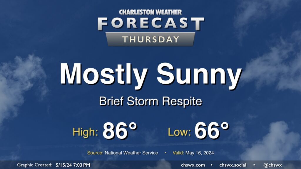
Thursday brings us a brief respite from the periods of storms that have punctuated the past few days as high pressure builds in. Temperatures start in the mid-60s, warming to the mid-80s in the afternoon. Dewpoints will run a couple degrees cooler than they did on Wednesday, so it won’t feel quite as humid.