A cold front will move through and stall out nearby on Tuesday, allowing drier air to mix into the area. This will largely suppress cloud cover and will help drive temperatures to the mid-90s in the afternoon; fortunately, the drier air mixing in will also keep dewpoints reasonably in check, so heat indices will only top out around 96°-98° or so.
A few thunderstorms will still be possible very early Tuesday morning, but widespread severe weather does not look to be an issue. Still, there’s a small chance you could be woken up overnight, especially the further north you go.
Sunday will be a much more traditional warm and somewhat muggy June day across the Lowcountry than we’ve felt for much of the month, really. We start the day in the low 70s before temperatures warm into the low 90s under mostly sunny skies. Kick in some humidity and it’ll feel closer to 95° in the afternoon at peak heating. It looks quite unlikely that a shower or storm will develop, though it can never be totally ruled out in the summertime. Suspect it’ll be another day full of Instagram stories from the beach. Use that sunscreen as the UV index will be a solid 10.
Thursday will be another active weather day across the region as a warm front draped across SC interacts with low pressure aloft to generate numerous showers and thunderstorms. A few of these storms could be on the strong side, with damaging wind gusts the main concern, though some hail can’t be ruled out either. Highs on Thursday top out in the mid-80s before storms get rolling once more. It won’t rain all day in any one spot, but when it does, it could be quite heavy. Keep rain gear handy, allow additional travel time, and keep an ear out for flood advisories as well.
Showers and thunderstorms remain in the forecast for Tuesday and beyond as a Rex block (high pressure to the north, low pressure to the south) sets up across the area, feeding in plenty of moisture and sufficient forcing to keep things quite unsettled. Expect the day to start out in the upper 60s to around 70° before warming to about the mid-80s before storms get going. There’s the potential we could even be dealing with some showers and storms advancing through the area in the morning if some of the high-resolution guidance is correct, too, but the best chance for showers and thunderstorms will arrive in the afternoon. Bottom line: Keep the rain gear handy throughout the day, and be patient getting to where you’re going.
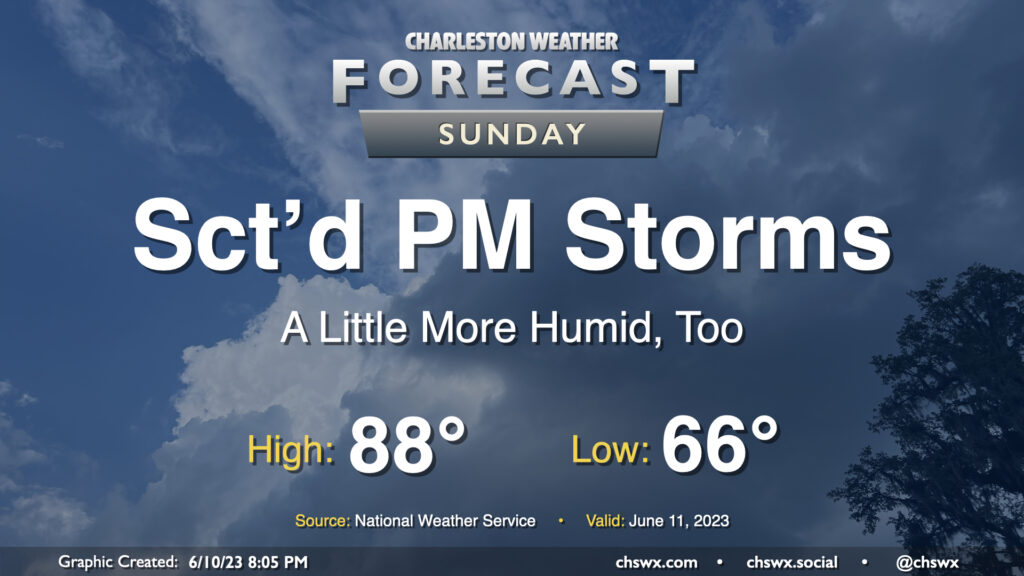
We have another warm day in store for Sunday, though with a better shot at an afternoon or evening thunderstorm. We start the day in the low 70s before warming into the upper 80s with a little more humidity than we saw on Saturday. (Hopefully a little less smoke, too.) Temperatures could feel a little warmer, generally around 90° or so, when factoring in the humidity.
With a little more available moisture, so it goes with instability. We could see the seabreeze get a little more active than it did on Saturday across the area, with scattered showers and thunderstorms possible in the afternoon and evening hours. Not everyone sees storms, so don’t cancel plans — just be ready to move indoors if a thunderstorm approaches.
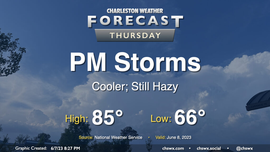
Another round of scattered to numerous showers and thunderstorms is expected Thursday, particularly in the afternoon and evening as daytime heating and some upper-air help kicks in, though a shower or storm will be possible for much of the day. Before storms fire, expect to start the day in the upper 60s, warming to the mid-80s under a mix of sun and clouds. Dewpoints around 70° will yield heat indices around 90°.
The risk for severe weather is looking a little lower than it did on Wednesday, with the best risk displaced to the south, but a storm with a damaging wind gust or two and some hail can’t totally be ruled out.
More showers and thunderstorms are in the forecast for Tuesday afternoon and evening as a stalled front hangs around the area. First, though, we’ll start the day in fine June fashion with lows around 70° in the morning. Temperatures should head to about 90° in the afternoon before thunderstorms fire. Dewpoints in the mid-60s should yield heat indices around 92° — nothing totally out of hand for this point in the year, but certainly steamy.
I hope y’all enjoyed the relative dearth of humidity on Saturday — it was a rare June day in the Lowcountry where the heat index was cooler than the air temperature — because humidity will return to the area during the day Sunday as a warm front lifts north of the area. We start the day in the mid-60s before warming into the upper 80s; dewpoints heading back into the upper 60s will make it feel more like the low 90s at the height of the heat of the day. From there, we should start to see scattered showers and thunderstorms develop and move eastward across the area. Instability and shear aren’t super-great, so the risk for any severe storms looks limited — but remember, all thunderstorms are dangerous because of the lightning they produce. Regardless, it doesn’t look to rain all day at any one location — as always, just make sure you have an indoor backup plan for outdoor activities.
Our string of stormy afternoons looks to continue on Thursday as a cold front slowly moves through the area. Showers could fire as early as mid-morning, but the better chance of thunderstorms arrives in the afternoon and evening hours as we get some daytime heating in place. Much like the past two days, a few storms could produce gusty winds and hail, so be on the lookout for quickly changing weather conditions and be ready to move indoors quickly if storms approach.
With the front in the area, highs will top out somewhat lower than Wednesday’s 92° — expect generally mid-80s across the region before thunderstorms fire in the afternoon. We could run a little warmer — or cooler — depending on how fast the front gets south of here. (That could also modulate our thunderstorm chances a bit, too.)
Finally, there are no air quality concerns with the ongoing wildfire smoke that is being transported south into the eastern United States from Quebec, though we will continue to see a milky haze in the sky, which should persist into the weekend.
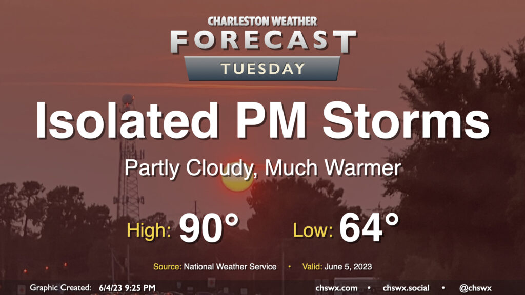
June makes a triumphant return on Tuesday as high pressure slips offshore and winds go southwesterly, transporting more warm and humid air into the area. Temperatures should reach 90° after a mid-60s start under partly cloudy skies. We should see a few isolated storms pop up in the afternoon as the seabreeze makes its inland trek. A strong pulse storm with gusty winds and maybe even a little hail can’t be totally ruled out given decent instability; this will be most likely near outflow boundary collisions.
There will be a risk of some minor coastal flooding around the 10:58 PM high tide, but the westerly component to the wind will make this a much more limited threat compared to the past few days. Still, watch for some salt water around the Citadel and on Lockwood late Tuesday evening.