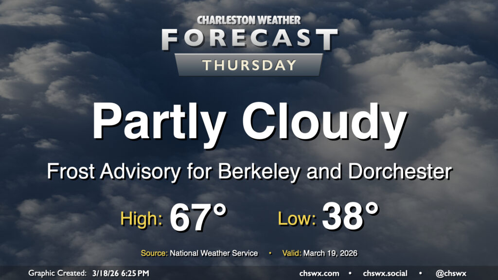
Another frosty start awaits for Thursday as temperatures fall to the upper 30s in the metro and a little lower across inland locations. Calmer winds and higher dewpoints will allow for frost formation overnight, particularly in Berkeley and Dorchester counties where a Frost Advisory is in effect through 9am. From there, it’ll feel much warmer than it did on Wednesday, with highs expected to peak some 10° warmer Thursday afternoon, generally in the mid-to-upper 60s. Cloud cover will be a bit variable, but generally expect a fair bit of sunshine throughout the day with no concerns for precipitation.
Thankfully, the atmosphere did not live up to its potential on Monday, leaving us to get some much-needed rain without any of the shenanigans that we thought might come with. The cold front is through now, and temperatures will be falling into the mid-30s overnight in the metro, with subfreezing temperatures expected further inland, perhaps in parts of Berkeley and Dorchester counties. Elsewhere, frost shouldn’t be much of a factor given elevated winds continuing overnight.
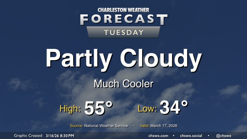
Temperatures will only peak in the mid-50s on Tuesday despite plenty of sunshine, owing to the potency of the cold airmass.
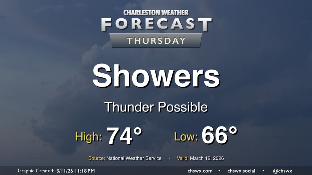
After a new daily record high of 89° was set at the airport on Wednesday, changes are forthcoming as we head into Thursday as a cold front approaches the area. We will start the day quite warm — record warm low temperatures are not out of the question — with lows in the mid-60s at coolest. Temperatures will then head into the mid-70s before a band of showers and thunderstorms approaches the area by mid-morning. Brief periods of heavy rain are possible, but storms will be moving quickly, so no concerns about too much rain in one location. Any rain we can get remains helpful as severe drought continues across the Lowcountry. There could be some thunder, too, and a few strong thunderstorm wind gusts can’t be totally ruled out as the line gets through.
The front will sweep the moisture and warm airmass offshore by evening, and temperatures will drop quickly into the 50s in its wake. If you are out and about Thursday evening, keeping a light jacket close by may not be the worst idea!
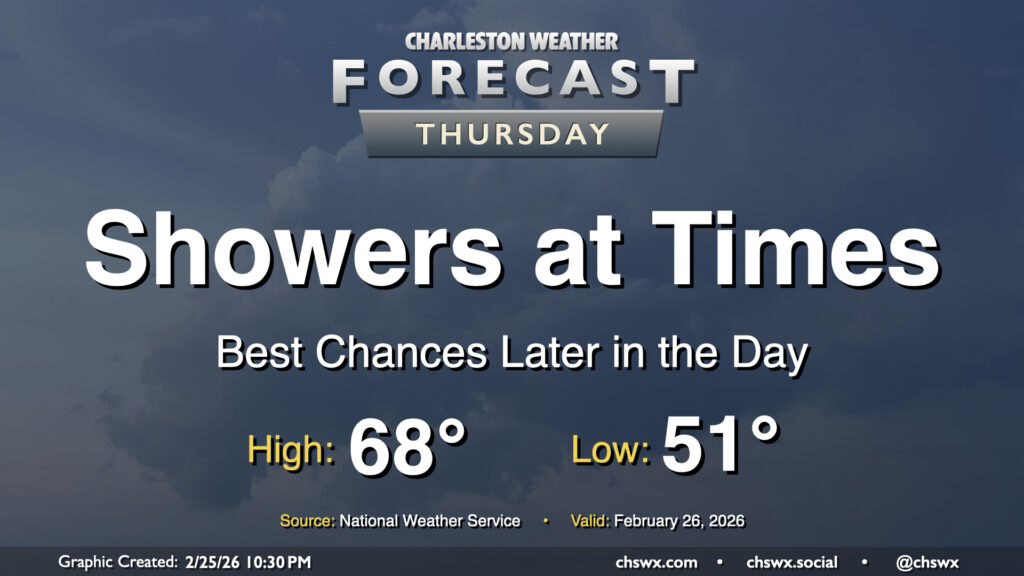
Showers return to the area on Thursday as energy aloft moves across the region ahead of a slow-moving cold front. The best chance for rain will arrive later in the day, and will stick with us into Friday. Temperatures Thursday start on a much more mild note — generally expect lows to fall to the low 50s in the morning, with highs peaking in the upper 60s in the afternoon.
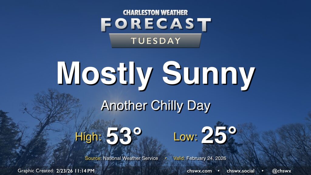
Our cold snap continues Tuesday as lows bottom out in the mid-20s in the morning. Winds will remain a touch elevated with the lingering pressure gradient between the high to our west and the nor’easter pulling away from New England, so wind chills will be a factor, perhaps briefly dipping into the teens (but not long enough for a Cold Weather Advisory, per NWS). Temperatures will run a few degrees warmer than they did on Monday, but that’s not saying much as Monday’s high only peaked around 48°. We can at least expect another day of mostly sunny skies with the cool and dry airmass still in place. Temperatures turn back up starting Wednesday as a cold front approaches the area; we should be in the 70s again by Thursday, and shower chances return for Friday.
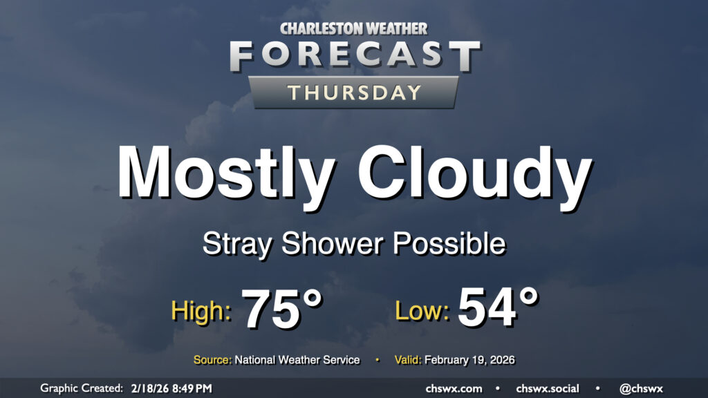
We’ll see more in the way of cloud cover and maybe even a few showers on Thursday, but that won’t stop temperatures from getting back to the mid-70s after a warm-for-February start in the mid-50s. Deep southwesterly flow will continue to pump warm and moist air into the area, and as temperatures warm into the 70s, this could spawn a few popup showers (not something we often say in February!) along with gusts around 20-25 MPH.
A warming trend kicks off Tuesday as high pressure moves overhead and eventually offshore. It’ll be quite a nice day after we start around 40° in the morning; temperatures will head well into the 60s by afternoon with plenty of sunshine to be had and comfortable relative humidity values. Winds won’t be quite as strong as they were on Monday, either, with speeds generally around 5 MPH. Winds will shift around to the southeast as high pressure slips into the Atlantic, a harbinger of warmer air to come.
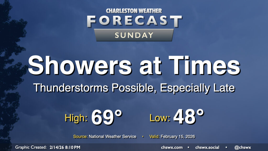
A storm system will affect the area on Sunday, bringing us some showers at times and maybe even a few thunderstorms as we get into the afternoon and evening hours. We need the rain as moderate drought continues to envelop the area, and a half-inch to even an inch of rain will be possible. While that won’t put an end to the drought by any stretch, it will certainly help.
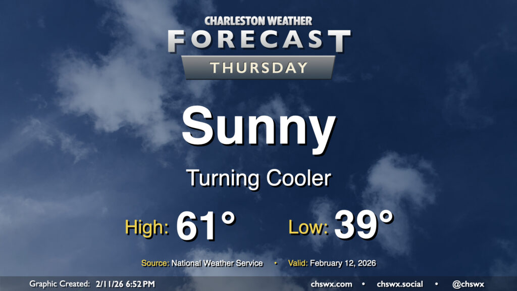
After a front gets through overnight, we’ll turn cooler for Thursday as temperatures head ever-so-slightly below normal. We’ll start Thursday in the upper 30s to around 40°, warming to the low 60s in the afternoon under predominantly sunny skies. While not quite the 70s, it’ll still be a solid mid-February day in the Lowcountry.
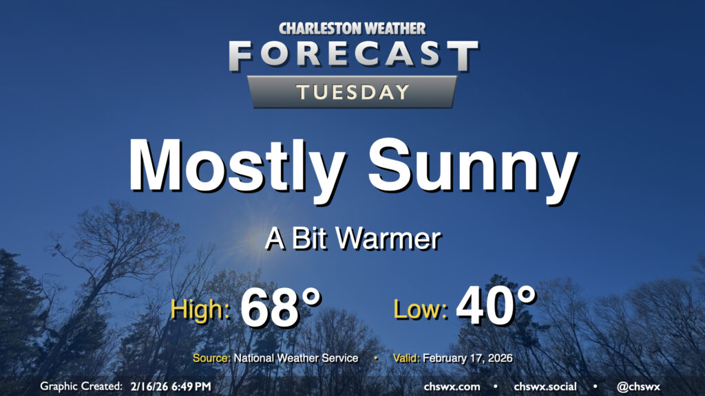
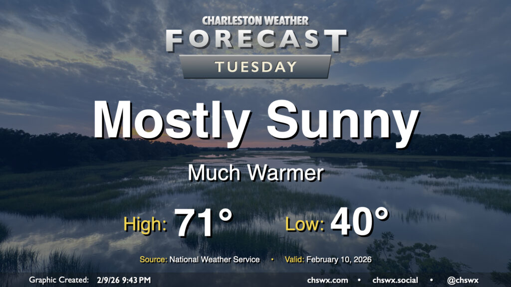
One could make the argument that Tuesday’s forecast might be the most pleasant in a few weeks as temperatures head well above normal as we end up on the north side of high pressure centered roughly around Tampa, FL. We’ll start the day around 40°, but west and southwest winds along with mostly sunny skies will help drive temperatures some 30° warmer during the day, with highs reaching the low 70s across much of the area (save for the immediate coast, where marine influences will keep temperatures capped to the upper 50s to around 60°). This should be our first 70° day since January 22, when the high reached 72°.