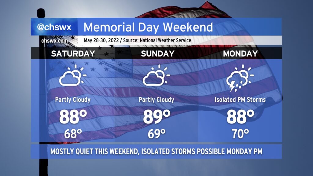
Memorial Day weekend in the Lowcountry looks quite seasonable — highs in the upper 80s, lows in the upper 60s, and partly cloudy skies for Saturday and Sunday as a front stalls offshore, but far enough offshore to keep us in some nicer weather. Indeed, we should stay mostly rain-free for the long weekend, though there will be a chance for a few isolated afternoon thunderstorms Monday as a little more moisture begins to work back into the area. All in all, though, things are looking pretty good to get outside.
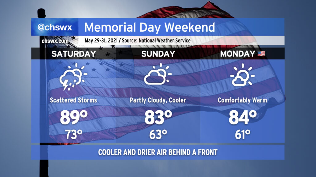
We’ll get off to a warm, humid, and perhaps a stormy start to the Memorial Day weekend, but a late-season cold front will make the weather very pleasant for Sunday and Monday.
A cold front, which as of publish time was draped over the Mid-South from Kentucky southward through Tennessee and far northwest Mississippi, will be advancing eastward toward the coast on Saturday. Atmospheric moisture will surge ahead of the front, providing a more hospitable atmosphere for afternoon showers and thunderstorms than we have seen in the past week or so. Temperatures will top out around 90° before scattered storms kick in ahead of the front. Brief downpours will be possible, but no severe weather is expected. (In fact, not everyone may even get rain.)
The front will get through overnight Saturday into early Sunday morning, ushering in a cooler and drier airmass. We’ll start Sunday about 10° cooler than we started Saturday, with lows in the low 60s away from the locally warmer coast. Highs will top out in the low 80s, a little below normal for late May, and will feel pretty great after a week of 90s. This comfortable warmth continues into Monday with a little bit more blue sky to boot. Overall, not too bad — we need the rain, and it’s awfully nice to enter June in the mid-80s rather than the upper 90s!
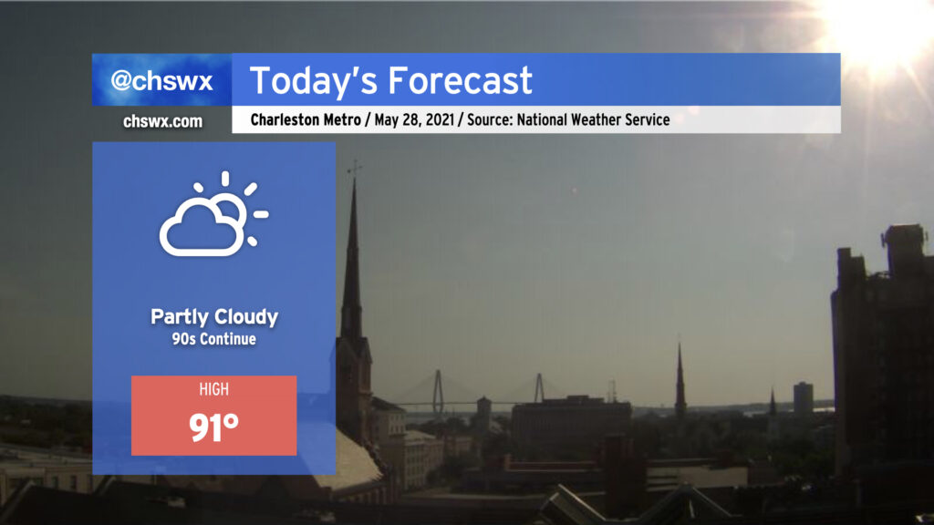
We’ll be back in the 90s today — perhaps for the last day for a little while — as the lingering effects of high pressure aloft remain for one more day before a front moves into the area on Saturday. Unlike yesterday, an earlier seabreeze progression will keep highs capped around 90-91°. (Yesterday’s high was 94°, tying Monday for warmest so far in 2021.) A shower or two can’t be totally ruled out as the seabreeze progresses inland, but with dry air remaining in place for one more day, coverage will be limited.
UPDATED at 6:30 PM: The National Weather Service in Charleston has confirmed a tornado on Johns Island yesterday. The tornado went a little over 3/4 of a mile along Chisholm Road, downing trees and power lines before dissipating over Church Creek. The storm survey team also found straight-line wind damage along Maybank Highway between Angel Oak Road and Oak Grove Road.