Expect more in the way of showers and thunderstorms this weekend, particularly on Sunday as a frontal zone moves into the area from the north. Storms could fire as early as mid-morning on Saturday, but should remain scattered through the evening hours. Thus, outdoor activities should have a backup plan, but don’t expect to be washed out, either. Temperatures will top out around 90° with heat indices peaking around 105° with the continued very warm and moist atmosphere in place across the area.
Saturday evening, we’ll be watching for a line of thunderstorms to sink southward into the metro area. Timing right now looks to be generally around and after sunset. Heavy rain, frequent lightning, and gusty winds will be the main concerns with this line as it sags into the area. We could see some sporadic wind damage from it, so we’ll want to keep an eye on that.
Sunday turns even more unsettled as the frontal zone sags southward into the area and stalls out. Expect on and off showers and thunderstorms throughout the day. It probably won’t rain all day at any one location, but it’ll be a good day to favor indoor plans. Sunday’s evolution could be a bit conditional on how things go with the Saturday night thunderstorm line, so stay tuned for more specifics as the mesoscale details work out. Regardless, the expectation of widespread rain and the nearby front will keep high temperatures in the mid-80s. Mix in the humidity, though, and it’ll still feel like the upper 90s.
While not quite as dry as we saw this past weekend, humidity will certainly not be stifling this weekend with east and northeast flow keeping cooler and drier air in place. After a nice start to Saturday morning, expect highs to top out just shy of 90° (even cooler closer to the coast). Thanks to the lower dewpoints, heat indices will not run too far out of bounds — probably topping out around 92°. Sunday will bring similar conditions with even more in the way of sunshine. Our next rain chance will be Tuesday, with chances heading up as we head further into the next work week. That being said, we have plenty of time later to think about the next work week — let’s enjoy the weekend first.
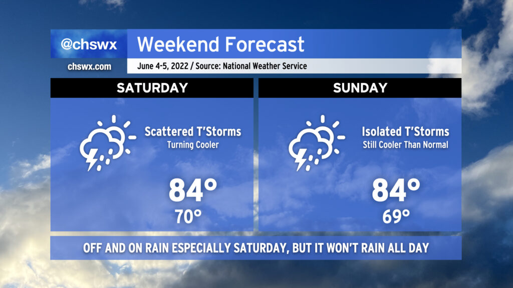
As we head into the weekend, we’ll get a break from the run of mid-90s that we’ve seen in the latter half of this abbreviated work week. This is courtesy of a cold front, which will sink southward across the area tonight bringing with it some showers and thunderstorms. Said front is expected to stall out to our southeast, and this combined with an influx of tropical moisture from what could be an eventual tropical cyclone well to the south and some energy rippling through aloft will be enough to generate periods of showers and thunderstorms for much of the day Saturday. It won’t rain all day at any one location, but be ready to move outdoor activities inside quickly in case the weather changes. Highs top out in the mid-80s on Saturday thanks to the cooler air and expected cloud cover. Sunday should be a little bit drier, though there will still be a slight chance of showers and thunderstorms. Highs once again will top out in the mid-80s, and with any luck, there will be longer breaks in the rain so you can enjoy it a bit.
Our run of early summer weather continues into the weekend. While temperatures will be lower than we’ve seen recently — we hit 95° yesterday, and 94° today — we’ll be adding popup showers and thunderstorms back into the mix each afternoon, which is typically the other mode of summer weather we see around these parts.
The drill remains the same: No washout, but conditions could change quickly in the afternoon as thunderstorms develop. Expect storms to develop in the early afternoon around the Highway 17 corridor before moving inland with the seabreeze heading into the late afternoon and evening hours. A storm or two could turn strong to severe with damaging wind gusts and large hail, but an organized, widespread severe weather threat is not on the table here either day. Just be ready to move indoors if thunderstorms approach — remember, lightning makes every thunderstorm dangerous.
I know y’all are thirsty for rain, and this weekend represents a decent chance for many of us to see some much-needed precipitation. Keep in mind, though, that the scattered and cellular nature of these storms will mean that a few people could see quite a bit of rain, while others may not measure much if any. The good news is that we are heading into a more unsettled weather regime getting into next week, so many of us should see at least a little drought relief before the month is over.
Temperatures will run in the upper 80s to around 90 each afternoon after starting in the low 70s each day, still above normal for this time of year. We look to stay in this temperature regime heading into next week depending on how far south a cold front can get.
After today’s round of rain for many of us, we return to a drier and warmer pattern once more as low pressure slips out of the area. While isolated to scattered thunderstorms will be possible each afternoon, a good bit of us will remain dry. Highs will begin to head back up starting Saturday, with low-to-mid-80s expected across the area. On Sunday, highs look to peak closer to the upper 80s, and we’ll be flirting with 90° by Monday, as above-normal temperatures are expected heading into much of next week.
Coastal flooding will remain a concern with each high tide cycle through Saturday evening, and then with the evening high tide on Sunday as well. Minor to moderate coastal flooding looks to be probable, with road closures a consideration an hour or two each side of the predicted time of high tide. Expect Coastal Flood Advisories from the National Weather Service.
This weekend’s high tides:
Saturday: 6:55 AM (approaching minor flood), 7:33 PM (minor flood stage)
Sunday: 7:46 AM (currently predicted to stay below flood stage), 8:23 PM (minor to moderate flood)
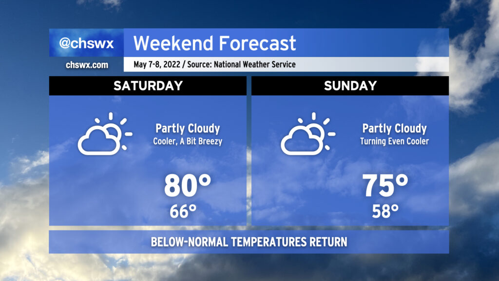
A series of cold fronts will usher in a fairly refreshing airmass after our first 90° days of the year this past week. The first front gets through early tomorrow morning, helping to limit highs to around 80° Saturday afternoon under partly cloudy skies. Winds will be breezy, though, with gusts 30+ MPH possible at times, so be aware if you have outdoor plans or need to drive on the bridges.
A second front comes through overnight Saturday, which will make Sunday even cooler. We’ll start in the 50s and only get to the mid-70s in the afternoon with partly cloudy skies continuing. This is several degrees below normal for this point in May. We’ll keep below-normal temperatures well into next week, too.
One thing we won’t see? Rain. We could certainly use it, too, as moderate drought continues across the area. Our next rain chance arrives next Thursday, so keep watering until then.
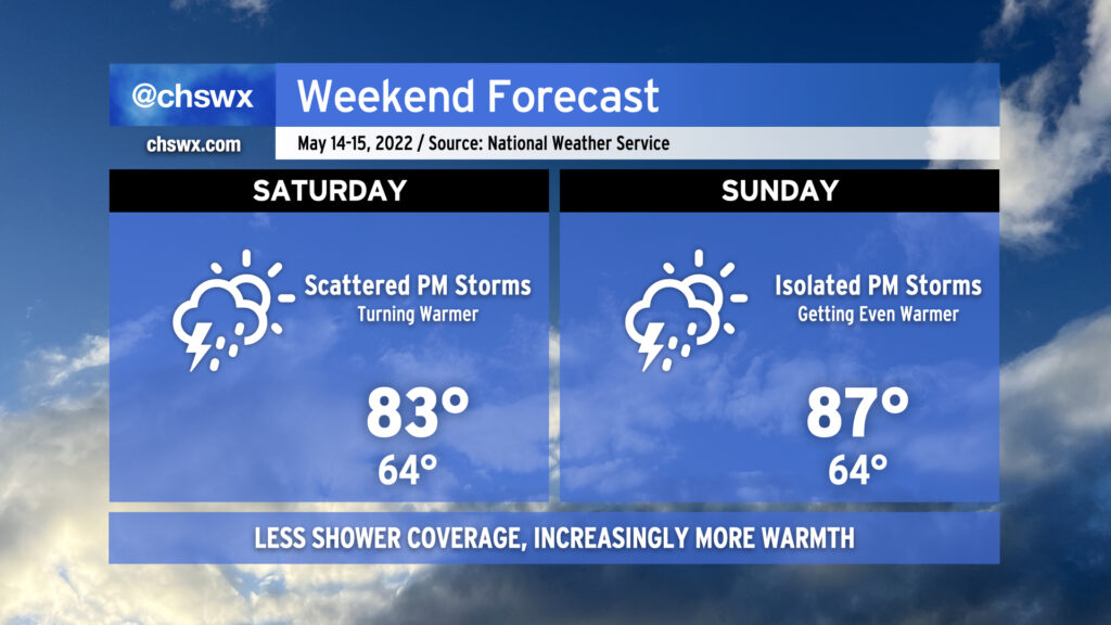
We’ve got another pretty good-looking weekend coming up. It won’t be quite as clear or as dry as last weekend, but it’ll still more than get the job done as temperatures rise through the 80s throughout the weekend. If sunshine’s your thing, suspect Saturday is going to be a little more in your favor as deep-layered high pressure hangs on for one more day, keeping cloud cover to just some scattered fair weather cumulus ahead of the seabreeze in the afternoon.
We’ll start to see high pressure aloft move out of our area a little bit more on Sunday. This should increase cloud coverage and could even introduce an afternoon shower or storm particularly inland. However, most of us will stay dry as highs head into the mid-80s in the afternoon. Outdoor activities are still go — just remember, when thunder roars, go indoors!
Looking ahead to next week, we see some of the warmest weather thus far this year in store particularly as we get into midweek and beyond. Periodic shower and thunderstorm chances will factor into the forecast, especially later in the week as a front gets nearby. But for now, enjoy the weekend as we flip the calendar to May! (Already!)
Liked today? Good, because we have more of that coming up this weekend as high pressure remains in firm control of our weather. We’ll see some clouds from time to time, but other than that, expect widespread sunshine across the region and seasonably warm temperatures around 80° both days (cooler near the coast). Pack the sunscreen if you’re going to be outside!
Looking ahead, temperatures will turn even warmer to start the work week. Tuesday could feature the warmest temperatures we’ve seen this year, reaching or even topping late February, when we hit 86° on the 23rd and 25th. Rain chances return for mid-week, but that looks to depart in time for next Friday, too. Can’t get mad at that.
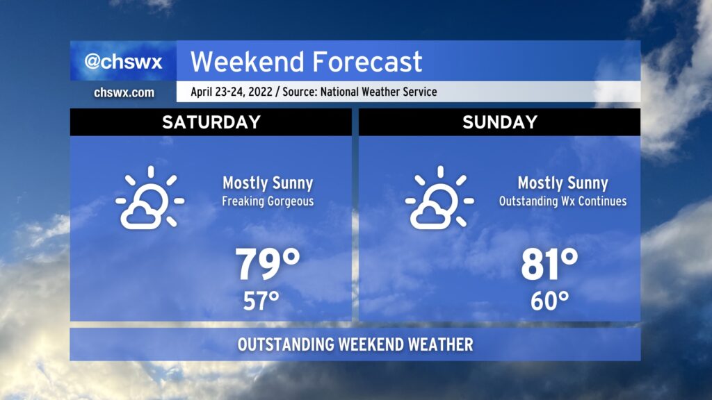
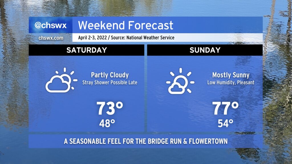
We’ve got another winner of a weekend (weather-wise, anyway) in the cards, with seasonable temperatures in the low-to-mid 70s each afternoon and an appropriate mix of sun and clouds. The only fly in the ointment in this forecast could be a stray shower or two later Saturday evening primarily near the coast, but the chances of any one spot seeing rain are rather slim. Humidity will continue on the low side, too.. We truly couldn’t ask for much better weather for the Bridge Run and Flowertown Festival in Summerville this go-around. (Bridge runners, here’s your hourly forecast for the race.) Enjoy the weekend!
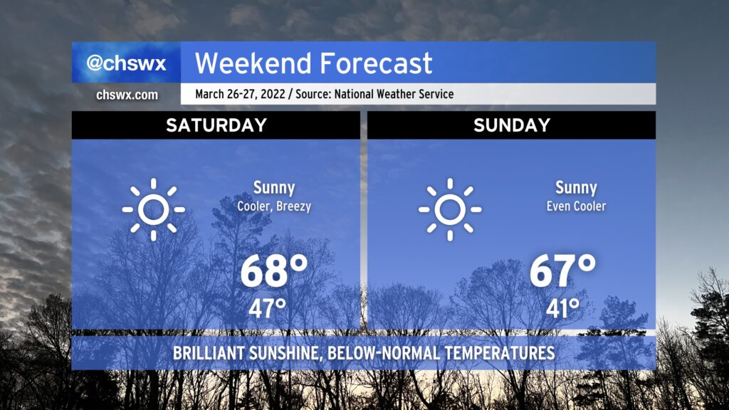
We’ve got a very nice weekend coming up, especially for those of you who prefer temperatures a little on the cooler side. A series of dry cold fronts will swing through, ushering in progressively cooler airmasses each day this weekend. Saturday will find temperatures starting in the mid-40s, headed to the upper 60s in the afternoon with some downslope flow and March sun angle helping to counteract the cool advection. Winds may turn gusty at times, with gusts to 30-40 MPH certainly possible, so be aware of this if you have any outdoor plans or need to drive a high-profile vehicle.
Another front swings through early Sunday, sending low temperatures into the low 40s before rebounding to the mid-to-upper 60s in the afternoon again under largely uninterrupted sunshine. It’ll be a little less windy on Sunday, but gusts still could reach 25-30 MPH at times.
Looking ahead, one more front comes through Monday before a warming trend begins across the area. Expect temperatures to rebound to the mid-70s by Tuesday and into the low 80s by Wednesday. Our next meaningful rain chance doesn’t show up in the forecast until Thursday. While the rain we got Wednesday and Thursday certainly helped, there’s still a good bit of ground to make up rain-wise to get us out of drought. That being said, I won’t complain about sunshine and comfortable temperatures, either. Enjoy!