Jared Smith founded @chswx on Twitter in 2008 as an experiment in disseminating weather data through social media. In the ensuing decade-and-a-half, @chswx has provided live coverage of tropical cyclones, tornadoes, severe weather, and even a couple bouts of winter weather to the good people of Charleston, SC.
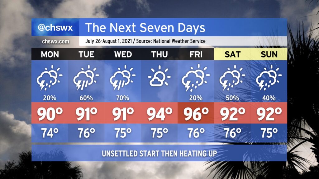
The good news for next week is that there will be no 110°+ heat indices to speak of. The bad news is that we’ll accomplish this with periods of heavy rain helping to keep temperatures down as a front stalls out across the area. Troughing aloft will help unfettered moisture transport over the next several days, and with the boundary in place focusing development of showers and storms, we look to see quite a bit of rain especially as we get into mid-week.
Monday looks to be the driest day of the work week as showers and storms should hold off until late. (It will also be the warmest day of the week as a result, but highs should only top out around 90°.) Deeper moisture will be shunted southward for a good bit of the day, helping to limit shower and storm coverage. This will change by Monday night, though, as the moisture feed retreats northward. Once this happens, expect the boundary to begin to come alive with periods of heavy rain moving across the area. Generally speaking, this will be the basics of the forecast for the next several days. As of right now, it’s unclear how long this setup will remain in place, especially when looking toward the weekend.
It’s important to note that this doesn’t mean it’s going to rain all the time. It is difficult to predict exactly when and where the heaviest rain — and the dry slots — will set up more than a day in advance in regimes like this. The general advice is this: Prepare to have plenty of indoor plans this week, monitor forecast updates for dry periods, and stay alert for the potential for flooding, especially in advance of and around times of high tide. That, and don’t totally toss your weekend plans just yet, as there’s plenty of uncertainty in the long range.
Storms have remained mostly at bay today (aside from a few popups in the Walterboro/Summerville corridor) as we put in another hot day with highs topping out at 95° at the airport and 92° at Downtown.
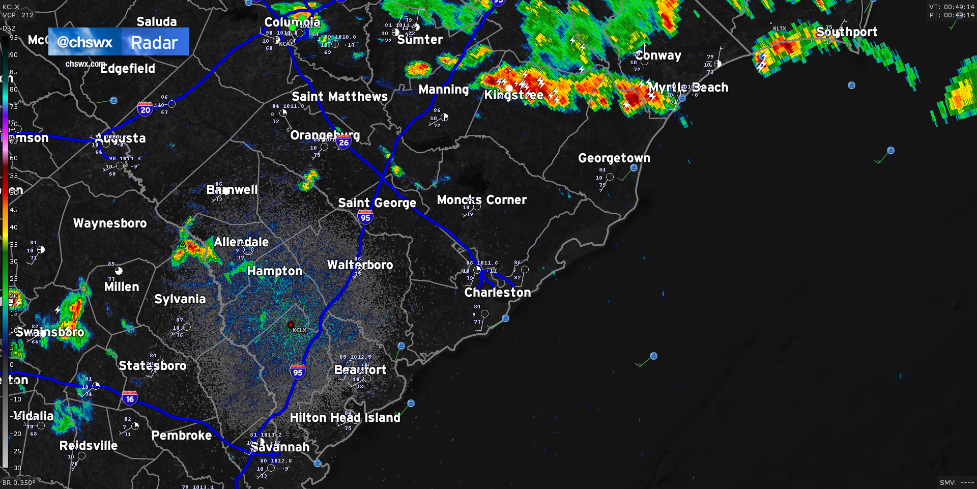
We’ve seen showers and thunderstorms essentially split the area so far today; severe thunderstorms with even a few tornado-warned cells fired up in North Carolina, while a separate round of convection has been ongoing in far southern Georgia into Florida. This has kept the Charleston Metro Area fairly quiet, but I suspect that will be changing fairly soon as a frontal boundary continues its southward trajectory across the state. Radar is doing a good job at picking out an outflow boundary cutting through the Midlands right now, which has caused storms to fire in the Columbia metro area.
This outflow boundary is approaching a few smaller popup storms in Orangeburg and northern Berkeley counties. The atmosphere over Charleston continues to be fairly ripe for thunderstorm development, and short-term models continue to indicate additional shower and thunderstorm coverage developing in the I-95 corridor by 10PM. With the loss of daytime heating, instability has been waning, but there is still more than enough fuel for some loud and rainy thunderstorms in spots tonight.
The front helping to drive all this will stall out across the area tomorrow. With plenty of available moisture and instability, we’ll see several rounds of showers and thunderstorms over the next few days. I’ll have more details in another post later this evening.
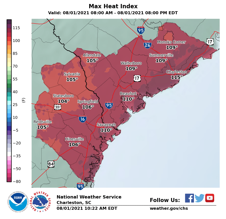
Temperatures will once again reach the mid-90s this afternoon across the area (fun fact: yesterday was the first 95° day all year at the airport). Combined with moisture-laden air characterized by dewpoints near 80°, this will once again drive the risk for excessive heat indices upwards of 115° near the coast, where an Excessive Heat Warning is in effect for today. For the inland counties, a Heat Advisory will be in effect with heat indices approaching 110°. Regardless of whether you are in the advisory or warning area today, you’ll want to take precautions against heat illness if you must be outside during the afternoon.
Showers and thunderstorms look to initiate a little later in the day than we saw yesterday, with the best risk of storms coming in the late afternoon and early evening hours. Models suggest a line of thunderstorms could develop and move across the area today. Timing is always a question mark, but I would be on guard for storms starting about 3-4 PM, with the earlier timeframe the further north and west you are. Available energy will be abundant with such strong surface heating and moist dewpoints. Thus, a few storms could be on the strong to severe side with damaging wind gusts, but frequent cloud-to-surface lightning and pockets of heavy rain remain the overwhelming concern from any storms that form this afternoon.
A cold front looks to get close to the area tonight. This will help shut off the oppressive heat of the last few days, but at the cost of another few days of on and off heavy, flooding rainfall. Will have more on the upcoming week later this evening.
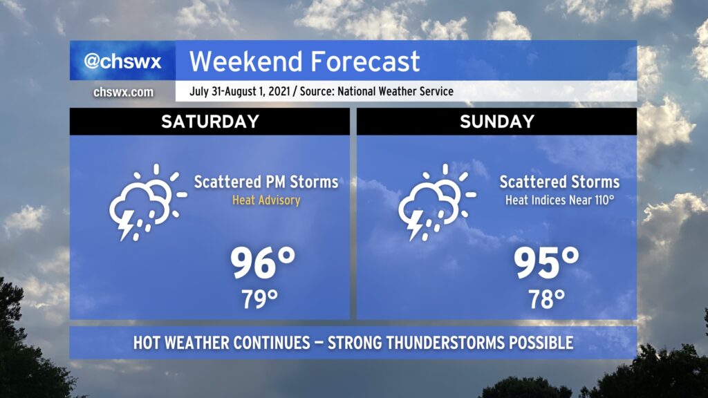
We will continue our string of hot days this weekend as we remain under mostly westerly flow at the surface and aloft. A cold front will be closer to the area, though, and this along with some upper-level energy will instigate a few more showers and thunderstorms starting Saturday afternoon. A few of these storms could turn severe with damaging wind gusts the primary concern; locally heavy rain and lightning will also certainly factor in. Shower and thunderstorm chances continue into Sunday, though it won’t rain all day.
Heat and humidity will continue to combine for heat indices around 110° on Saturday and perhaps approaching that number again on Sunday. A heat advisory is in effect for Saturday afternoon as a result; you’ll once again want to take heat safety precautions if you must be outside.
The heat will back off Monday, but at the cost of the resurgent potential for isolated flooding rainfall as deeper moisture and upper-level features become favorable once again for very heavy rainfall.
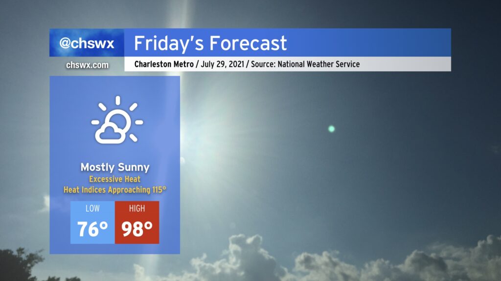
Friday will be the hottest day of 2021 so far. Temperatures will soar into the upper 90s in the afternoon as deep westerly to northwesterly flow in the troposphere pins the seabreeze to the coast, keeping the cooler marine air at bay for much of the day. On the other hand, this will allow very humid air characterized by dewpoints approaching 80° to pool near the coast. When the seabreeze finally begins its inland trek in the mid-to-late afternoon, the highest heat indices will then be realized as this incredibly moist air moves across the much warmer air found over land. Given this potential, an Excessive Heat Watch is in effect for the Tri-County area. Ridging aloft will put the kibosh on any shower or thunderstorm activity, so don’t count on that to bring any relief, either.
If it’s at all humanly possible, avoid exertion in the heat of the day tomorrow. If you must be outdoors, get shade and hydration on a very regular basis. If you begin to feel ill, move into an air-conditioned area immediately. If you feel faint and your skin is hot to the touch, that’s quite possibly heat stroke — a 911-worthy medical emergency requiring swift treatment.
High heat will continue through Sunday, and heat advisories for heat indices approaching 110° are certainly possible. Please take it easy!
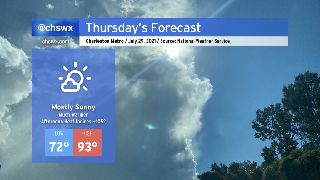
We’ll trade the persistent rain of the last few days for a real taste of summer beginning on Thursday. Temperatures will easily rise into the low 90s in the afternoon under mostly sunny skies as high pressure builds in aloft and at the surface. The humidity will make it feel closer to 105°, which is as hot as the heat index has been all summer. Take appropriate precautions: Plenty of water, plenty of shade, and most importantly, look before you lock. One hot car death is too many.
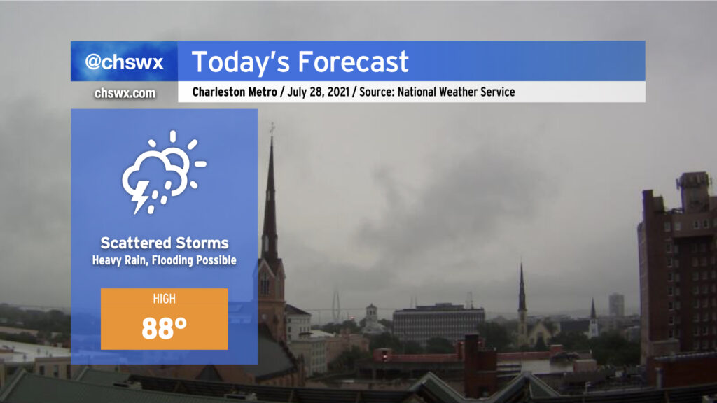
Today will continue to feature scattered showers and thunderstorms, especially this morning as slow-moving storms develop and move in from the west. Flooding will certainly be a concern wherever thunderstorms set up and rain for long periods. The next high tide will be at 12:07 PM.
It won’t rain all day, however; high-res models have this batch of storms eventually fizzling out by early this afternoon. Another round of storms could fire along the coast this evening, and this may drive additional heavy rain concerns before departing later tonight.
This will be our last day in the 80s until next week; the hottest temperatures of the season will begin Thursday and last into Sunday with highs well into the 90s and heat indices approaching 110°. (More on that later today.)
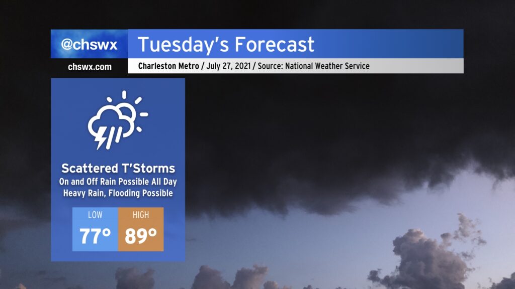
We’ve got a muggy and potentially soggy Tuesday ahead. While it won’t rain all day, expect plenty of shower and thunderstorm coverage to bring just about everyone some rain at some point tomorrow. Given plentiful tropical moisture, some of this rainfall could become quite heavy at times, leading to the potential for isolated bouts of flooding where the heaviest rain falls. Heavy rain will be possible possibly as soon as shortly after daybreak, similarly to today, as it likely won’t take much heating to start convection. We’ll want to watch the 11:18am high tide closely as high-resolution guidance suggests storms in the area around that time.
Temperatures will remain on the warm and muggy side. We’ll start in the upper 70s across much of the area, with 80° lows possible along the coast and in downtown Charleston. Highs will only top out in the upper 80s given the expected shower and thunderstorm coverage.
High rain chances continue into Wednesday before moisture departs and we heat up for Thursday and especially on Friday, which could be the hottest day of 2021 thus far if the forecast of 96° remains on track. Stay tuned.
After a very rare weekend of relatively low humidity (for late July, anyway) we’ll see dewpoints return to the low to mid-70s as tropical moisture builds back into the area. Monday will feature isolated showers and thunderstorms primarily driven by the seabreeze, but as we get into Tuesday and Wednesday, a low pressure system — labeled by the National Hurricane Center as Invest 90L with a 50% chance of tropical development — will be approaching the coastline as we get into mid-week. Regardless of what it ends up doing from a tropical standpoint, it will enhance our shower and thunderstorm chances Tuesday and Wednesday, particularly in the afternoons. Temperatures will top out in the low 90s each day.
As we get closer to the end of the week, the strong high pressure over the central US noses its way into the eastern US. This, in turn, will drive down rain chances and drive up temperatures. Temperatures should top out in the mid-90s Thursday and Friday.
Owing to just how “mild” this summer has actually been, the hottest it’s been this year is 94°, which we’ve reached three times (twice in May and last on June 15). If Friday’s forecast of 96° verifies, that will be the warmest we’ve been all year.
By the weekend, we could see an uptick again in showers and thunderstorms as the ridge backs off a little bit and we get underneath some northwest flow aloft. NWS noted in its afternoon discussion that this could open up the pathway for summer thunderstorm complexes — the technical term for which is “mesoscale convective system” — to roar through the area starting this weekend. Something to watch, but nothing we need to be overly concerned about right now.
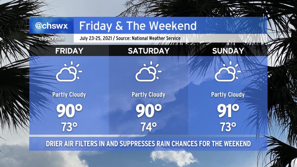
After another day of very heavy rain in the Charleston metro area — this time in West Ashley — we mercifully get Friday and the weekend to dry out a little bit as a front sags south of the area, turning winds to the east and northeast. This will keep temperatures right around, if not slightly below, late July normals. Heat indices will even be reasonably in check — upper 90s on Friday, but down to the mid-90s for Saturday and Sunday.
With the drier air comes a little less cloud cover and far lower shower and thunderstorm chances (though I suppose you can never totally rule out an afternoon shower or storm in late July). Wildfire smoke transported all the way from the western U.S. looks to filter into the area starting tonight and will last for the next few days. This will make for some interesting sunrises and sunsets. It doesn’t look like this smoke will be close enough to the ground to cause any major air quality impacts, at least right now. We’ll keep an eye on this in case it changes, but for now, good air quality is in the forecast for Friday.
We’ll also want to keep an eye on the risk for salt water flooding with the evening high tides this weekend. Onshore flow will combine with astronomical influences to produce a few rounds of sunny-day flooding through at least Sunday. Be ready for coastal flood advisories and possibly some closed roads due to salt water on the roads. Fortunately, we don’t look to have much if any rain on top, mitigating a more serious flooding issue.
All in all, it’ll be a pretty good July weekend — I hope you can take advantage.