Jared Smith founded @chswx on Twitter in 2008 as an experiment in disseminating weather data through social media. In the ensuing decade-and-a-half, @chswx has provided live coverage of tropical cyclones, tornadoes, severe weather, and even a couple bouts of winter weather to the good people of Charleston, SC.
The solstice must have kicked something into alignment, because this week fits perfectly into the normal summertime routine with temperatures running in the upper 80s to low 90s each day and a chance of thunderstorms each afternoon. Could see some additional coverage of showers and storms Wednesday and Thursday, but other than that, it’ll be a typical Charleston summer setup. If you’ve got outdoor plans, just keep an eye on the weather each afternoon. When thunder roars, go indoors!
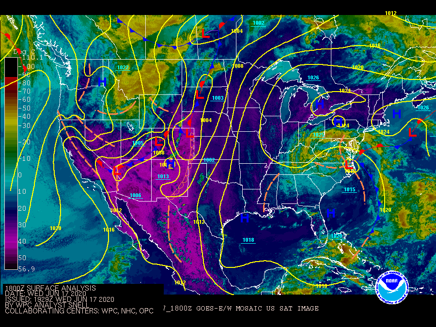
National surface analysis with satellite overlay at 2PM June 17, 2020.
We have been in quite the cool spell this week as an upper-level low pressure system in concert with a stalled front have kept clouds and showers in the forecast. The cool temperatures have been rather remarkable for June, with legitimate hoodie weather the past couple days as several record low maximum temperatures were achieved both at Charleston International Airport and downtown Charleston. Summer’s coming back, though…
It sure has been cool and occasionally rainy over the last few days! Today’s high only made it to 77° at the airport, which barring an unforecasted heating episode will be a new record low maximum temperature for the date. The previous record low max for June 14 was 78° set in 1939. This cool pattern is thanks to an upper low aloft and a wedge of high pressure at the surface. Moisture riding atop the wedge is keeping cloud cover and the occasional showers around, and this will continue for a couple more days before the pattern turns more summer-like by the end of the week.
Periods of heavy rain will continue for much of Monday before winding down in the evening. Once again, temperatures will run well below normal (upper 70s) thanks to cloud cover and rain-cooled air. While we’ll have less rain on Tuesday, we will have one more day of cool temperatures with continued cloud cover and northerly winds on the back side of a coastal low. Before it’s all said and done, another 1-3″ of rain may have fallen across the area in what has been a wet year — we have a 6.2″ surplus of rain at the airport.
As we get into mid-week, we’ll begin to see the upper low finally take leave of the area, allowing the surface low to go with it. Showers will continue to be in the forecast, but temperatures will moderate into the lower 80s. By the end of the week and into the weekend, expect temperatures to head back into the upper 80s and lower 90s with the typical afternoon thunderstorm regime we all know and love during summers in Charleston.
June in Charleston is typically characterized by afternoon thunderstorms and highs in the upper 80s, and this week will not disappoint in either department. We’re caught between Atlantic high pressure and the broad circulation of Tropical Storm Cristobal, putting us within a corridor of deep moisture which will help drive scattered showers and thunderstorms each afternoon to start the week. All the while, a stalled frontal boundary will be hanging around to our north, meandering for the next several days and acting as another focal point for showers and storms. As we get into the weekend, another front approaches. As we so often see in the warm season, though, the front looks to have a hard time getting through the area, keeping us in the soup with scattered afternoon thunderstorms through Sunday.
It’s June 1, and that means that the Atlantic hurricane season has once again officially started. (Don’t tell Arthur and Bertha that they were early to the party.)
Through November 30, we’ll be keeping a weary eye on the Gulf of Mexico, Caribbean Sea, and Atlantic Ocean for possible tropical mischief. It could be a busy year for tracking storms, too. Let’s dig in.
Monday and Tuesday sure won’t feel like June in the wake of a cold front that came through earlier today. Cool high pressure will wedge into the area, and the resulting onshore flow will keep temperatures rather pleasant and cloud cover reasonably low to start the new work week. We’ll begin a warming trend on Wednesday with a return to the 90s by Thursday. Next rain chances arrive by this weekend.
Tropical Storm Bertha at landfall northeast of Charleston on Wednesday morning.
In case you missed it — and you’ll be forgiven if you did — we had our first landfalling tropical cyclone of the 2020 hurricane season on Wednesday. Tropical Storm Bertha, which was classified as such when it was 30 miles southeast of Charleston, came ashore around 9:30am with maximum sustained winds (primarily offshore) of 50 MPH. Bertha was not a major wind-maker on land, but dropped enough rain at low tide to cause flooding in downtown Charleston. Its heavy rain spread inland, adding to rain totals on what has been a soggy second half of the month already. Charleston Airport set a new rainfall record on Wednesday, as well; 2.08″ broke the record of 2″ set in 1977.
We’re getting a rainy start to our Tuesday as showers spread northward ahead of a low pressure system that is hugging the Florida coast. While some of these showers could be heavy at times, flooding is not expected to become an issue during the day on Tuesday. The worst weather is poised to arrive later tonight and into Wednesday as the center of the low makes its closest approach. Let’s get a look at what that means…
UPDATED at 6:30 PM: The National Weather Service in Charleston has confirmed a tornado on Johns Island yesterday. The tornado went a little over 3/4 of a mile along Chisholm Road, downing trees and power lines before dissipating over Church Creek. The storm survey team also found straight-line wind damage along Maybank Highway between Angel Oak Road and Oak Grove Road.
Some much-needed rain is in the forecast for much of the upcoming week as a cold front with an accompanying upper low moves through the area. Said upper low will then stall out over the Southeast into the end of the week, keeping thunderstorm chances around and temperatures a little below normal. As the upper low shifts away from the area toward Friday and the weekend, we’ll see rain chances decrease and temperatures approach the 90° mark. Overall, expect around an inch of rain before the week is over, with locally heavier amounts possible in thunderstorms — a healthy amount of rain, but not all at once, thankfully.