Sunday: Starting out unsettled, drying by evening
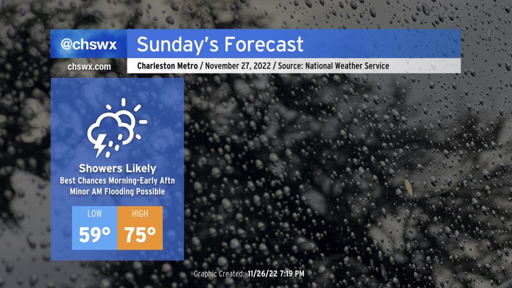
A storm system will approach the area overnight into Sunday, bringing another round of rain chances to the area primarily tomorrow morning into early afternoon.
Read more »A storm system will approach the area overnight into Sunday, bringing another round of rain chances to the area primarily tomorrow morning into early afternoon.
Read more »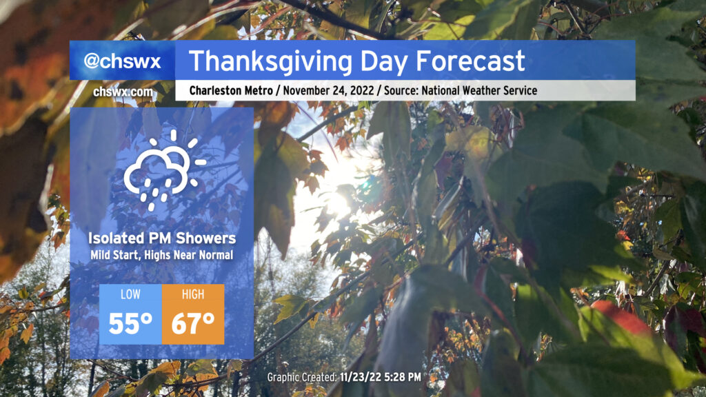
We have a relatively mild Thanksgiving Day ahead as temperatures start in the mid-50s, about 10° above normal for this point in the year. Pesky cloud cover will remain pesky with the coastal trough lingering offshore, and a few showers will be possible before rain chances increase further after sunset as more moisture makes its way ashore. Overall, don’t be surprised to dodge a shower or two, but I suspect that a lot of us get a majority of Thanksgiving in rain-free.
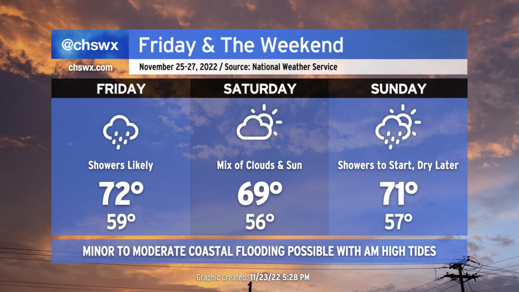
Shower chances will peak on Friday as a warm front moves by followed by a cold front moving in from the north overnight. Lows will approach 15° above normal with cloud cover and a moist airmass in place. The warm front will help temperatures reach the low 70s in the afternoon despite shower activity that’s expected to be in the area. (A thunderstorm can’t be ruled out, either.) These showers will work their way out of here overnight with the aforementioned cold frontal passage.
Saturday should remain mostly dry with a mix of clouds and sun remaining in place. Temperatures will once again bottom out around 10°+ degrees above normal for another mild start followed by highs running right around 70° in the afternoon.
Showers return to the forecast Sunday as another cold front moves by the area. Once again, highs in the low 70s will follow a seasonably mild start to the day in the mid-50s. We should see showers begin to decrease later in the afternoon, paving the way for a cooler, drier, and sunnier Monday.
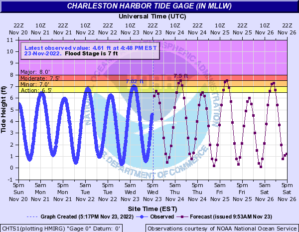
This morning’s high tide peaked around 7.02′, which scraped minor coastal flooding thresholds. Expect additional rounds of minor to moderate salt water flooding around times of the morning’s high tide through Thanksgiving and the long weekend. High tide on Thanksgiving morning is forecast to peak around 7.5′, or moderate flood stage, around 7:43am. We should see similar results from Friday morning’s high tide which is predicted to peak around 8:34am. Minor coastal flooding is forecast for Saturday morning’s 9:29am high tide, while guidance indicates another round of flooding will be possible for Sunday morning’s 10:28am high tide. Stay tuned for Coastal Flood Advisories from the National Weather Service.
Follow my Charleston Weather updates on Mastodon, Bluesky, Instagram, Facebook, or directly in a feed reader. Do you like what you see here? Please consider supporting my independent, hype-averse weather journalism and become a supporter on Patreon for a broader look at all things #chswx!
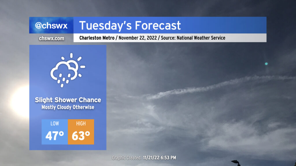
Cloud cover moving over the area tonight will make for a much warmer start to Tuesday than we saw on Monday, with lows only dipping into the mid to upper 40s. Wakeups will trend even warmer as we get into the rest of the week, with lows in the 50s becoming commonplace through the weekend.
Keep an eye out for a few showers during the day on Tuesday as a coastal trough develops. Otherwise, expect temperatures to top out in the low 60s under mostly cloudy skies.
There will be a risk for a little salt water encroaching on roads around Gadsden Creek (Hagood/Fishburne/Lockwood) around the 6:10am high tide, but more significant flooding is not expected as water levels are expected to peak just shy of the 7′ coastal flooding threshold in Charleston Harbor.
Read more »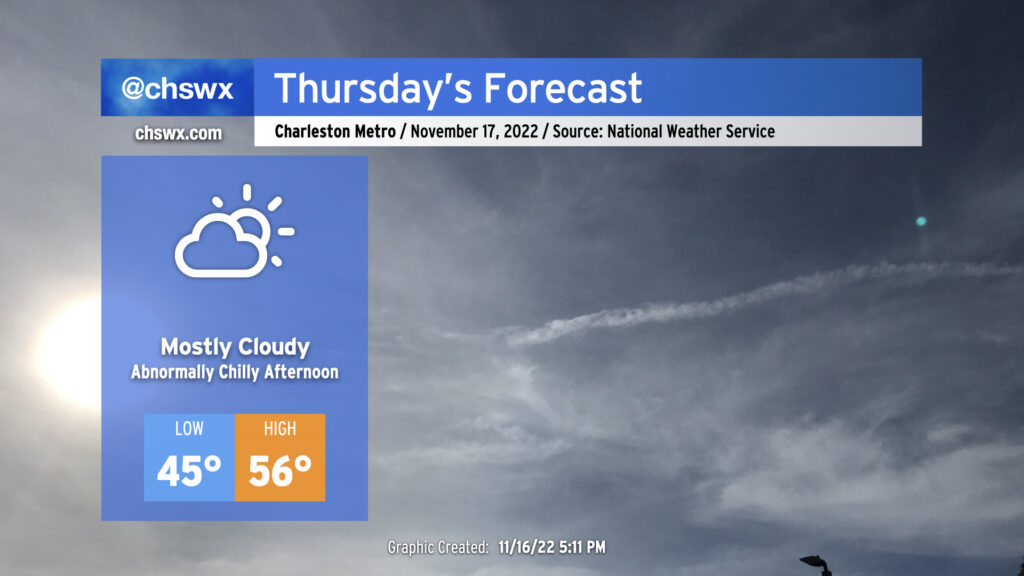
We’ve got more clouds and chilly weather in store for Thursday after a rather chilly and somewhat dreary day across the Lowcountry. The high temperatures of 68° at the airport and 70° downtown on Wednesday were set right around midnight as cooler air filtered into the area throughout the day. We should see another near-normal morning Thursday (lows mid-40s) before temperatures once again struggle into the mid-50s in the afternoon, well below the usually nice normal November temperature around 69°. There’s a decent chance we should see a little sun before the day is out, but overall, expect more in the way of gray. Silver lining: No precipitation is expected.
Read more »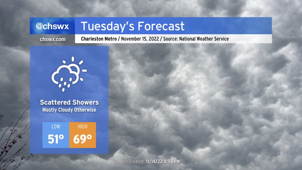
Here comes the warmest day of this week! A coastal trough will move inland during the day Tuesday, which will allow some warmer air to infiltrate the area from the Atlantic. It remains to be seen just how far inland this warmer air can penetrate; we could see some spots near I-95 run much cooler, possibly not getting out of the 50s.
Expect a scattering of showers in association with the aforementioned trough, but it won’t rain all day at any one location. A couple of the models want to bring some instability inland, but the thinking is that any thunder stays over the water. Aside from slick roads from the rain, not expecting much in the way of any hazards from tomorrow’s weather.
Read more »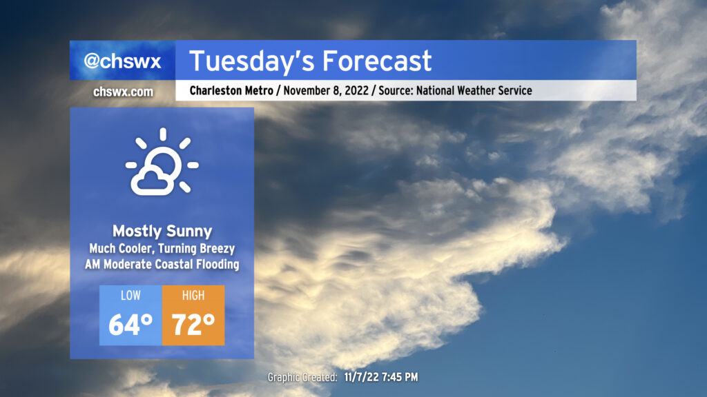
Election Day will feature rain-free conditions, plenty of sunshine, and much cooler temperatures as high pressure to the north wedges into the area. This will definitely feel a lot different than the mugginess we’ve had for the past week-plus. You’ll want to keep a jacket around, too, as winds become gusty as the pressure gradient between the high building in from the north and Subtropical Storm Nicole to the south intensifies. Watch for gusts upwards of 25 MPH away from the coast, with gusts 30-35 MPH possible at the beaches.
The last total lunar eclipse of 2023 — and last one visible from the US until 2025 — will peak tomorrow morning just before 6am. The moon will be getting lower on the horizon in the western sky, but cloud cover should be sparse for eclipse viewing.
The full moon will also be a contributor to elevated water levels in Charleston Harbor with the 7:31 AM high tide, which is expected to peak around 7.6′, producing minor to moderate coastal flooding. This may have some impacts on the morning commute for folks traveling around downtown Charleston. Be ready to use alternate routes in case you encounter flooded or closed roads.
Mariners should take note that a Tropical Storm Warning has been hoisted for the coastal waters (not the harbor, yet) with very rough marine conditions expected to develop due to the aforementioned pressure gradient. There are no land-based tropical headlines as of this writing.
Read more »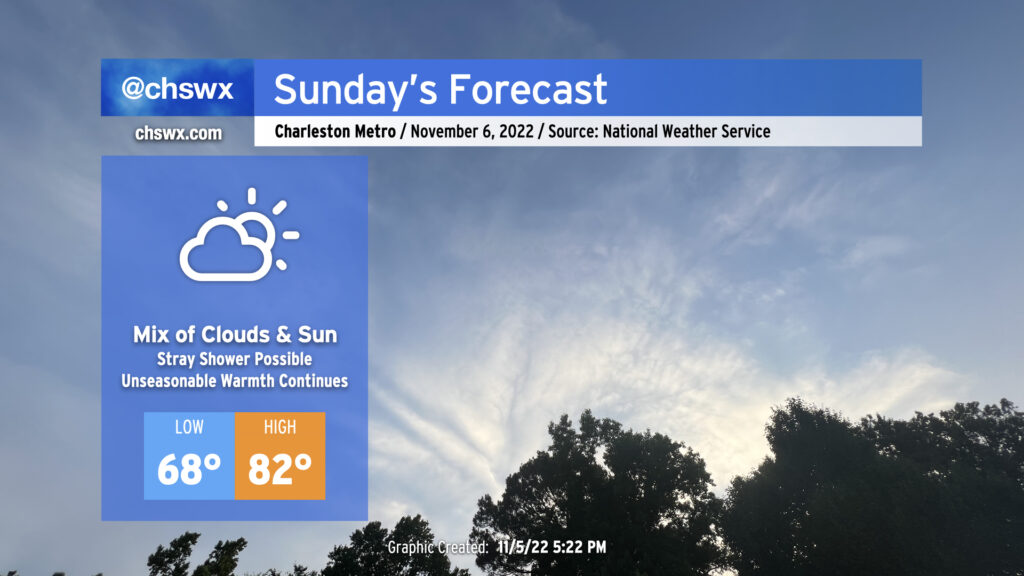
We’ve got another unseasonably warm day on tap for Sunday as an anomalously strong ridge of high pressure aloft continues to extend into the Carolinas. High clouds will favor prominently well ahead of a cold front to our west, but that won’t act as much of a governor on temperatures with low 80s still expected in the afternoon. Indeed, onshore flow is likely going to be the only thing keeping us from approaching the record high of 87° set in 2003.
The morning warmth is almost more remarkable: lows in the upper 60s are forecast, which is getting close to 20° above normal for this point in the year. We should fall shy of the record high minimum temperature of 71° set in 2003, but it does look like we’ll give the record a good run for the money.
A stray shower or two can’t be totally ruled out, but we’ll stay sandwiched between the front to the west and better instability and convergence over the waters and should stay dry as a result.
Finally, minor coastal flooding will be possible with the 6:05 AM high tide as we approach a full moon on Tuesday. Water levels approaching 7′ in the harbor could put some salt water on roads around Gadsden Creek once again — think Fishburne and Hagood — as well as spots along Lockwood (both Drive and Boulevard).
Read more »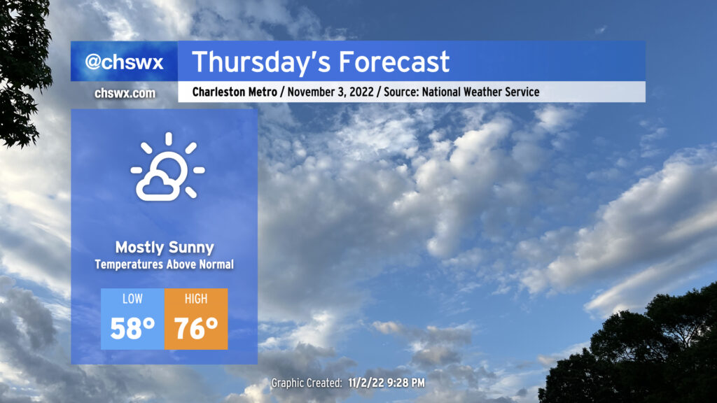
Weather’s looking good for Thursday as high pressure at the surface and aloft are in control. It will remain mild for November with temperatures running a few degrees above normal, especially in the morning. Expect plenty of sunshine with just a few passing clouds from time to time. If there’s one thing that might throw a fly in the ointment for an outdoors lunch, it’s that there will be a bit of a northeasterly breeze. Pin your napkins down appropriately and otherwise enjoy!
The only other weather concern will be the risk for some minor coastal flooding around the 5PM high tide. This could have commute impacts around Lockwood Dr. and the Citadel as salt water spills onto Fishburne and Hagood. If this is part of your evening commute, consider another route to avoid salt water splashing onto your car’s undercarriage.
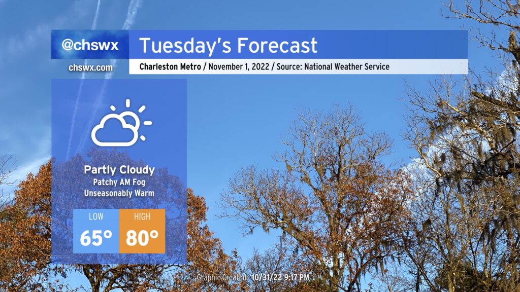
A cold front will push offshore Tuesday allowing dry high pressure to build into the area from the west. Before the front gets offshore, though, patches of fog — perhaps dense fog — will be possible in the morning as lows only bottom out in the mid-60s, a rather warm start to the first day of November.
Slightly cooler and drier air will filter into the area once the cold front has passed, but ridging aloft will help temperatures head to about 80° once again in the afternoon with ample sunshine peeking through scattered clouds. Rain-free conditions are expected.
We keep a rain-free forecast heading into the rest of the week, with more onshore flow helping to curb temperatures closer to normal especially as we head into Thursday and Friday. 80s look to return for the weekend before our next rain chance next Monday.
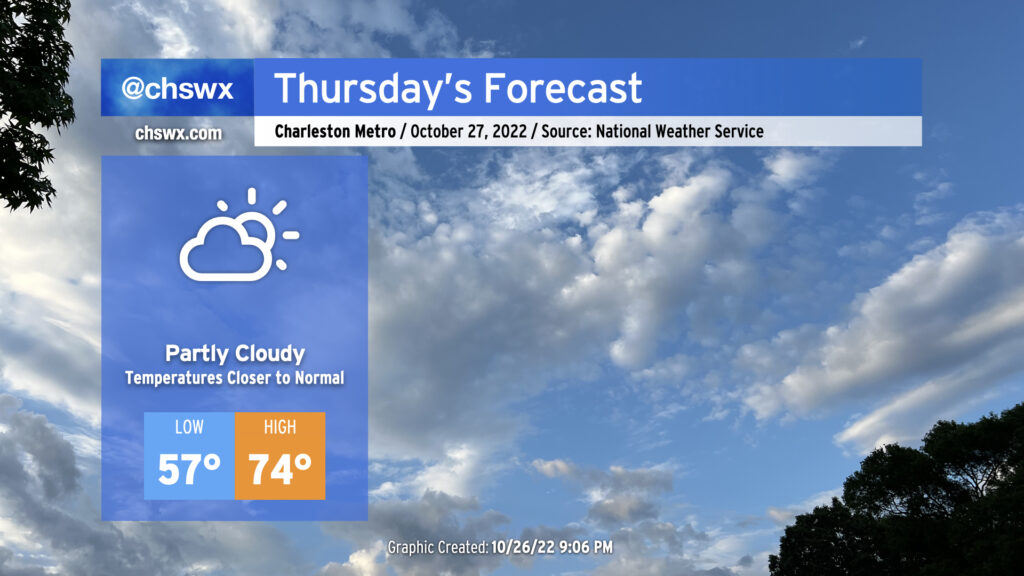
A cold front is on its way through this evening, which will bring cooler temperatures for Thursday and beyond after highs peaked in the low 80s this afternoon away from the locally cooler coastline. Winds will go to the north and then the northeast overnight as high pressure builds in from the north and west. We’ll generally see scattered clouds throughout the day with those northeast winds keeping us about 5-7° cooler than we saw Wednesday. The aforementioned northeasterly winds and upcoming lunar perigee will contribute to another risk for minor to moderate coastal flooding around the 9:47am high tide, so be aware of the potential for closed roads once again tomorrow morning (though the peak of any tidal flooding should miss the bulk of any commute time at this point).
Read more »