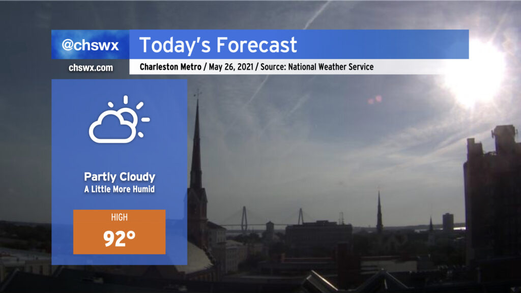
High pressure will continue to slip a little more to the east today, allowing the resulting return flow to bring a little bit more humid air characterized by dewpoints in the mid-60s into the area. Once again, we look to remain mostly rain-free across the area; the best chance of a shower or two will be in northern sections of Berkeley and Dorchester counties near I-95 closer to a trough of low pressure. Otherwise, expect a mix of high clouds and fair-weather cumulus as temperatures rise into the low-to-mid-90s ahead of the seabreeze. Heat indices will be a couple ticks higher today, generally in the mid-90s in the afternoon, particularly right after the seabreeze and its associated dewpoint surge pass by.
Temperatures and humidity will continue to creep up for the next couple days before a cold front knocks down temperatures — and brings some isolated to scattered storms — for the Memorial Day weekend.
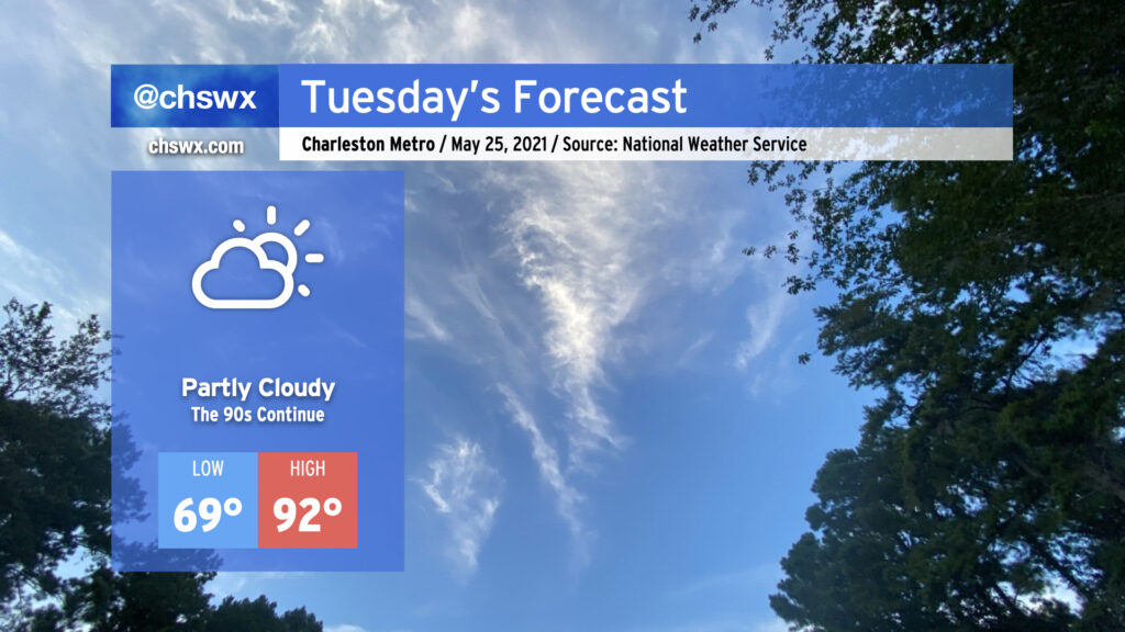
After topping out at 94° today to mark the hottest day of 2021 so far, we return to the 90s tomorrow as the stacked high pressure pattern remains in place. If you’re looking for rain, you’re not going to find it with the ridge keeping a lid on any deep convection. Humidity remains tolerable, so heat indices will not get too far out of bounds (though there may be a brief spike as the seabreeze pushes inland). That being said, low-to-mid-90s are still plenty toasty, so find shade when you can if you’re outdoors.
We stay in the 90s for the rest of the week, with temperatures turning hotter as we get into Thursday and Friday. Humidity will also be creeping up as high pressure slides offshore, bringing winds out of the southwest and pumping in 70°+ dewpoint air. Our next rain chances kick in over the weekend as a front gets close to the area.
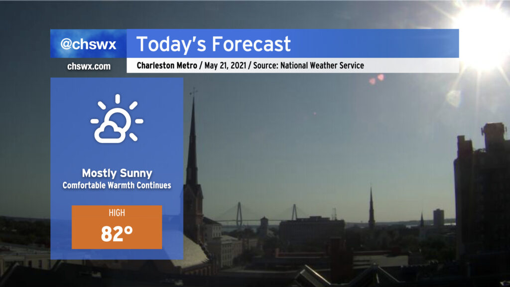
We’ve got another comfortably warm day ahead as strong high pressure remains firmly in control of our weather. This morning’s satellite just shows some high clouds filtering in from the north, though we can expect some fair weather cumulus to develop this afternoon as highs get into the low 80s and the seabreeze circulation develops and moves inland. Temperatures will top out in the mid-70s at the beaches with onshore flow continuing. We could see some occasionally gusty winds behind the seabreeze, which is quite important particularly if you are trying to make the cut at a certain major golf tournament.
After today, we begin to warm up quite a bit, with the heat really turning on beginning Sunday. More on this later today.
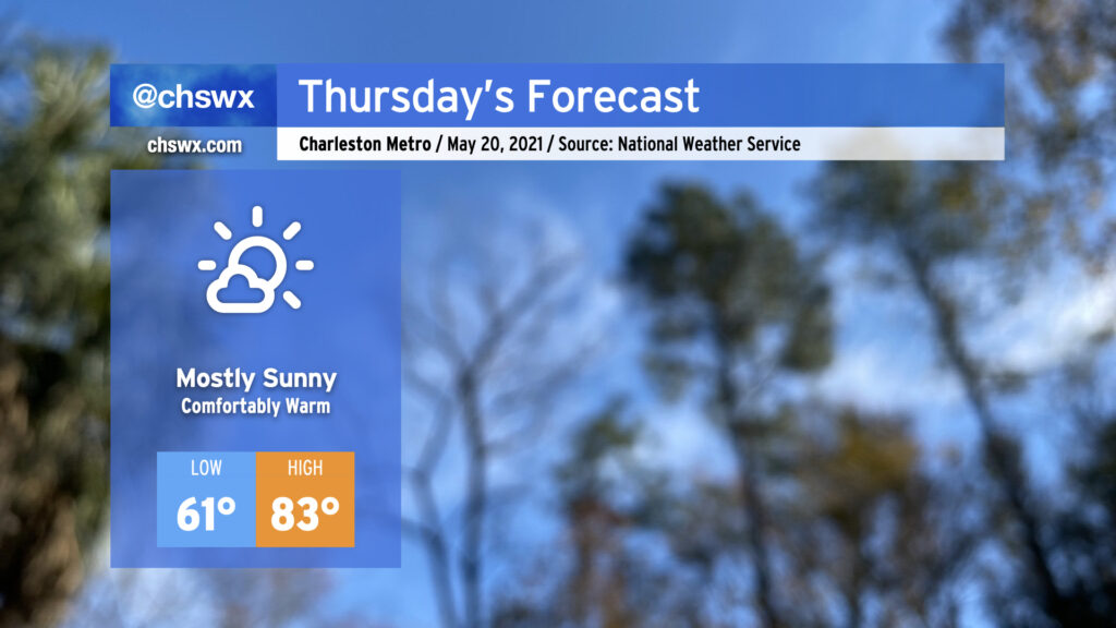
Thursday is looking quite good with high pressure beginning to assert greater control over our weather. The periods of showers we saw over the past couple days will be a thing of the past, and temperatures will remain comfortably warm with onshore flow. After starting the morning in the 60s, expect highs in the low 80s away from the immediate coast. Dewpoints in the upper 50s keep heat indices in check, making for a nice mid-May day.
Wednesday looks quite a bit like today: a mix of clouds and sun with temperatures right around normal for mid-May. Much like today, a little bit of troughiness on the periphery of high pressure will come ashore during the day, potentially being a touchpoint for a shower or two. Don’t expect much in the way of widespread measurable rainfall — the vast majority of us will remain dry. Highs will top out in the low 80s away from the locally cooler coastline, and low 60s dewpoints will be reasonably comfortable.
After tomorrow, high pressure will take even firmer control of our weather. Expect temperatures to steadily rise into the end of the week through the weekend; we’re very likely going to see our first 90° days of the year beginning Sunday, with a bit of a heat wave persisting into next week as highs approach the mid-90s. It’ll certainly be the warmest stretch of 2021 thus far. Suffice to say, it’s safe to stow the winter wear for a few months!
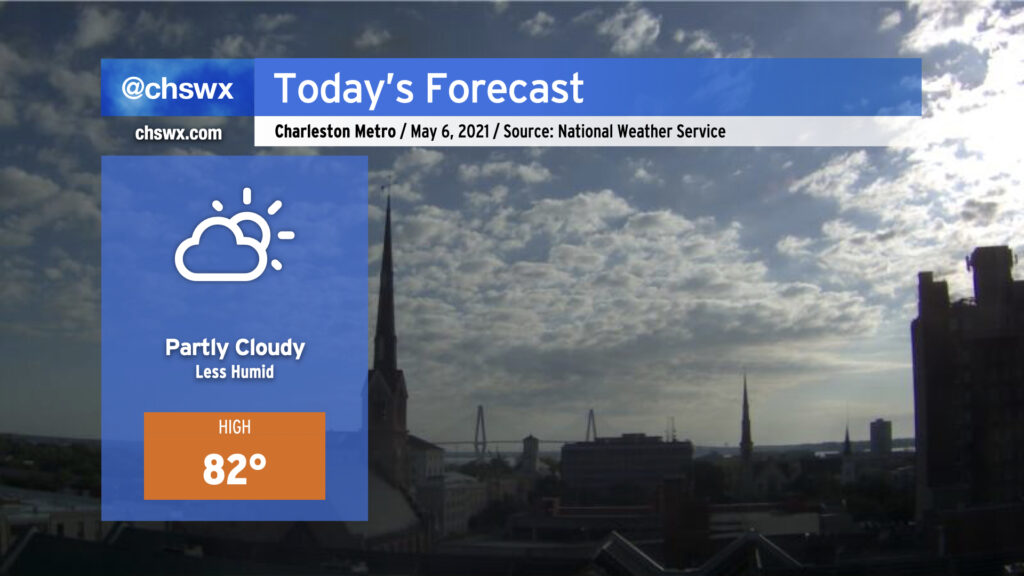
Despite a little more cloud cover, expect temperatures to run a little warmer Tuesday in part due to a little more moisture being available and the overall modification of the airmass that settled in behind the front last week. Temperatures will still run generally around, if not slightly below, normal for mid-May, with cooler air at the coast keeping highs at the beaches in the 70s.
Despite high pressure continuing to build across the area, one cannot totally rule out a shower or two developing on the southern extent of the ridge. The better rain chances will be south of us, but a few sprinkles aren’t out of the question. All in all, the vast, vast majority of us stay dry tomorrow — and we’ll stay that way through at least early next week.
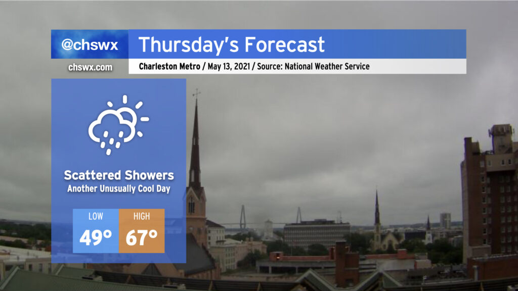
A late-season cold air damming wedge will remain in place on Thursday, keeping temperatures well below normal for mid-May and shower chances in place as low pressure develops off the Florida and Georgia coasts. We’ll start the day in the upper 40s to around 50° with highs — provided the wedge scours away a bit — topping out in the mid-60s. That may be generous, though. Breezy northeast winds will continue within the wedge throughout the day with persistent cloud cover. There’s a chance we could see some breaks in the clouds later in the evening, but that’s somewhat up in the air based on how much moisture could be trapped within the wedge.
As mentioned before, scattered showers look probable, with even some drizzle possible especially if the wedge remains entrenched. Suspect that the best rain chances are going to be closer to the coast and will be greatest in the morning. As low pressure pulls away, drier air will punch into the area, but it may take time to erode the layer of overcast just off the surface.
Fortunately, this will be relatively short-lived — clouds will begin to break on Friday, and by the weekend we’ll see mostly sunny skies and temperatures in the mid-to-upper 70s. Hang in there!
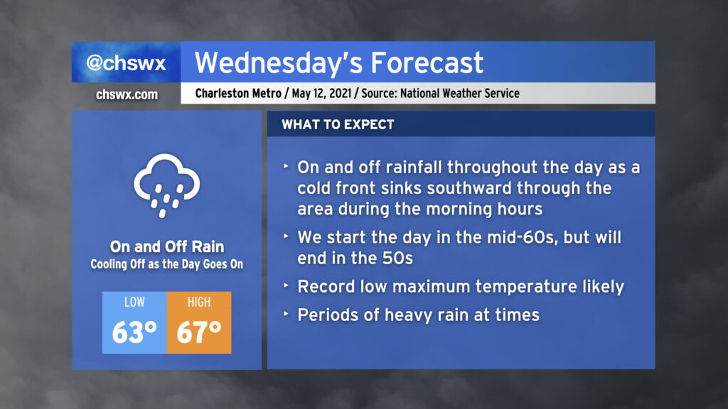
We will start Wednesday in the low to mid-60s across the area with showers and maybe a thunderstorm or two ahead of a cold front. Said front will sink southward through the area during the morning, and we will cool off as the day goes on. Expect our high in the mid-60s to be recorded before noon, with temperatures falling into the 50s during the afternoon and evening hours. Rain will be off and on throughout the day, so just be prepared with the rain gear as needed. (You might want to go with something fleece-lined.) Models suggest we may see a little break in the rain as we get into the evening hours once low pressure develops offshore and heads away, which may not be the worst thing for the commute home.
It looks like we will set a new record low maximum temperature on Wednesday. The current coldest high recorded at the airport on May 12 is 69° set in 1963. The current forecast high of 67° will clear that bar fairly comfortably. All will hinge on how quickly the cold front can get through the area during Wednesday morning.
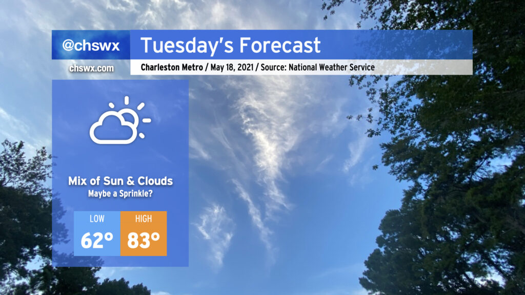
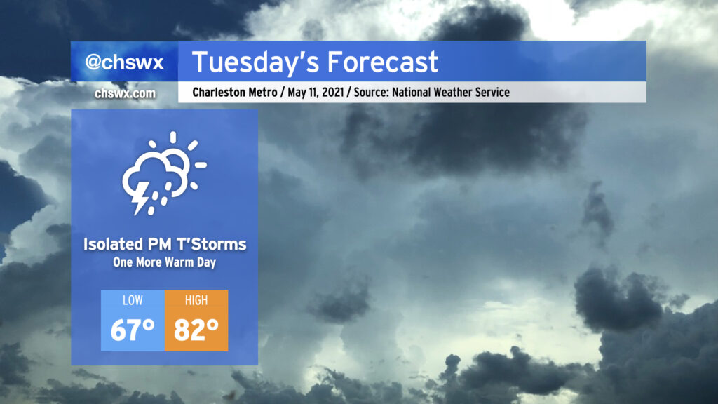
We have one more day in the 80s on Tuesday before a backdoor front sinks south of the area Tuesday evening, bringing quite a cooldown to the area Wednesday and Thursday. Isolated showers and thunderstorms will be possible as the front sags southward across the area, particularly in the afternoon.
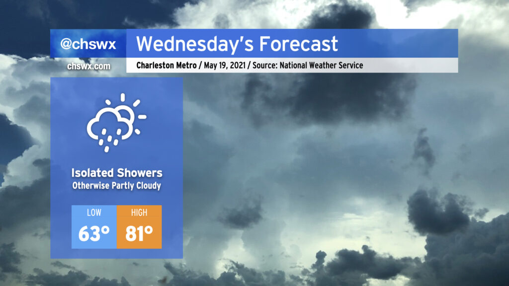
Better rain chances arrive overnight into Wednesday, as moisture overruns a weak wedge of high pressure, setting up widespread precipitation for Wednesday and potentially into Thursday. An excessive rainfall event is not expected — indeed, this rain will be quite welcome as we continue to experience abnormally dry conditions across the Lowcountry. The persistent rain falling into the wedge will keep temperatures pinned down in the upper 60s. Record low maximum temperatures of 69 on Wednesday (set in 1963) and 68 on Thursday (set in 1996) are certainly in jeopardy. (At least it’s May and not January, where the wedge is often much chillier and the rain much more unpleasant!)
Temperatures rebound beginning Friday, and we continue to look really good for an extremely pleasant weekend of weather. (It’s never too early to think about the weekend, after all.)
A cold front came through early this morning and you can really feel the difference out there! The air is much drier this morning in comparison to yesterday, with dewpoints down into the upper 50s and low 60s as opposed to the mid-to-upper 60s as they were 24 hours ago. Partly cloudy skies will continue today as low pressure organizes off the coast later today, with a very tiny chance of a shower this evening. We’ll see a second round of dry air punch in overnight, making for excellent weather especially Friday into Saturday.