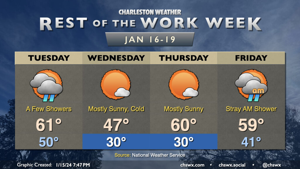
Temperatures will be somewhat fickle this week as a series of fronts move through the area. Tuesday will trend on the warm side, with lows around 50° to start the day heading into the low 60s in the afternoon as the first front moves by. A few showers will be possible along and ahead of the front, primarily midday through early evening. They won’t have much moisture to wring out, so expect the showers to be on the light side. From there, temperatures will plummet overnight.
We will most definitely know that a front has come through Wednesday morning. We’ll wake up to subfreezing temperatures across much of the area away from the immediate coast; breezy northwesterly winds will make it feel closer to the low 20s. The ongoing cold advection will prevent temperatures from reaching too far into the upper 40s in the afternoon despite mostly sunny skies.
Thursday gets off to a similarly chilly start (though with less wind, at least) as lows once again head toward around 30° (and likely colder further inland and in rural areas). However, the coldest air will be departing during the day, and temperatures head to around normal in the afternoon, generally running around 60°. The respite from the very cold air continues Friday. We’ll wake up in the low 40s and top out in the upper 50s to around 60° with a few morning showers possible as another front moves by, which brings the coldest air thus far this season into the area for the weekend.
Quieter weather returns to the area for the weekend, and not a moment too soon. We start Saturday in the mid-40s, but a breezy westerly wind will keep temperatures suppressed to the mid-50s despite partly cloudy skies as cool air blows in behind a cold front. Cloud cover decreases overnight and winds calm down, allowing for decent radiational cooling conditions for Sunday morning, when temperatures look to fall back to the mid-30s (and maybe near freezing in more rural areas). It’ll be a brilliantly sunny day, and temperatures will respond nicely, heading into the low 60s in the afternoon. Quiet weather should prevail for much of Martin Luther King, Jr. Day, too, with only a few showers possible after sunset; the better risk for rain arrives Tuesday.
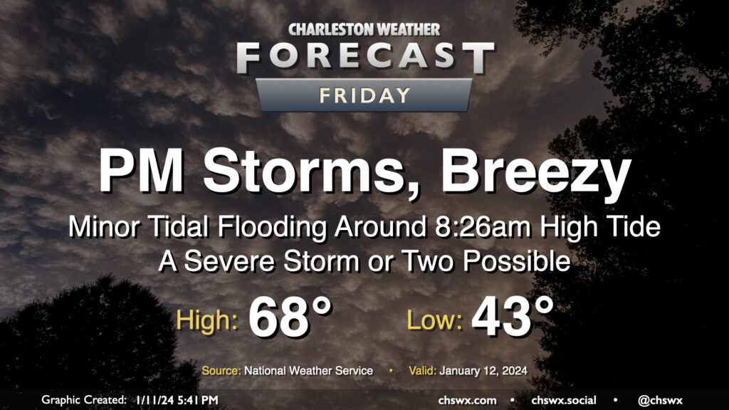
Another storm system will impact the area on Friday with gusty winds and some showers and storms in the afternoon and evening hours, with a few pockets of severe weather possible, but certainly not the widespread threat that we saw on Tuesday.
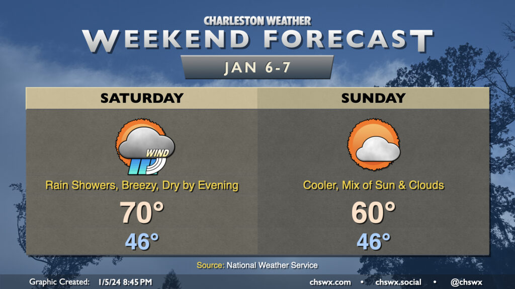
We’ll likely be waking up to rain Saturday morning as a storm system moves through the area. Rain could be heavy at times, with a half-inch to an inch of rain possible in many spots. It’ll be windy, too: gusts to 30-35 MPH will be possible, so batten down the hatches if you have rain-or-shine outdoor events. The bulk of the rain should exit by early afternoon, though guidance does suggest some wrap-around moisture may keep a few showers around through early evening. From there, we should dry out. Temperatures during the day will be as warm as they’ve been so far in the small sample size of 2024: expect lows in the mid-40s to yield to highs near 70° in the afternoon as warm air advects into the area.
Sunday will be a quieter weather day, with cooler and somewhat drier air working into the area in the wake of Saturday’s storm system. Expect to start the day in the mid-40s with breezy westerly winds keeping highs capped to around 60° in the afternoon under a mix of sun and clouds.
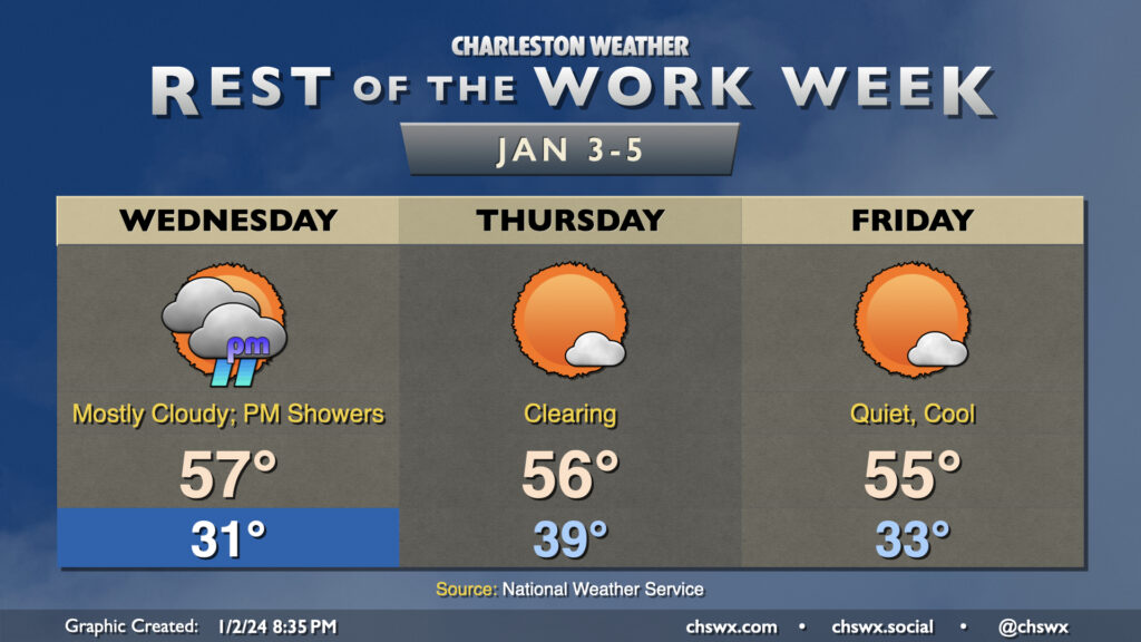
Wednesday gets off to a freezing start across the metro area as lows dip into the low 30s away from the warmer coastline thanks to calm winds and mostly clear skies setting up for a good night of radiational cooling. The sub-freezing air doesn’t last long, though, as moisture increases ahead of a storm system that will be traversing the Gulf of Mexico during the day Wednesday. It’ll fling some showers our direction, primarily from late afternoon Wednesday into the overnight and very early Thursday morning.
The storm system clears the area by daybreak Thursday, setting up a couple quiet days of weather. Expect highs in the mid-50s on Thursday and Friday, with an upper 30s start on Thursday before heading back to near the freezing mark on Friday morning.
A nor’easter will make this second-to-last shopping weekend before Christmas a little tricky, with heavy rain, gusty winds, and coastal flooding all coming into play, especially on Sunday.
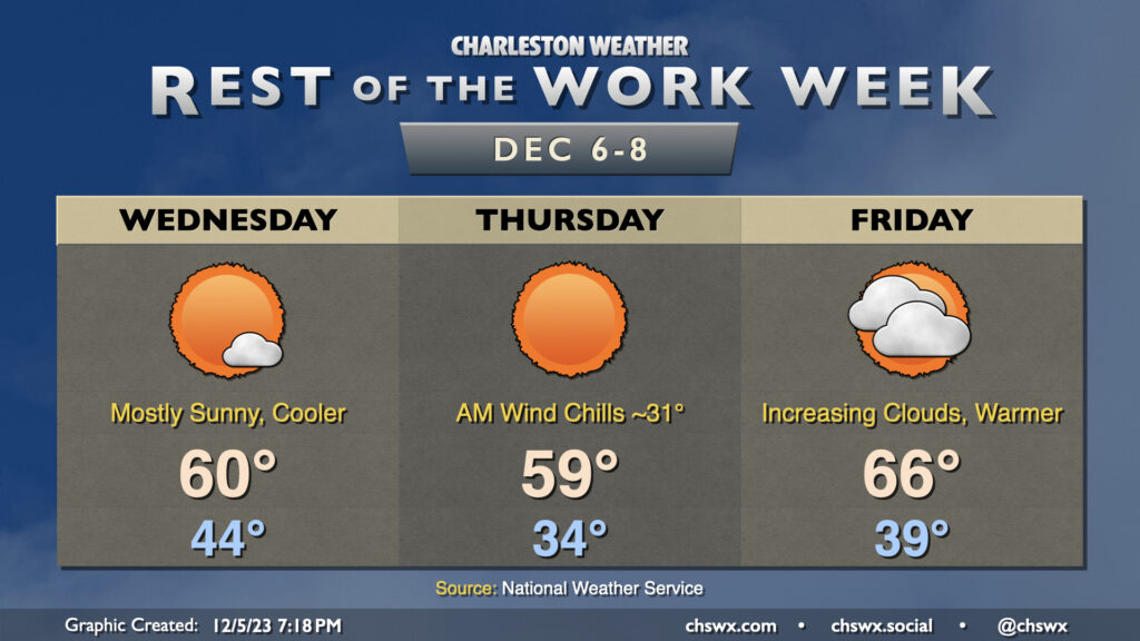
Another chilly start is in store for Wednesday as high pressure to our north keeps some cool air blowing into the area throughout the night. This will send temperatures down to the mid-30s once again, with another shot at freezing in a few more secluded spots. Wind chills will dip below 32° at times in the morning, so be sure to dress appropriately. The good news is that we warm up some compared to Tuesday, heading to the low 60s in the afternoon under partly cloudy skies.
The brief warmup doesn’t last long, though: a reinforcing cold front comes through overnight Wednesday into Thursday, ushering in strong high pressure that will not only reinforce the chill — expect highs just to top out in the mid-to-upper 50s — but also kick up the northeasterly winds, which will start to drive tidal departures higher as well, which may lead to minor to moderate coastal flooding in the morning. This strong high pressure will lead to another mid-30s start on Friday, with highs struggling to the upper 50s despite mostly sunny skies. We’ll also need to watch Friday morning’s tidal departures for the risk for additional coastal flooding.
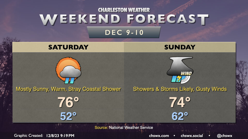
So, let’s get this out of the way: If you’re going to do stuff outside this weekend, do it Saturday. Temperatures will be unseasonably warm and there will be plenty of sunshine. Expect to start the day in the low 50s — a good ten degrees or more warmer than many of us started this morning — with highs topping out in the mid-70s in the afternoon. Aside from the risk for a stray coastal shower to sneak ashore at times, much of the metro gets Saturday in rain-free.
Sunday should be a different story. The first thing to note is that it probably won’t rain all day — there will be breaks, especially in the morning and early afternoon. However, winds will be cranking up with gusts approaching 30 MPH (and likely higher on bridges and overpasses, especially closer to the coast) ahead of a band of showers and a few thunderstorms that looks to push through during the mid-afternoon and evening hours. These could bring down some even stronger wind gusts especially inland of 17, but widespread severe weather isn’t expected given a lack of available instability. We should see any thunderstorms weaken as they approach the coast and the locally more stable air thanks to shelf waters in the upper 50s. Still, keep an ear out for possible statements or warnings in case a strong thunderstorm approaches your location.
Rain tapers off overnight Sunday as the front gets by, and it looks like high pressure will keep things on the cool side of normal for much of next week.
Another cool couple days lie ahead as a reinforcing front comes through early Wednesday morning. This will be a pretty solid shot of cool and dry air as high pressure builds in from the west. We’ll start Wednesday in the mid-40s, but the cooler air rushing in will limit the high to around 60° in the afternoon despite primarily sunny skies. It’ll be a bit breezy, with gusty winds out of the northwest at times, so some element of wind-breaking may be ideal.
Thursday will be the coolest day of the week. We’ll start the day in the mid-30s, with inland locations possibly approaching freezing. A light wind will make it feel a little cooler, with wind chills in the low 30s across the metro. Skies will once again be predominantly cloud-free, but the cold high pressure settling in will hold highs to the upper 50s to around 60°.
High pressure slips offshore Friday, and this allows some warmer air to move back in. We start Friday in the upper 30s to around 40°, but temperatures will warm back toward the mid-60s in the afternoon. Clouds will also be increasing as a coastal trough begins to take shape nearby, but rain is not expected.
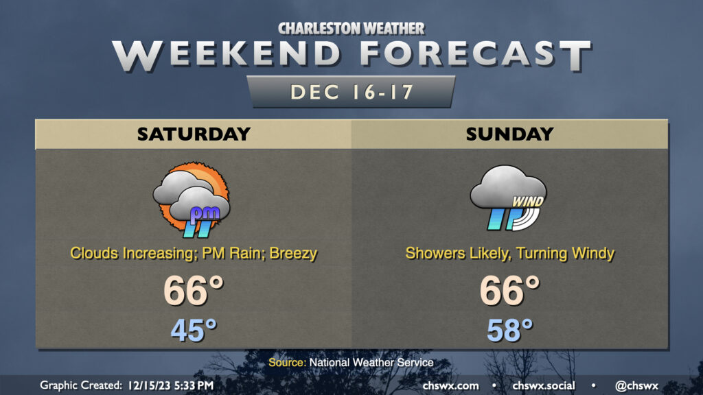
The weekend will be unseasonably warm with off and on showers, particularly starting Saturday afternoon and lasting into Sunday. The first thing of note will be the low temperatures in the low to mid-60s each morning. The normal high for early December runs around 67° or so…and we’ll be within striking distance of that in the mornings. Afternoon highs will be tempered by cloud cover and shower activity, but will still run well above normal in the mid-70s. As for the rain, it looks to be fairly on and off, with models hinting that a thunderstorm complex moving across the Gulf Coast into Florida may rob some of the moisture transport into the area. This could act to reduce the amount of rain we ultimately receive and may make the weekend look like less of a washout than first thought. We’ll keep an eye on this, but keep rain gear handy anyway and be ready for travel issues, because when it sprinkles, traffic snarls.