Jared Smith founded @chswx on Twitter in 2008 as an experiment in disseminating weather data through social media. In the ensuing decade-and-a-half, @chswx has provided live coverage of tropical cyclones, tornadoes, severe weather, and even a couple bouts of winter weather to the good people of Charleston, SC.
A warm start to the work week will give way to a taste of fall to close it out. (I mean, my goodness, 82° and fair skies on Thursday? Pinch me!) Plus, no worries about the tropics for the foreseeable future, either. Here’s a look at the week ahead…
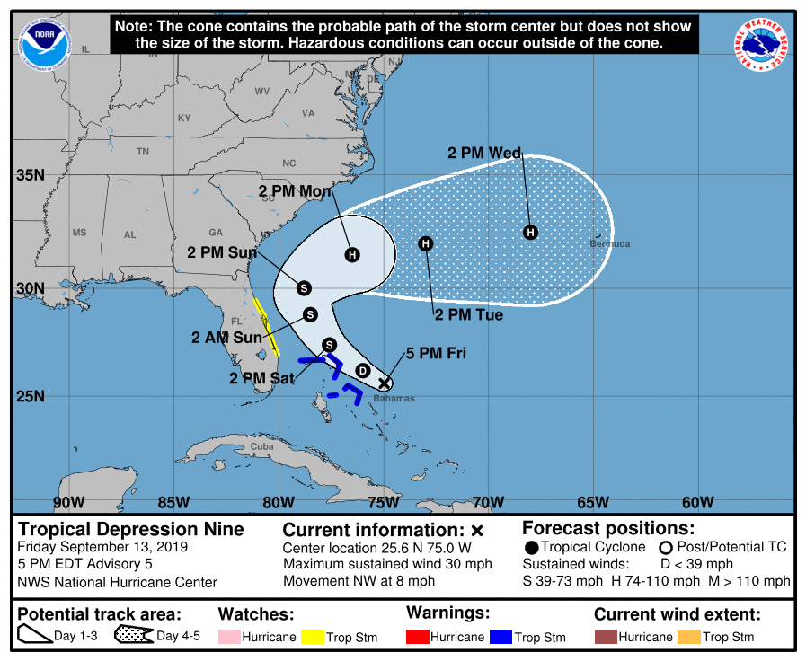
We now have Tropical Depression Nine in the Atlantic after a closed circulation was found. It has maximum sustained winds of 30 MPH and it moving NW at 8 MPH. It is expected to become Tropical Storm Humberto tomorrow as it moves very near the Abaco Islands.
Potential Tropical Cyclone Nine, which is forecast to develop into Tropical Storm Humberto by tomorrow, continues to bring breezy conditions and rain to the Bahamas, who totally need such a thing right now. We continue to monitor this storm for potential impacts to our weather next week, but there is still serious uncertainty that has not yet been resolved in the models. So, we watch and wait.
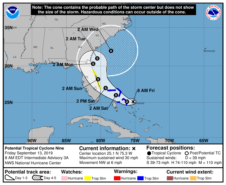
The National Hurricane Center has started advisories on Potential Tropical Cyclone Nine. This is a wave that has not yet become a tropical cyclone, but the probability of it becoming one is high enough for NHC to issue Tropical Storm Warnings for the Abaco Islands and Grand Bahama — exactly where they are not needed. If named, PTC 9 would be Humberto.
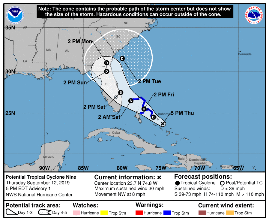
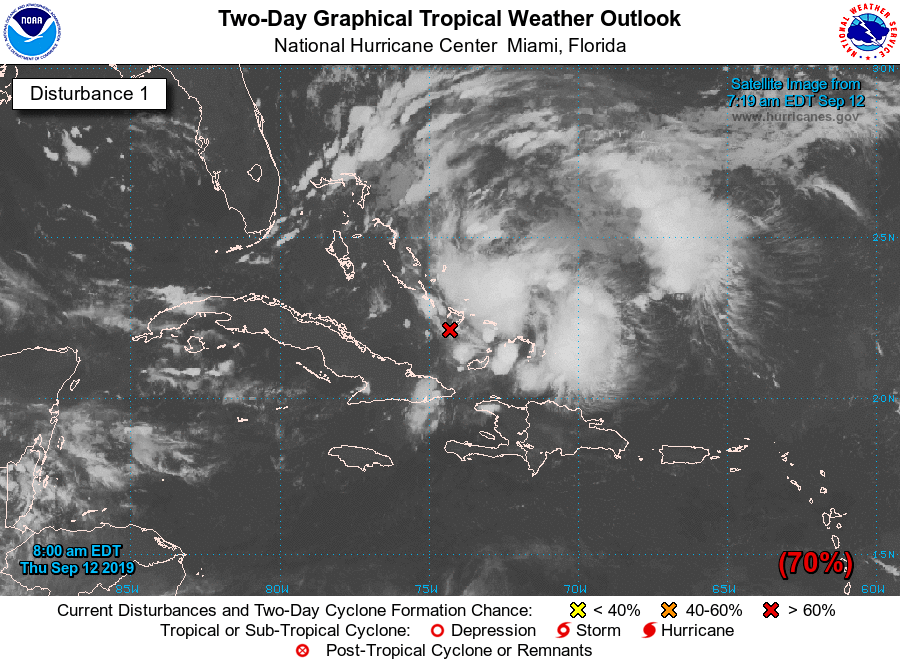
The National Hurricane Center is watching an area of disturbed weather affecting the Bahamas for potential tropical cyclone development. This wave has been watched closely for the last few days, and probabilities for development have been rising. It now appears likely that we will see a tropical depression form in the next couple days. If it becomes named, it would be named Humberto.
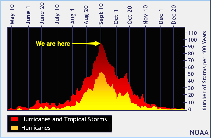
Today is September 10, which marks the climatological peak of hurricane season in the Atlantic basin. Fresh off our brush with Dorian, let’s take a look at where we are and where we might be headed for the rest of the season, which runs through November 30.
The week ahead will continue to feature a late-summer heat wave, especially as we kick off the new work week. Temperatures in the 90s will feel closer to the 100s with humidity with just a slight chance of an afternoon shower or storm to cool things off. Thunderstorm chances kick up as we head into the weekend as a tropical disturbance (more on that in a sec) is set to move through Florida, enhancing moisture in our neck of the woods.
An abnormally strong ridge of high pressure is going to build in for the weekend, keeping rain chances relatively low and temperatures rather high for early September. In fact, the record high of 95° for Saturday is forecast to be at least tied. By Sunday, more humidity works its way in and heat indices may exceed 105°. Aside from an isolated afternoon thunderstorm, relief from the heat looks unlikely. Keep this in mind if you or someone you know remains without power — they’re going to want some air conditioning this weekend!
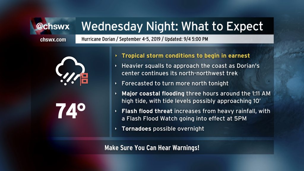
Dorian is about to ramp up across the Charleston metro area as the storm’s more central rainfall begins coming ashore. Tropical storm-force winds are already being felt at Folly Beach, and will spread further inland with time. Your window to safely evacuate has closed. Time to shelter in place and ride this thing out.
Prepare for the potential for flash flooding, power outages, and perhaps a tornado. Make sure you can hear severe weather alerts and that they can wake you!
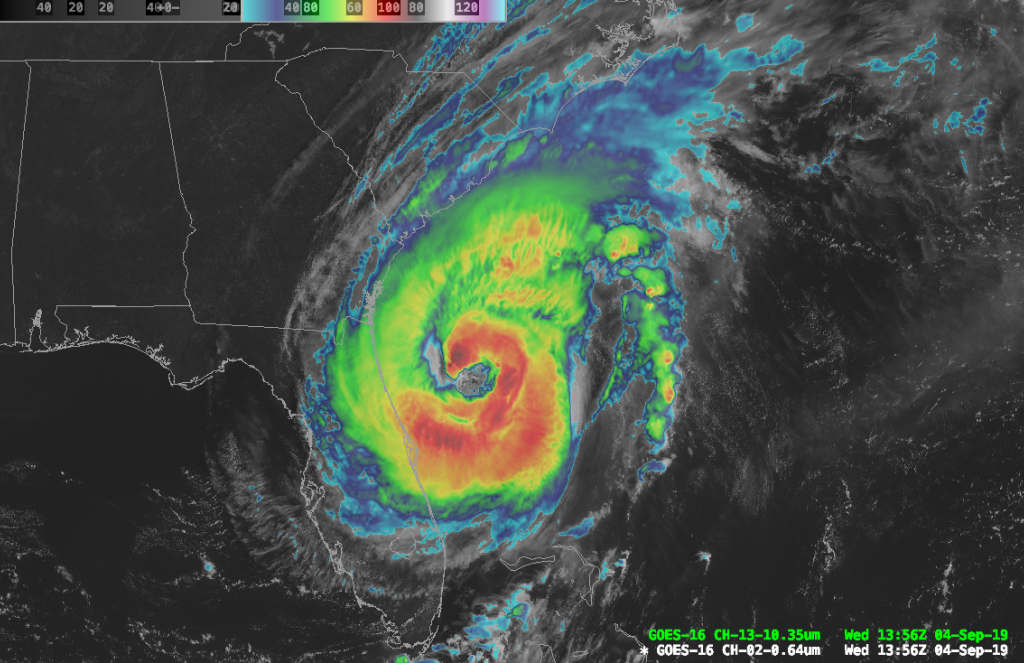
Hurricane Dorian is making its move on Charleston. Going forward, I’ll be live-blogging updates as needed from the National Hurricane Center and sharing storm reports.