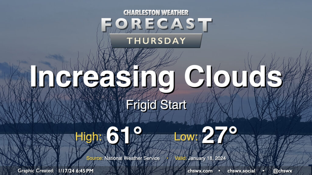
Thursday will get off to a very chilly start across the Lowcountry as calm winds and clear skies combine to allow for a solid radiational freeze across the area tonight into Thursday morning. Expect lows to bottom out in the mid-20s in a fair bit of the metro, with slightly warmer — but still at or very near freezing — temperatures near the coast. Bring pets in tonight and cover sensitive plants. Consider dripping a faucet, too, especially further inland.
The good news is that temperatures won’t stay below freezing for long after the sun comes up. High pressure will move offshore, allowing temperatures to recover to the low 60s by afternoon as cloud cover increases. There is a risk for a few showers very late Thursday into early Friday, but we’ll get the daytime hours in rain-free.
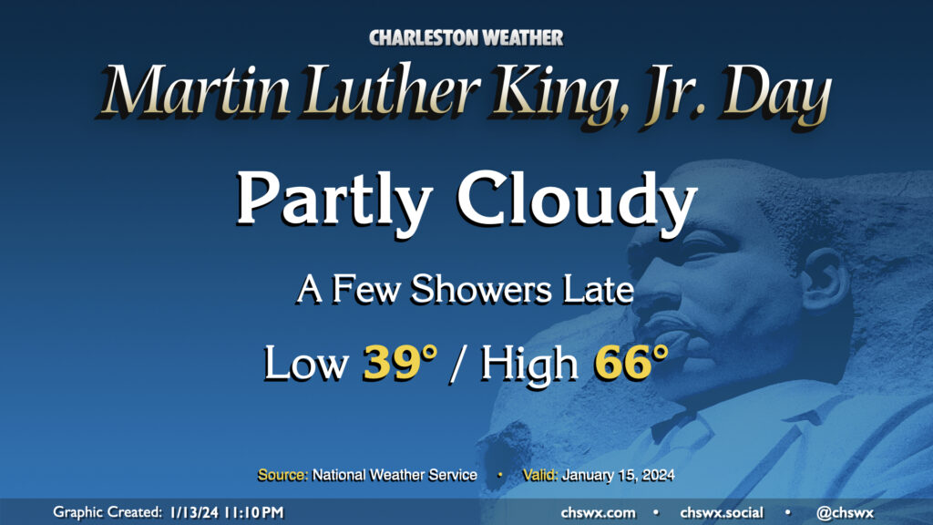
Martin Luther King, Jr. Day will be a generally quiet day of weather, with just a few showers potentially developing late. We start the day in the upper 30s, warming to the mid-60s (and maybe beyond) in the afternoon despite increasing cloud cover. Dry conditions should persist through sunset; thereafter, a few showers could move into the area as a front approaches. Overall, though, outdoor activities look to be generally okay and rain-free.
Slight shower chances persist as we head into Tuesday. Another front will then send some very cold air our direction. We’re going to feel it big-time on Wednesday as we wake up to air temperatures around freezing, but the westerly wind around 10 MPH will make it feel much colder (think low 20s). Strong cold advection will keep temperatures limited to the upper 40s in the afternoon. After a freezing start Thursday morning, temperatures recover to near 60° in the afternoon under partly cloudy skies. Another front swings through Friday, and that’ll usher in another round of even colder air over the weekend. Pipe-busting lows in the 20s could be quite common, particularly Sunday morning, with highs topping out just in the low 40s. Stay tuned to forecast updates this week as more data comes in.
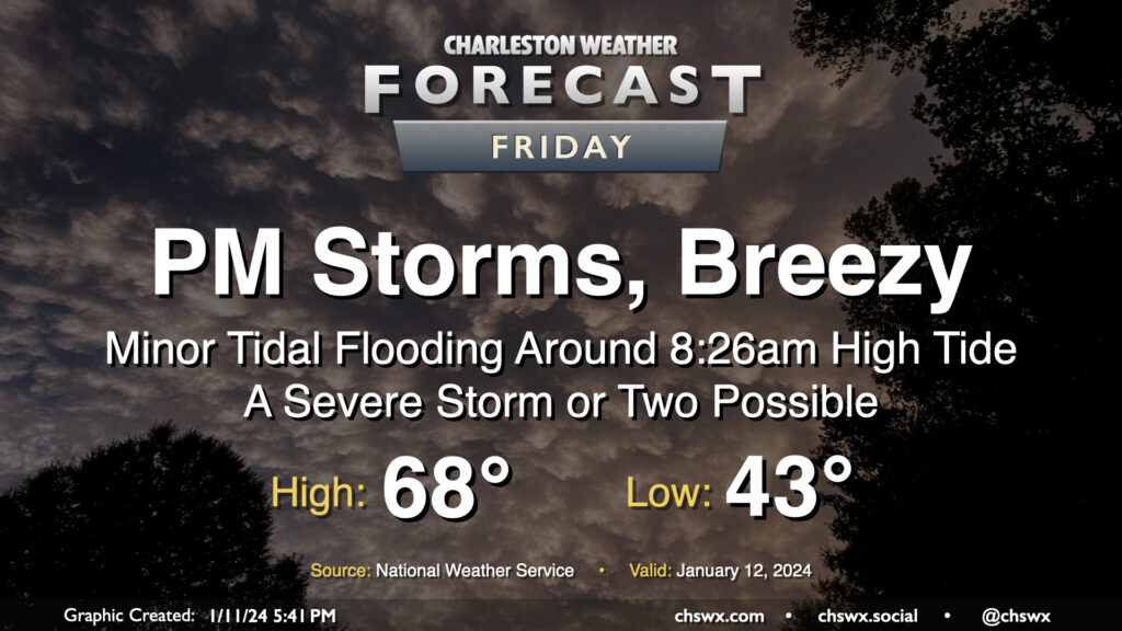
Another storm system will impact the area on Friday with gusty winds and some showers and storms in the afternoon and evening hours, with a few pockets of severe weather possible, but certainly not the widespread threat that we saw on Tuesday.
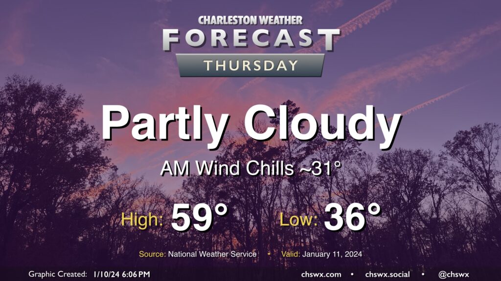
High pressure will be in control for one more day on Thursday. We’ll start the day a little cooler than we did on Wednesday, and certainly much less windy, too. However, a light breeze will still make lows in the mid-30s feel closer to freezing. Temperatures will head to the upper 50s in the afternoon under a mix of sun and cloud cover.
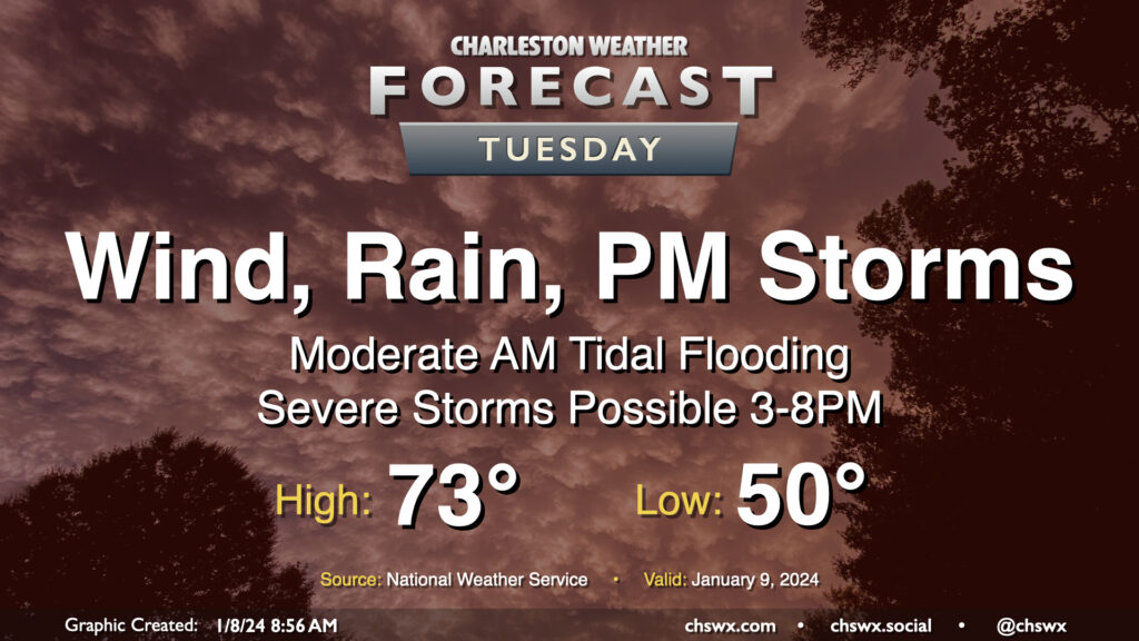
An unusually potent storm system will affect the area on Tuesday, bringing strong, gusty non-thunderstorm winds, some tidal flooding in the morning, and a squall line in the afternoon and early evening that could bring a swath of damaging winds and maybe a few tornadoes on its leading edge.
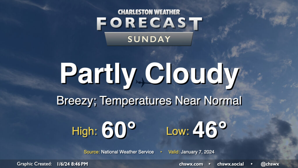
After a rather warm Saturday — the warmest day of the young year so far with a high of 75° — temperatures return to normal on Sunday as cooler and drier air blows in behind a cold front. We start the day in the mid-40s, but the ongoing cool air advection will hold highs to around 60° in the afternoon despite partly cloudy to mostly sunny skies. It’ll be another breezy day; expect winds generally 10-15 MPH out of the west with gusts approaching 25-30 MPH once again.
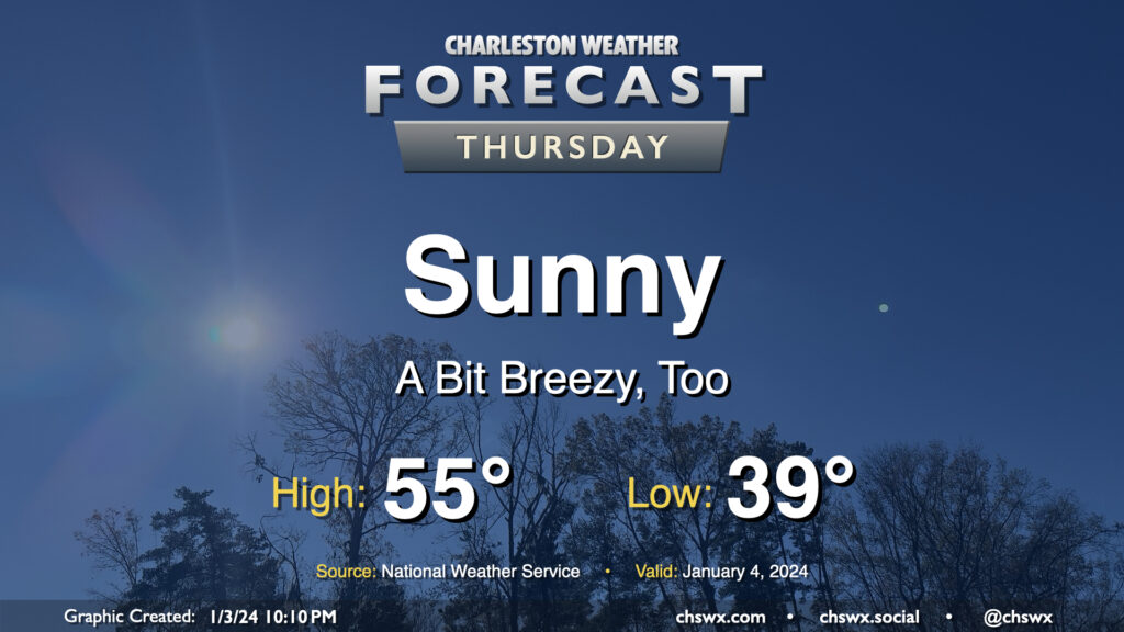
A brief round of rain on Wednesday night will depart the area by daybreak Thursday, leaving behind a little bit cooler air as well as unfettered sunshine. We start the day in the upper 30s to around 40° before warming to the mid-50s in the afternoon — a few degrees below early January normals (60°). It’ll be a little breezy, with winds out of the north and northwest around 10-15 MPH, which will be a contributor to keeping high temperatures below normal despite all the sunshine.
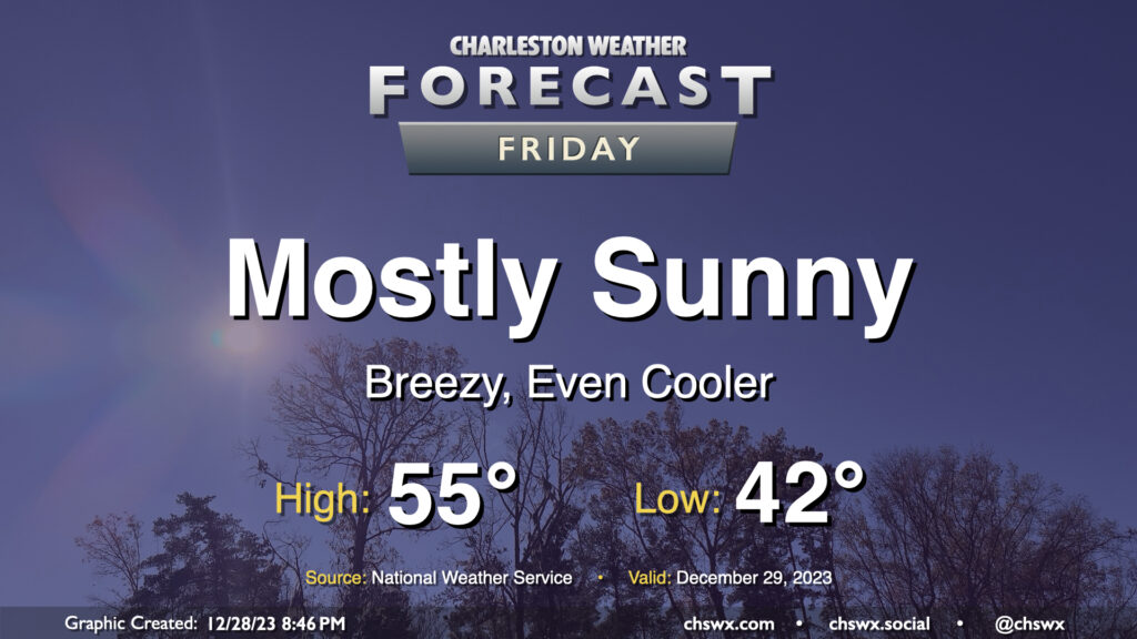
A cold front coming through overnight will send temperatures even cooler for Friday. We start the day in the low 40s, but cold air will be blowing in throughout the day. This will keep temperatures suppressed to about the mid-50s in the afternoon despite mostly sunny skies. It’ll be a breezy day, too; winds will generally run 10-15 MPH with gusts to 25 MPH as daytime heating helps push mixing heights to about 5,000 feet. Cloud cover will generally be sparse with a fairly dry atmosphere in place, with maybe a few fair weather cumulus showing up from time to time.
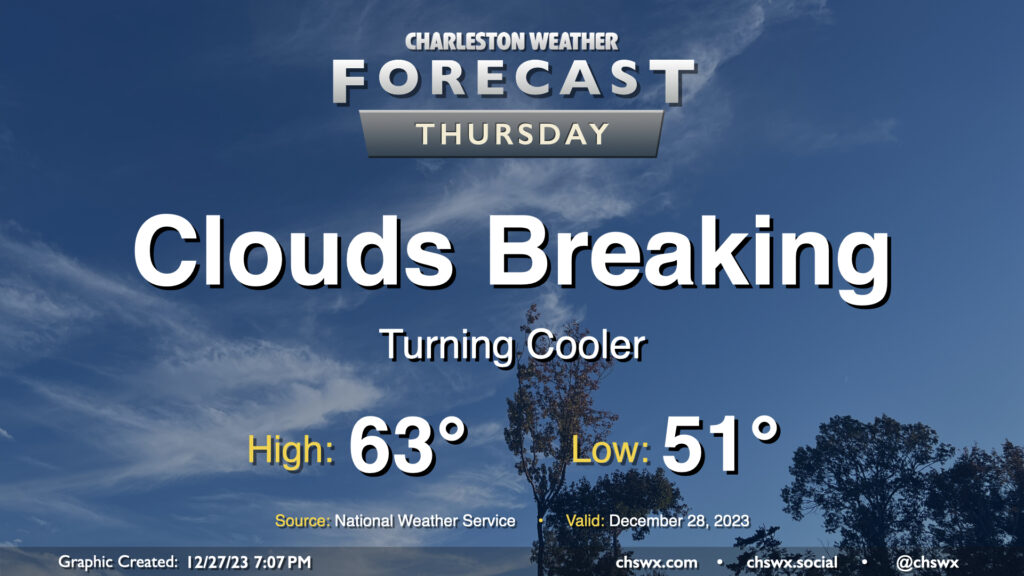
Thursday will be a much cooler day than Wednesday was across the Lowcountry, where most stations made it into the 70s at some point during the day, as an initial round of cooler and drier air infiltrates the area ahead of a reinforcing front which will really chill us out for Friday into the weekend. Dewpoints fall into the mid-40s throughout the night, allowing temperatures to drop generally into the low 50s to start Thursday. We’ll top out in the low-to-mid-60s in the afternoon — still a touch above normal — as clouds gradually start to break up along with the cold front’s passage.
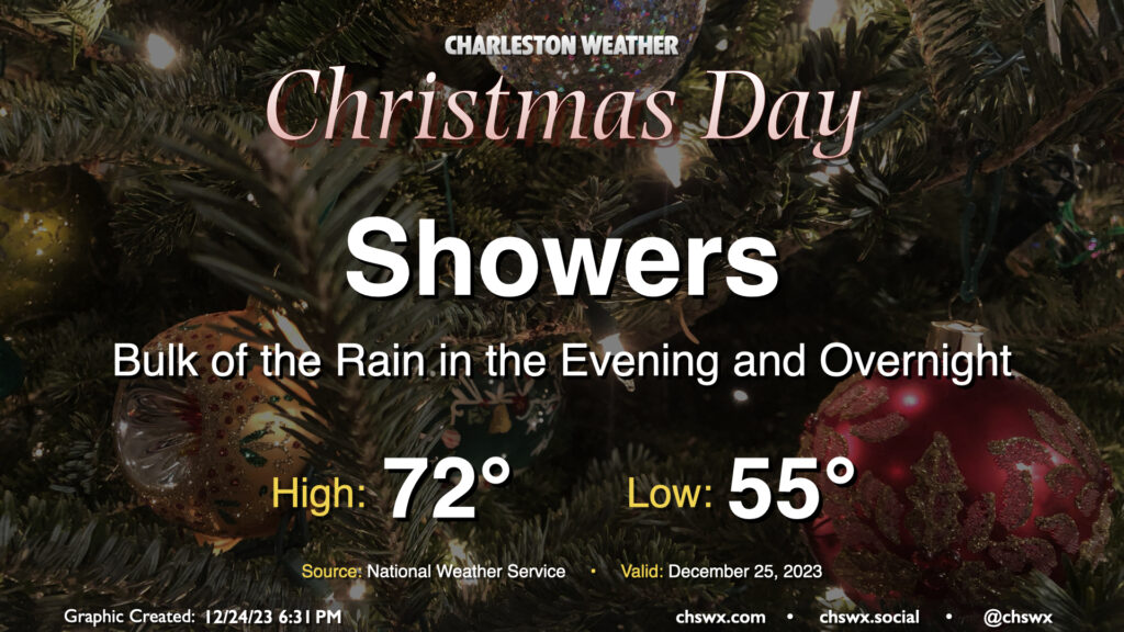
Unsettled weather arrives for Christmas as a complex and sprawling storm system begins to affect the area. We should see a few scattered showers in the morning through early afternoon, but expect shower coverage and intensity to tick up as we get further into the afternoon and evening hours. Temperatures on Christmas will run much warmer than climatology, though not into record territory. Expect lows in the mid-50s to yield to the low 70s in the afternoon before rain starts to kick in.
Water levels in Charleston Harbor look to reach flood stage (7′ MLLW) with the 6:30am high tide. This will put some salt water on some of the more vulnerable roads in Downtown Charleston, but no rain is expected to coincide, limiting the breadth of any flooding threat.