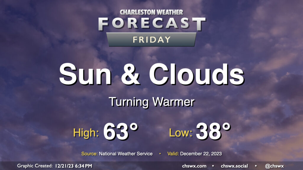
A warming trend continues for Friday as we head into Christmas weekend. We’ll get off to a warmer start — though it’ll still be in the mid-to-upper 30s — than we did on Thursday, which dipped back into the upper 20s. Temperatures Friday afternoon should once again head to the low-to-mid-60s with a mix of sunshine and high cloud cover as high pressure continues to be the main weather feature at the surface and aloft.
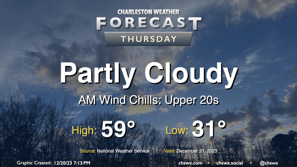
We have another chilly day ahead Thursday as we’ll once again start the day below freezing, though perhaps not to the degree we saw across the area Wednesday morning, when Charleston International Airport dropped to 27°, the coldest temperature this year and the coldest it’s been since December 28, 2022.
A warming trend will commence Thursday as highs head to the upper 50s under partly cloudy to mostly sunny skies as ridging moves overhead. While you’ll still want a jacket, it might not need to be as heavy!
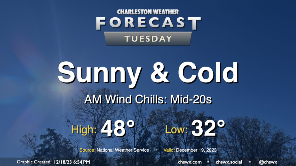
A cold front will swing through overnight, yielding a much chillier start on Tuesday as temperatures dip down to around freezing away from the coast and downtown. Breezy northwest-to-north winds will make it feel even colder, too, with morning wind chills dipping to the mid-20s across the area. Cold advection will continue throughout the day, and despite full sunshine, northerly winds will likely keep temperatures from heading above 50° in most locations.
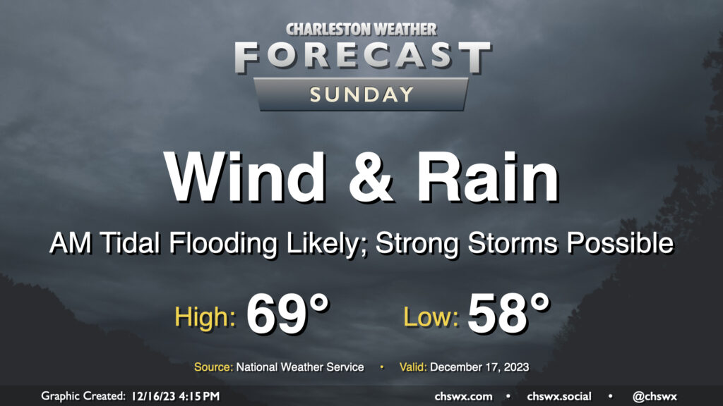
A fairly lousy and potentially high-impact weather day lies ahead for Sunday as a strengthening nor’easter moves along the coast. Wind and rain will begin to pick up early Sunday morning, with gusts near 45 MPH at times (and potentially even higher on bridges and overpasses). Rainfall could turn out to be quite significant, especially within any thunderstorms that can fire; before it’s over, many of us could see 3-5″ of rain with even higher amounts in some spots. Flooding is increasingly a concern as a result, especially with the potential for an 8′ water level around the 11:17am high tide coinciding with continued heavy rain. Finally, if surface-based instability can develop, a severe thunderstorm or two with locally damaging wind gusts and maybe even a tornado could be possible. All this to say that Sunday’s a good “stay inside” day.
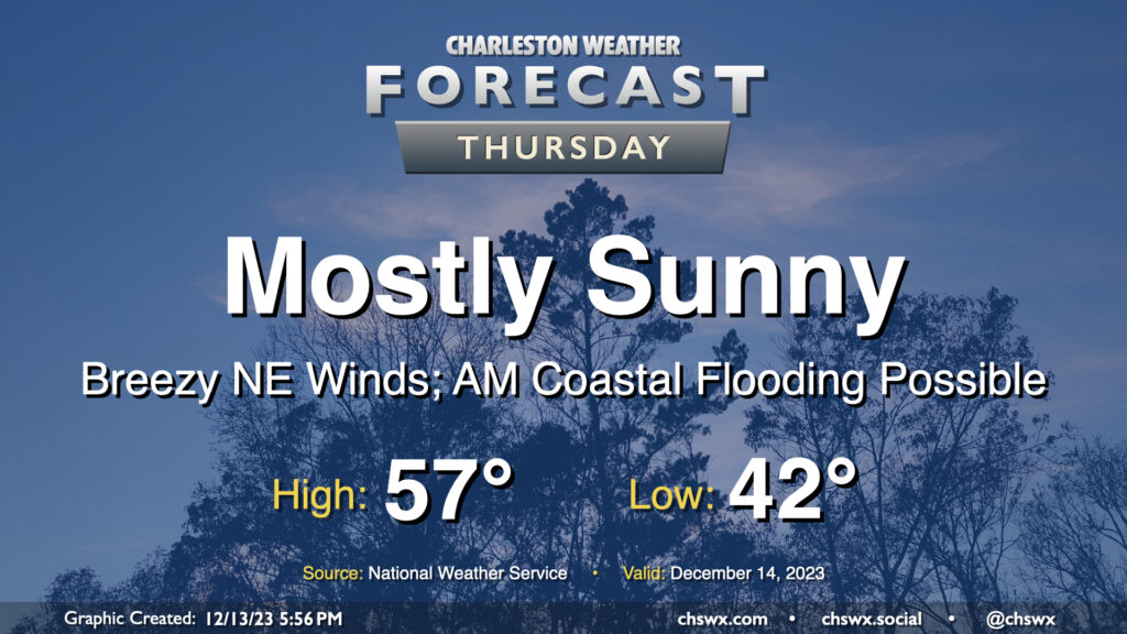
Reinforcing strong high pressure building into the area on Thursday keeps our weather generally cool and quiet, though winds will be blustery and there will be a coastal flooding risk in the morning.
Lows will dip only to the low 40s owing to breezy conditions restricting better radiational cooling. However, cool air pushing in from the northeast will keep highs capped to the upper 50s despite plenty of sunshine. Combine that with an increasingly stiff breeze — 15-20 MPH in the metro, with higher gusts — and you’ll be glad for a jacket with some wind-breaking capability. At least the sun will be out, and the sky should be largely unmarred by any cloud cover.
High tide around 8:37am will get high enough for minor to perhaps moderate coastal flooding smack dab in the middle of the commute. Be ready for possible road closures if downtown is in your commute plans. I’d also be cautious around Long Point Road near Snee Farm as water levels could approach thresholds to flood that road as well. Coastal flooding will remain a concern for the next few mornings, especially as we get into the weekend.
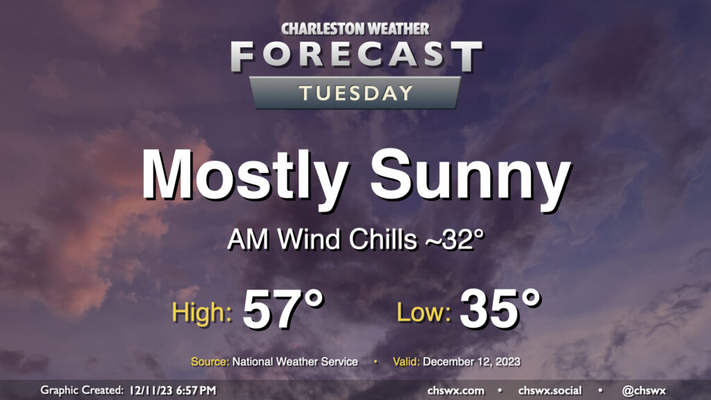
Tuesday will be another sunny day across the area, though you’ll want a jacket as cooler-than-normal temperatures continue. We start the day in the mid-30s, but the wind chill will make it feel around freezing. Some spots well inland could hit freezing, too. Bring in your pets tonight and cover or bring in any sensitive plants, just in case. Temperatures then warm once again to merely the mid-to-upper 50s despite mostly sunny skies as cool high pressure persists. This runs a few degrees below normal; the normal high for December 12 is 63°.
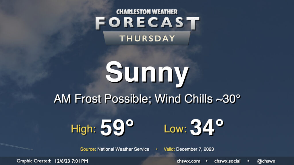
Thursday will represent the bottom-most point of this week’s temperatures rollercoaster, with lows bottoming out in the mid-30s across much of the metro with freezing temperatures further inland. Frost is a distinct possibility, and you’ll want to have pets and plants inside overnight Wednesday. Cool high pressure moves across the area during the day Thursday, limiting highs to the upper 50s to around 60° despite predominantly sunny skies.
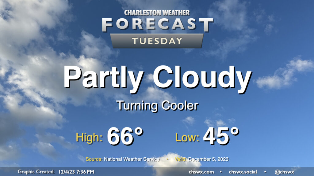
A reinforcing shot of cool air arrives overnight, and by Tuesday morning, we’ll wake up to temperatures about 10-15° cooler than we woke up to on Monday. Expect to start the day in the mid-40s before warming to the mid-60s in the afternoon under partly cloudy to mostly sunny skies. These temperatures are right around normal for December 5.
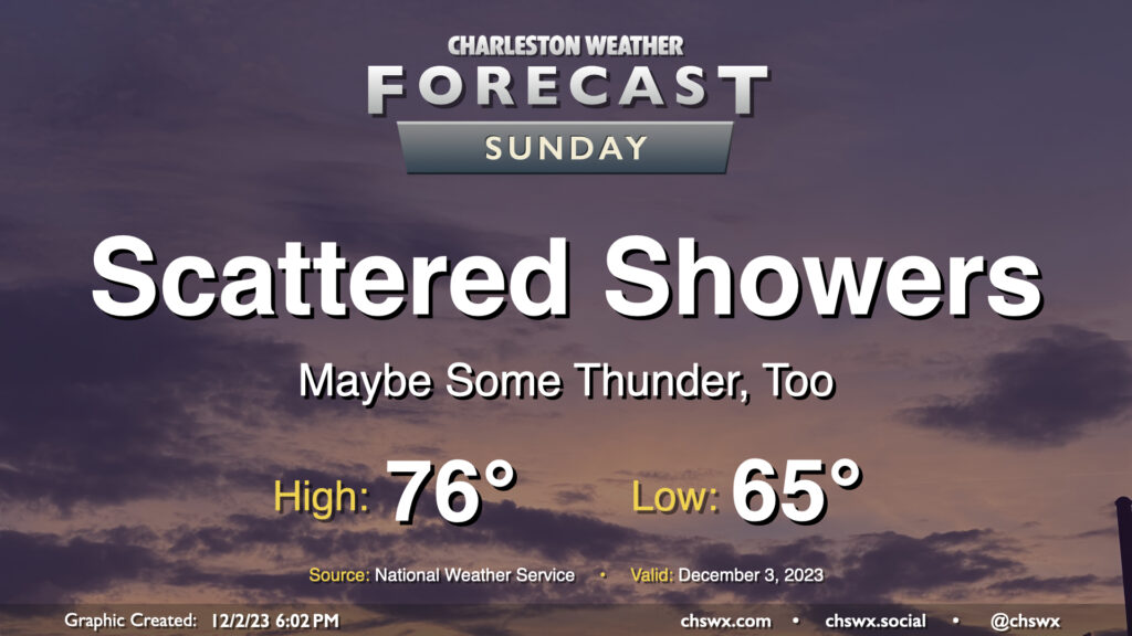
A cold front approaching the area should kick off some scattered showers at times throughout the day, with the best chances for rain generally occurring around midday to early afternoon. It’ll be one more unseasonably warm and muggy day across the area despite full overcast: lows will bottom out in the mid-60s — right in the neighborhood of the typical high for early December — with highs topping out in the mid-70s in the afternoon. It may be warm enough for some instability to develop, which could lead to a thunderstorm or two even as the front gets closer during the evening. No severe weather is expected, though. Generally speaking, rainfall amounts won’t be much to write home about — a few hundredths of an inch for most, with perhaps some locally heavier accumulation if a storm can fire. Shower chances taper after sunset, with the front to follow overnight.
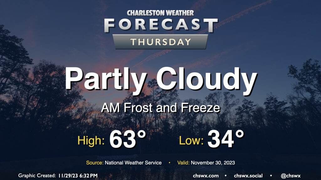
Keep those plants covered or indoors: Frost and freeze conditions will return Wednesday night into Thursday morning as cool high pressure remains in place for one more day. Lows will bottom out in the low to mid-30s in much of the metro, with the warmer temperatures near the water. We could even see some 20s further inland and in more rural locations as well. Make sure your pets have a safe place to be tonight!
Temperatures on Thursday will warm to the low-to-mid-60s in the afternoon under partly cloudy skies, perhaps running a few degrees warmer than Wednesday’s highs, but still on the cool side of normal for late November.