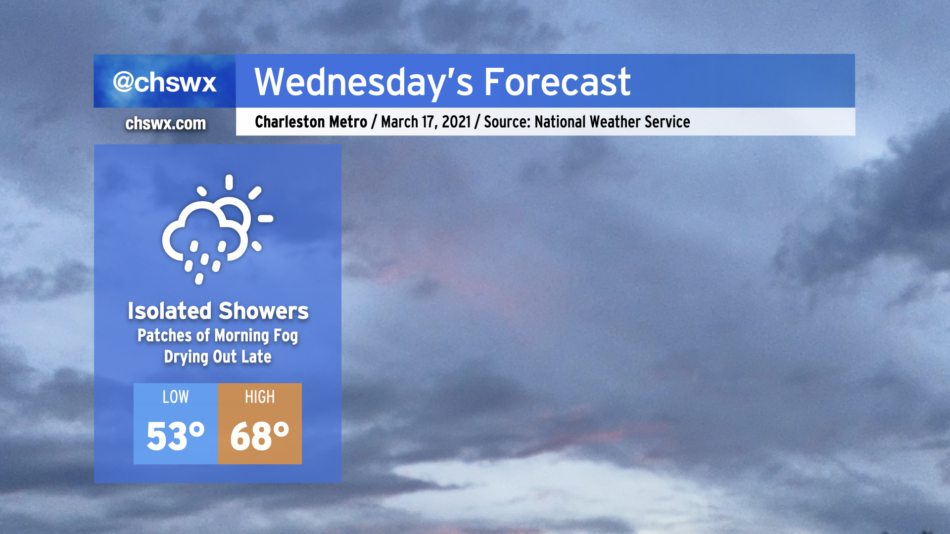
Another round of rain is expected overnight tonight as an upper-level disturbance moves through, with isolated showers possible during the day Wednesday.
The high pressure wedge won the day today, keeping temperatures well below forecasted levels in the low to mid-60s in the Charleston metro, while Moncks Corner struggled to 50°. It appears that the wedge will once again put a dent in temperatures tomorrow, with highs in the upper 60s in the Charleston metro perhaps being a bit generous if this afternoon’s high-resolution model runs have anything to say about it. Bottom line: Don’t misplace the light jacket tomorrow, preferably the green one given St. Patrick’s Day.
While we’ll be relatively calm tomorrow, a severe weather outbreak is expected from western Tennessee to Alabama as a strong storm system moves across the Mid-South. This storm system will head eastward and play a potentially major part in our weather on Thursday.
Well, it was nice while it lasted, but the rain is back overnight tonight into Tuesday as energy aloft as well as a surface low ripple along a stationary front to keep shower chances in the forecast, especially as we get into the evening hours. Expect the wedge front to retreat northward across the area during the day, with temperatures heading into the mid-70s in the afternoon in the metro area. 70s become a little less certain the further north and west you go; that will be governed strongly by just how far north the wedge front can retreat throughout the day. Models indicate a steep drop in temperatures across the front, potentially keeping areas near I-95 some 10-20° cooler than coastal areas.
A thunderstorm or two can’t be ruled out as we get into Tuesday afternoon and evening. A sampling of model soundings around the area suggest that a stronger storm or two may be in the cards, so we’ll want to keep an eye on this. However, no widespread severe weather is expected Tuesday.
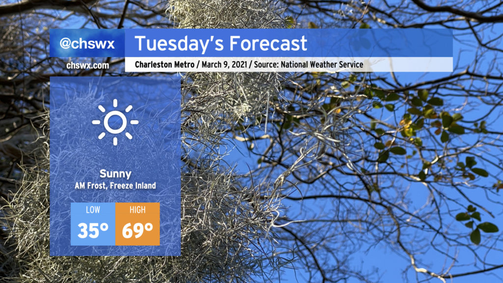
Our weather winning streak continues into Tuesday, with warmer temperatures in the afternoon after one more overnight frost. Cover up sensitive plants once again tonight and make sure your pets are in a warm, safe place.
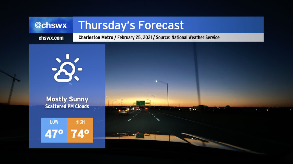
Expect mostly sunny skies with perhaps a few clouds sneaking in during the afternoon. Temperatures will rise to around 70°, making it a fairly lovely — and climatologically normal — March afternoon. Hope you can take advantage!
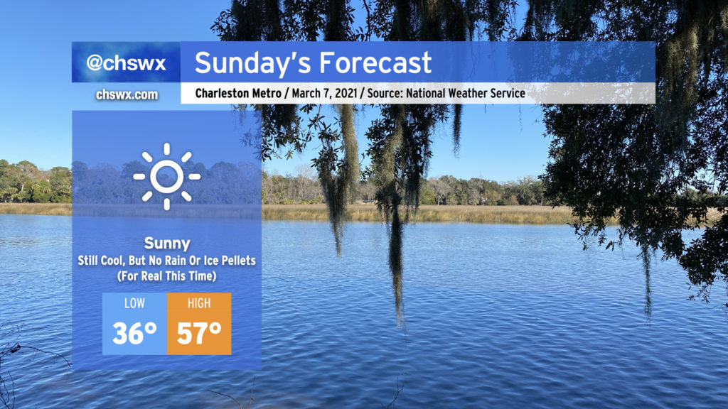
It was a weird Saturday. (More on that in a minute.) Fortunately, Sunday will restore order to the forecast as clouds dissipate overnight in response to high pressure building back into the area. Despite full, unencumbered sunshine, we’ll stay quite chilly tomorrow, with the high of 57° coming in well under the normal of 68° for this point in March. Frost and even a light freeze will be possible overnight Sunday into Monday, too, so be ready to protect plants and pets.
But yes, no surprise rain or ice pellets. For real this time. And thankfully (for our psyches, anyway), we look predominantly dry well into next week and perhaps beyond.
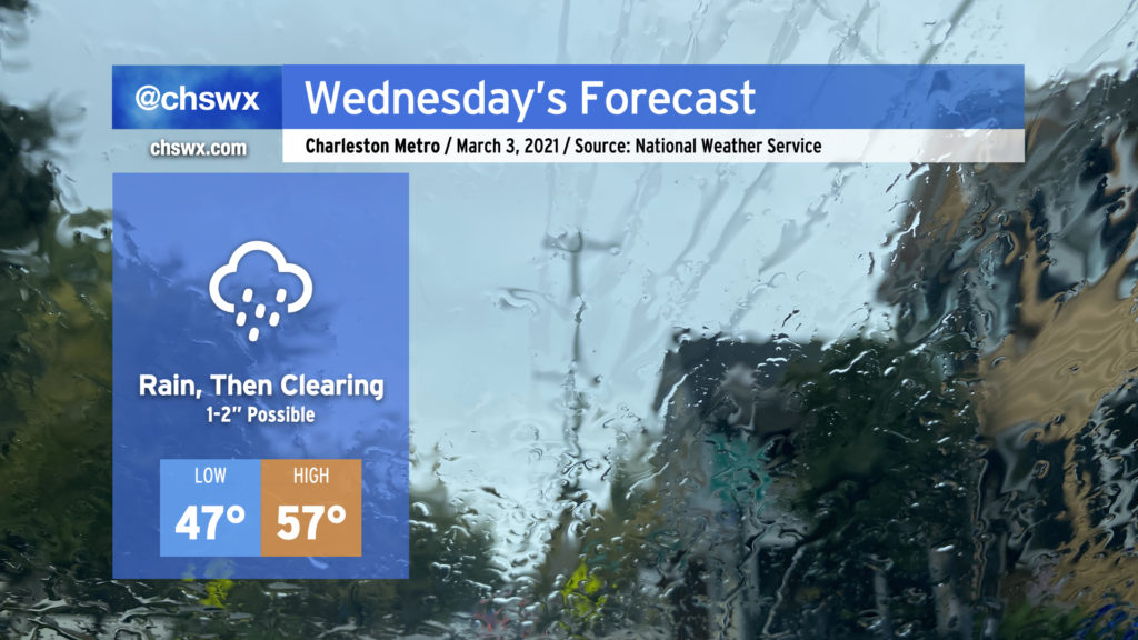
Expect a soaking rain to pick up overnight and last through early Wednesday afternoon. Rain totals should end up being around 1-2″ across much of the Tri-County with locally heavier amounts. If there’s a piece of good news in this, right now it appears that the heavier rain is going to miss our next two times of high tide (10:33 PM Tuesday, 10:49 AM Wednesday). Salt water flooding remains a concern around times of high tide, though, with a Coastal Flood Advisory until midnight as the 10:33 PM high tide will approach 7′ in the harbor. If rain does pick up around that time, there could be more trouble on area roads, so be aware of that possibility through tomorrow.
Low pressure will depart the area Wednesday afternoon, which will shut the rain off and allow skies to begin to clear out. Depending on the timing of the clearing, we should see temperatures rise to the mid-to-upper 50s in the afternoon, setting up a rather nice Thursday with clear skies and highs in the mid-60s.
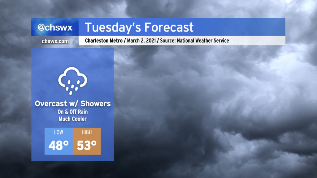
Stop me if you’ve heard this one before: We’re looking at a mostly cloudy day with occasional showers for Tuesday. Alas, March throws it back to mid-February tomorrow as temperatures only top out in the low 50s in the afternoon as cold air damming develops in the wake of this evening’s frontal passage. It won’t rain all day, but you’ll want to keep the gear close by in case you find yourselves in some showers. We’ll stay in the muck through Wednesday, with clearing developing on Thursday, but temperatures will remain well below normal for the rest of the week.
We’ll continue our nice weather winning streak into Thursday as temperatures will once again get into the mid-70s under mostly sunny skies. We’ll begin to see some clouds re-enter our skies tomorrow with a little more moisture moving in as a backdoor cold front moves across the Mid-Atlantic during the day, but no rain is expected. Overall, expect another pleasant day across the area.
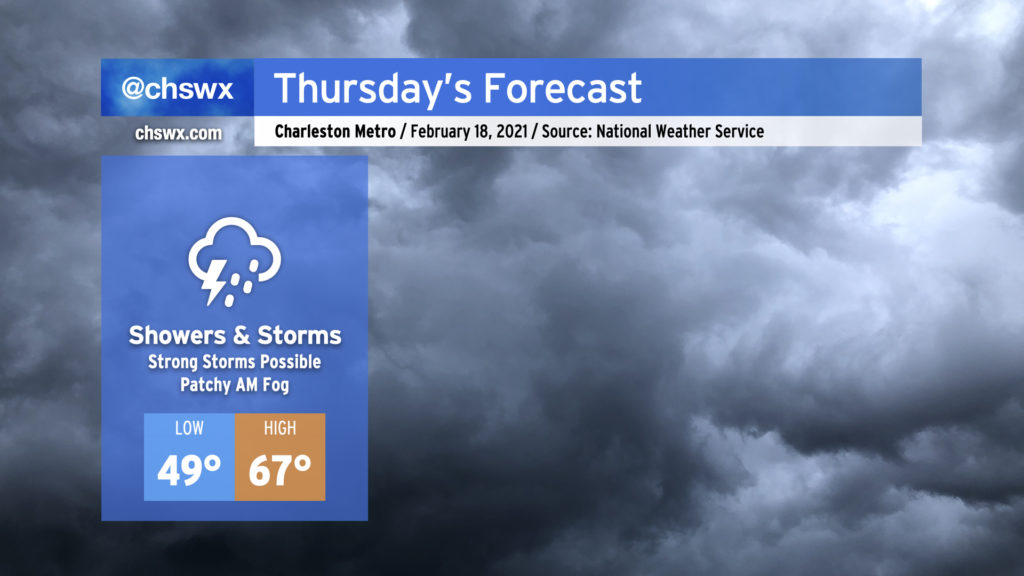
We’re back into the rain on Thursday as another storm system affects the area. Expect periods of showers and storms at any time throughout the day, and be ready for the potential for a couple storms to be strong.
I hope everyone enjoyed the outbreak of sunshine today! It was nice to see temperatures rebound into the mid-60s across the area with nearly cloudless skies for much of the day.
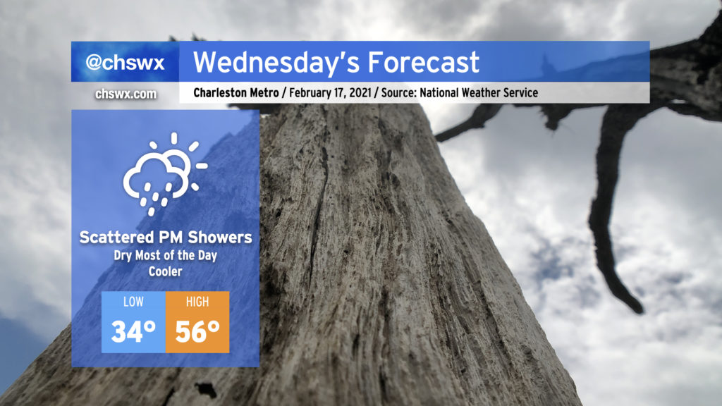
Unfortunately, our unsettled weather pattern remains in place, and today’s respite will be short-lived as clouds build back into the area during the day Wednesday, with shower chances increasing after sunset.
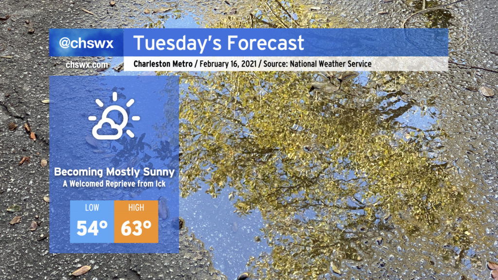
After a stormy Monday night caps off a rather dreary weekend, Tuesday is looking a lot better with at least a brief reprieve from the rain. Clouds will be scouring out in the wake of the front swinging through, and we should be mostly sunny by afternoon. Temperatures will rise quite nicely into the low 60s, which will feel downright blazing compared to the low 40s we found ourselves stuck in over the weekend. Unfortunately, this reprieve will be short-lived as rain chances return to the forecast Wednesday. We’ll take it a day at a time, though, and enjoy tomorrow!