Cool high pressure will be in control of Tuesday’s weather, with highs topping out in the low to mid-60s across the area under mostly sunny skies. A breeze out of the east will keep it feeling a little more brisk during the day as well. Overall, not too shabby with temperatures running a touch below normal.
Clouds will be on the increase Tuesday evening into Wednesday as our next storm system approaches the area, first bringing a warmup and then possibly some Thanksgiving rain.
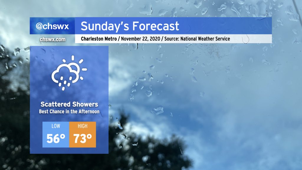
As high pressure to the northeast weakens and moves away, a trough of low pressure along the coast will move inland, and along with it will come a chance of showers for Sunday. The best risk for showers will occur in the afternoon. Not everyone will see rain and it won’t rain all day — just keep an eye to the sky and be ready to deploy the rain gear if you need to. Temperatures will remain mild (but not horribly so) for this time of year with highs topping out in the low 70s.
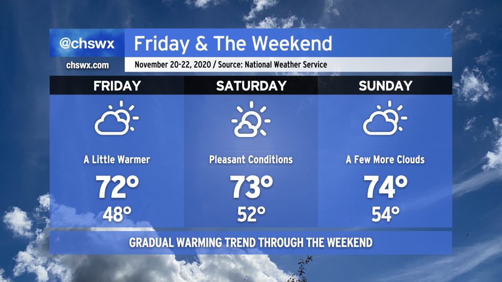
After a couple chilly days, the 70s return to the weather picture starting Friday and through the weekend. The warming trend will be very gradual, but expect Friday to start in the upper 40s, with low 50s for Saturday and perhaps mid-50s for Sunday. We’ll see a little more cloud cover than we have in previous days, but overall the weather should remain quite pleasant for the weekend before Thanksgiving.
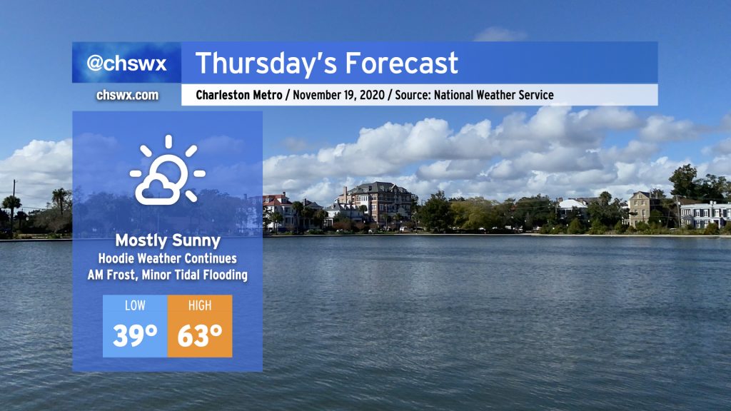
Clear skies and light winds will allow temperatures to drop into the upper 30s overnight, likely causing some frost to develop away from the coast. The National Weather Service has issued a Frost Advisory that includes Berkeley and Dorchester counties for early Thursday. Make sure you cover up your plants and have your pets in a warm place tonight.
Once we get clear of the frost, we’ve got a pretty solid November day ahead with highs topping out in the low 60s under mostly sunny skies and a bit of a northerly to northeasterly breeze.
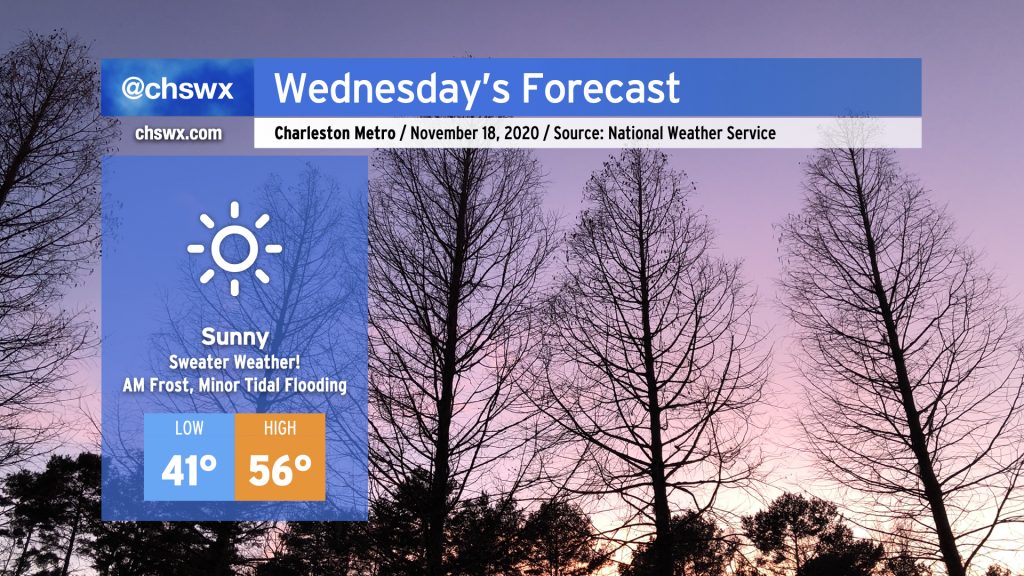
Get your sweaters ready — Wednesday is going to be a chilly one. A dry cold front featuring a reinforcing shot of cold air will swing through the area tonight. By tomorrow morning, winds will be back out of the north and a little breezy — lows in the low 40s may feel closer to the mid-30s when factoring the wind in. Despite full sunshine, temperatures will only rise into the mid-50s given continued cold advection into the area.
As high pressure slips overhead Wednesday night, winds will calm and skies will remain clear, allowing for excellent radiational cooling conditions. We may be contending with some frost as we get into overnight Wednesday/early Thursday morning, especially in the inland tier of counties. Keep an ear out for a possible Frost Advisory from the National Weather Service, and be ready to ensure plants, pets, and people are protected. (Pipes will be okay — not expecting a freeze just yet.)
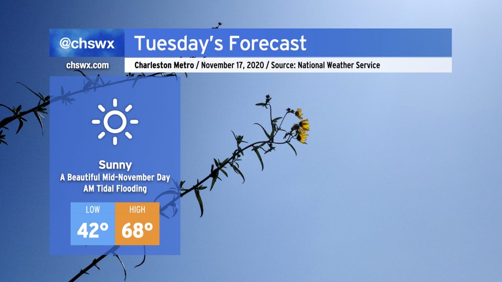
High pressure will remain solidly in control of our weather Tuesday with another beautiful mid-November day ahead. Highs will top out in the upper 60s after starting out in the low 40s (and maybe the upper 30s inland) with nary a cloud in sight. This will put temperatures right around, if not a little bit below, normal for mid-November.
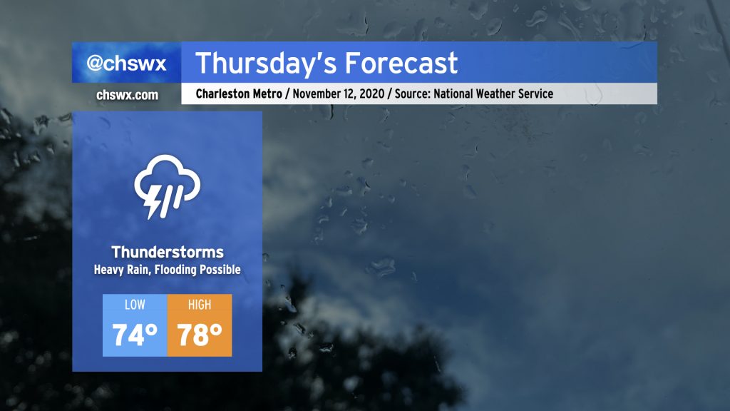
Some pretty heavy rain for any time of year, much less November, is in store for Thursday. Deep tropical moisture will continue to blanket the area ahead of a cold front. At the same time, Tropical Storm Eta will move across northern Florida and into the Atlantic, weakening while undergoing a post-tropical transition. Be ready for the potential for flooding due to heavy rain, especially around times of high tide (4:54am, 5:10pm). Some tidal flooding cannot be ruled out, either.
Temperatures are just not going to move much tomorrow with rain expected to be in place for a fair bit of the day. Highs will top out in the upper 70s after a low in the mid-70s, which would absolutely destroy the record high minimum temperature of 68° set in 1975. Our lows have been rewriting the record books for the last few days due to such abnormal warmth. (A normal November low based on 1981-2010 climatology is 48°!) Fortunately, there is some relief in sight with the cold front.
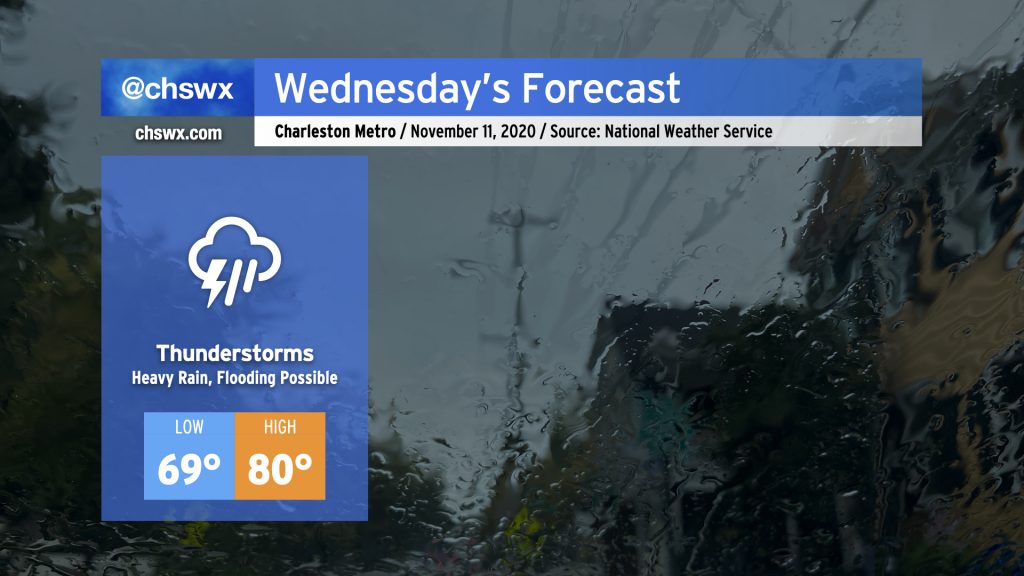
Periods of heavy rain look to continue for the next few days as moisture from Tropical Storm Eta in the Gulf continues to overspread the area with a stalling cold front to our west. For Wednesday, showers and thunderstorms continue to overspread the area throughout the day. It’ll be muggy, with highs once again topping out around 80° after starting out near 70°, which may threaten record high minimum temperatures once again.
As always, when heavy rainfall is in the forecast, we need to watch around times of high tide for particularly acute flooding in downtown Charleston. High tides will be at 3:55am and 4:13pm on Wednesday. Given continued onshore flow, the Wednesday afternoon high tide could tip briefly into coastal flood stage as well, so that will be something to watch carefully.
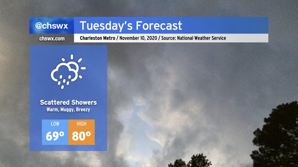
Expect a bit more in the way of cloud cover and showers for Tuesday as a moisture plume courtesy of Tropical Storm Eta begins to spread northward. Temperatures will remain rather warm for this time of year. We’ll start the day in the upper 60s to low 70s (especially near the coast). Temperatures will top out in the low 80s, with periods of cooling where showers develop. Shower chances will continue to ramp up with time on Tuesday, with thunderstorms becoming likely as we head into Wednesday.
Much quieter weather today as Isaias has long since departed the Charleston area. Temperatures top out in the low 90s, but the humidity will feel closer to the low 100s. There is a slight chance of an isolated PM shower or thunderstorm on the seabreeze as it advances inland this afternoon. A trough of low pressure aloft will keep things a little stormy each afternoon as we go into the rest of the week.