Jared Smith founded @chswx on Twitter in 2008 as an experiment in disseminating weather data through social media. In the ensuing decade-and-a-half, @chswx has provided live coverage of tropical cyclones, tornadoes, severe weather, and even a couple bouts of winter weather to the good people of Charleston, SC.
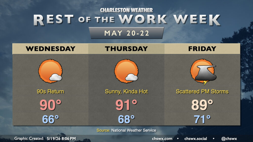
High pressure at the surface and aloft along with plenty of sunshine will help bring the 90s back to the Lowcountry over the next few days for the first time since mid-April. Dewpoints will not quite head back to those summertime 70s just yet, thankfully, so heat indices will remain in check, but it’ll still be plenty warm and a harbinger of things to come as we head toward June.
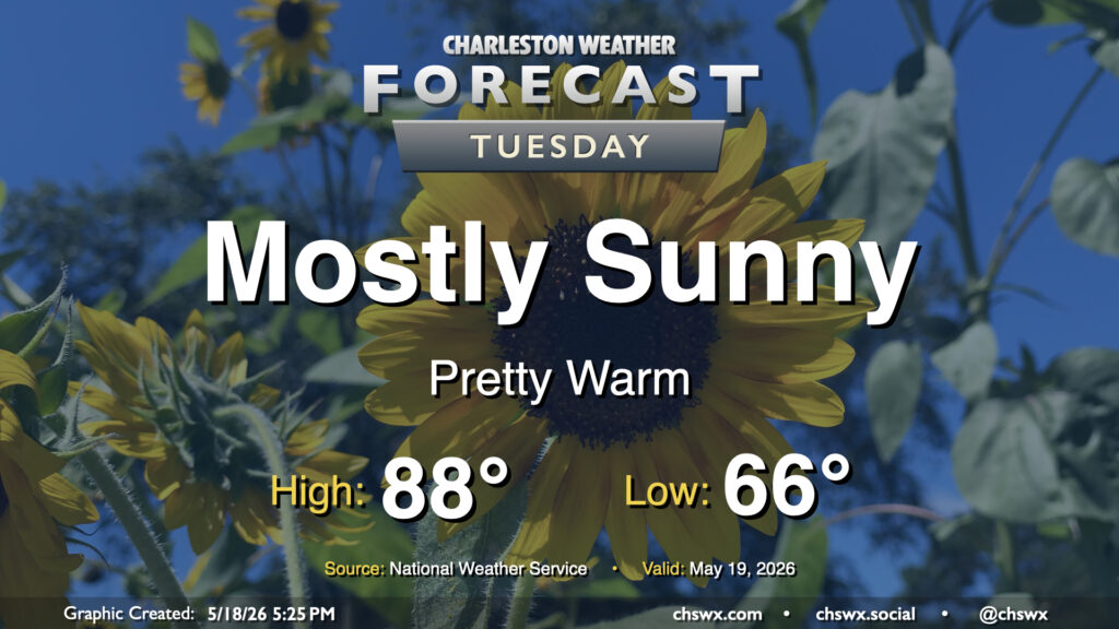
More sunshine is in the offing for Tuesday with high pressure in continued control of our weather. The air will have a bit of an early summer feel to it with lows bottoming out in the mid-60s, warming to the upper 80s and perhaps approaching 90° in the afternoon. Dewpoints will mix down to the mid-60s in the afternoon, so while it won’t be excruciatingly humid, there will definitely be a bit more heaviness to the air, so to speak.
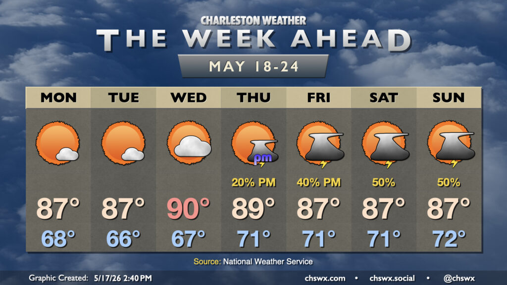
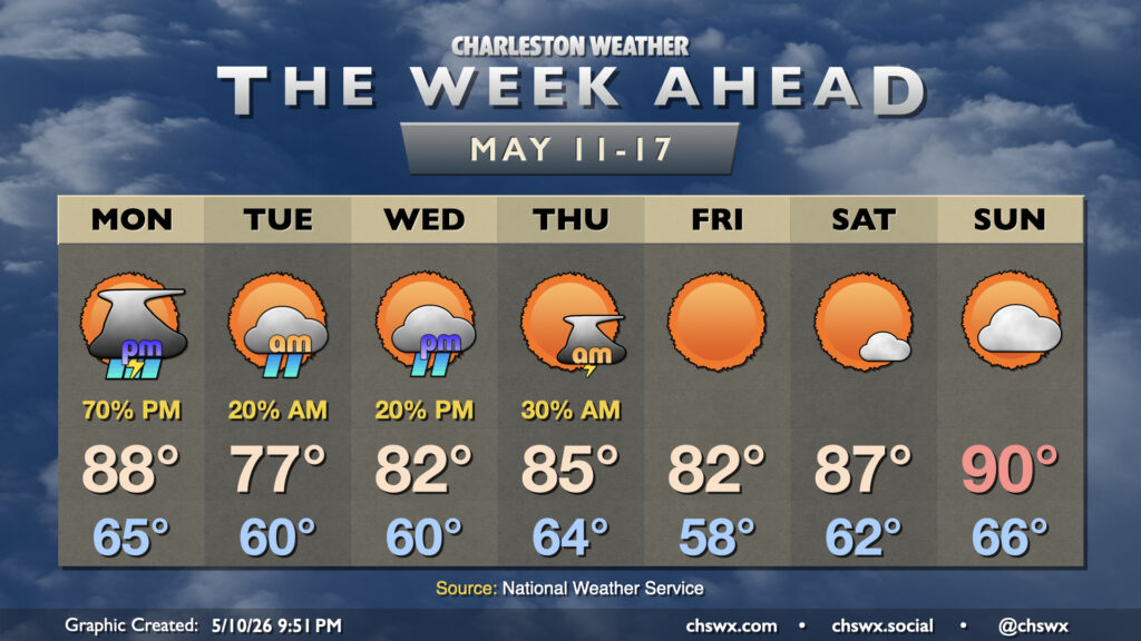
The upcoming week will have an early-summer feel with high pressure remaining in control for the first part of the week before a front stalls out nearby, bringing some rain chances back into the picture heading into the weekend.
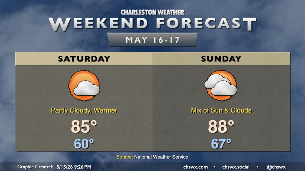
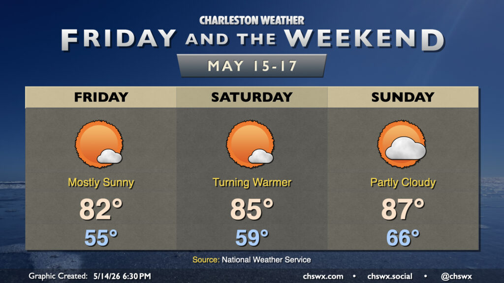
We’ll turn warmer over the weekend as high pressure aloft and at the surface remain the main weather features. With high pressure moving offshore, winds out of the south and southeast will bring warmer and somewhat more humid air into the area. This will contribute to a little more in the way of cloud cover, but despite that cloud cover, highs still peak in the mid-80s. Clouds thicken in the mid and upper levels on Sunday, but that doesn’t stop temperatures from running in the upper 80s in the afternoon. Shouldn’t see any rainfall, though, as the better moisture and rain chances will be well, well inland. Not excellent for the ongoing extreme to exceptional drought across parts the Lowcountry.
Generally quiet weather will continue for Friday and the weekend with high pressure in control. If you liked Thursday’s weather, we have more of that comfortable warmth in store for Friday. We’ll start the day a bit below normal — generally mid-50s — and warm to the low 80s in the afternoon.
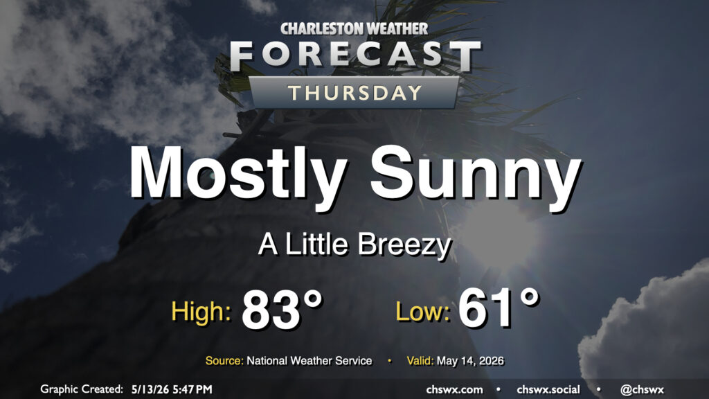
A cold front will swing through early Thursday with high pressure to build in behind it. Temperatures will start in the low 60s, warming to the low-to-mid-80s in the afternoon with northwesterly winds around 10 MPH. The downslope flow will dry out the atmosphere pretty nicely, allowing for mostly sunny skies with maybe a few fair weather clouds. The drier air will make the 80s highs feel a little more comfortable, too. Overall, it’s a good day to try to get some sunshine in the midst of the daily grind.
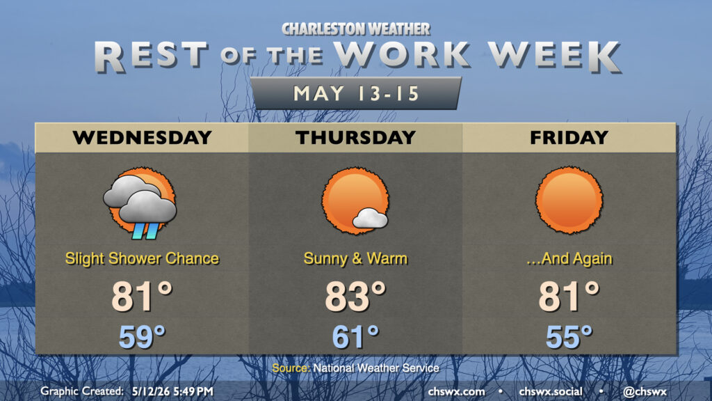
Generally quiet weather will be the rule for the rest of the work week as dry high pressure builds in from the northwest, keeping temperatures near mid-May norms.
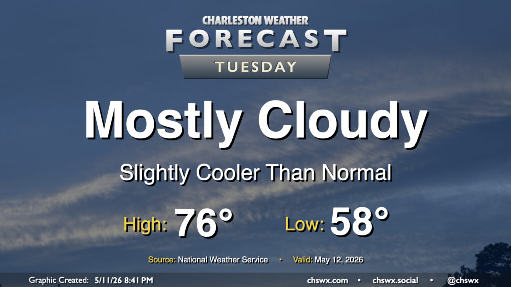
High pressure nudging in from the north will keep cloud cover in place and cool us off a bit for Tuesday after the third 90° day of the year on Monday. We’ll start the day in the upper 50s, warming to about the mid-70s given the expected cloud cover. A shower could get close to far southern Charleston County during the day, but most of us should stay rain-free.
I hope all of you out there who celebrated Mother’s Day today had a wonderful day. It ended up being a pretty good weekend weather-wise, with much of the moisture staying suppressed to the south. Monday, however, will bring more substantial rain chances as a cold front pushes south and eastward. We should stay quiet through the morning, though by early afternoon we should start to see showers and a few thunderstorms develop, first along the seabreeze and then becoming more widespread as the front moves by later in the day into the evening. There’s a risk for one or two thunderstorms to become severe, with damaging wind gusts the main concern, though widespread severe weather is not expected. We could see some brief periods of heavy rain, but with relatively quick storm motions expected, they won’t be hanging around long enough to cause any flooding issues. Temperatures will run on the warm side of normal for mid-May, with highs potentially reaching the upper 80s before thunderstorms kick in.
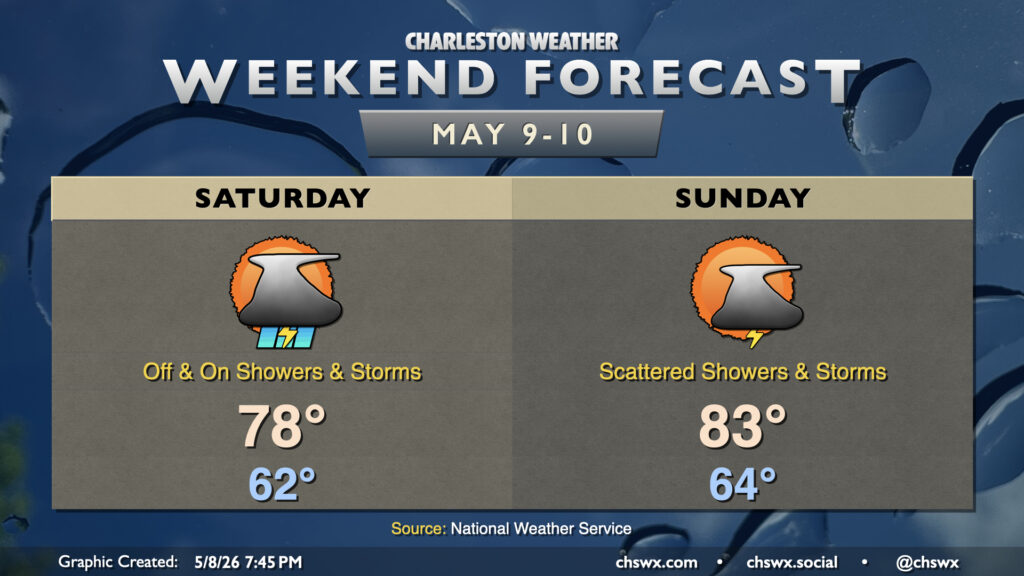
Showers and a few thunderstorms return to the weather picture this weekend as disturbances aloft ripple across the area. The good news is that it won’t rain all the time and that whatever rain we will get will help with the ongoing severe drought.