Jared Smith founded @chswx on Twitter in 2008 as an experiment in disseminating weather data through social media. In the ensuing decade-and-a-half, @chswx has provided live coverage of tropical cyclones, tornadoes, severe weather, and even a couple bouts of winter weather to the good people of Charleston, SC.
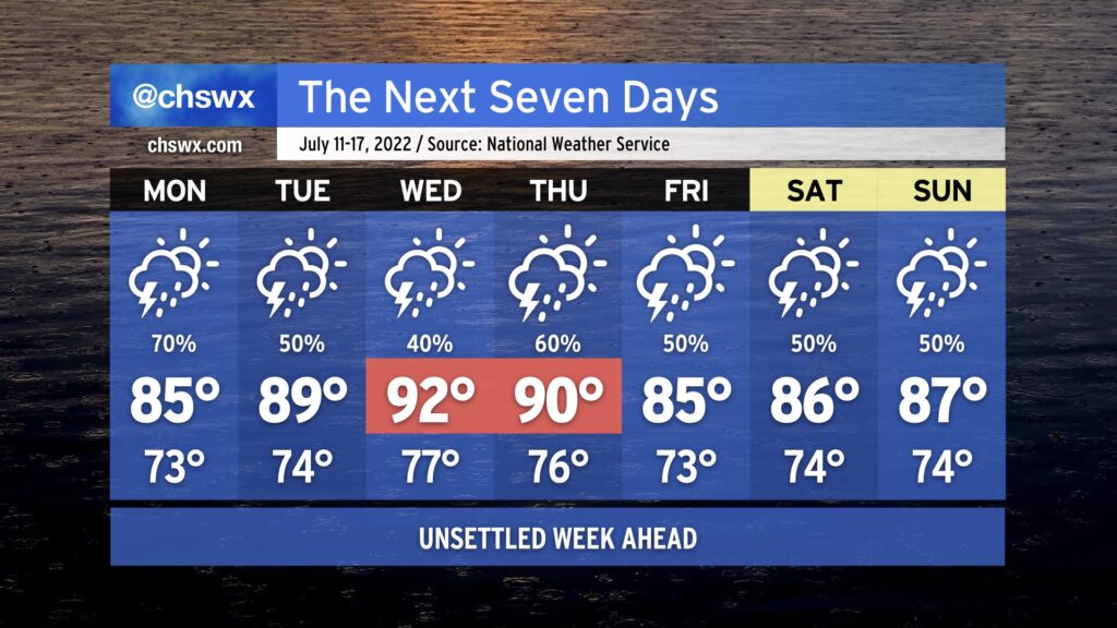
Showers and thunderstorms will continue to figure prominently in the forecast for much of the upcoming week. To start, we’ll continue to contend with the front that helped instigate today’s weather on Monday. Another bout of heavy rain is quite possible for some of us, which after 4-6” fell in some spots in the metro area today begins to seem excessive. We’ll want to keep an eye on a renewed risk for flooding on Monday as a result.
The front will wash out late Monday into early Tuesday, and as such, we’ll see a return to typical summertime form Tuesday and Wednesday. Temperatures will top out near 90° on Tuesday and in the low 90s Wednesday, with heat indices continuing to run around 100=105° given the continued humid airmass in place. Shower and storm chances in the afternoons will remain a little elevated as a result of said airmass.
Another front approaches later in the week, elevating rain chances again for Thursday and beyond. This will have the effect of keeping temperatures at or below normal, but it is also possible we might end up contending with more localized flooding due to heavy rainfall a distinct possibility. Keep an eye on forecast updates as we head toward later this week for that possibility.
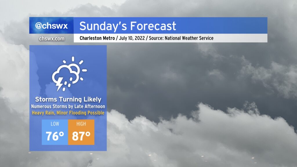
Another round of soaking, heavy rain is expected on Sunday as a front sinks into the area and stalls out. There will be a chance of rain for much of the day, but the best risk of rain will arrive in the afternoon and evening hours as thunderstorms look to erupt near the frontal zone as well as on other boundaries. Thunderstorms will be capable of very heavy rain and a good bit of lightning. Minor flooding will be a concern given 2.3-2.4” precipitable water values — atmospheric moisture that’s very much on the top end of what we’d see this time of year. We’ll also want to watch closely around the time of the evening high tide (5:48 PM) for the potential for heavy rain and said tide to coincide, perhaps increasing the flood threat for downtown Charleston in particular. An isolated wet downburst could pose an issue as well, but the overall severe threat will be limited.
We should see temperatures run up to the mid-80s before storms fire; this, combined with mid-to-upper 70s dewpoints will yield heat indices around 100° in the afternoon.
Stay alert for rapidly changing conditions tomorrow, and be ready to find alternate routes in case you encounter flooded roadways!
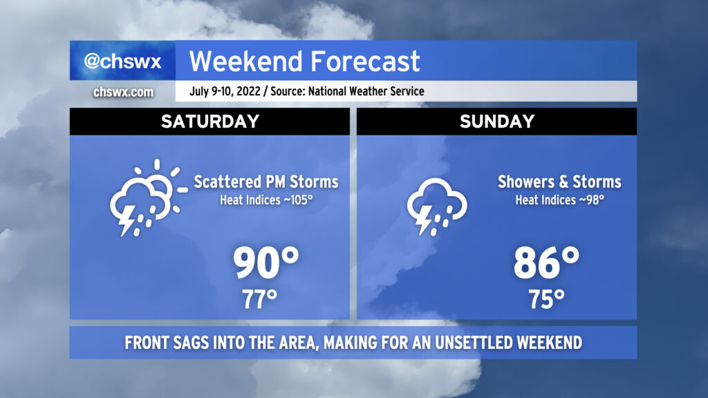
Expect more in the way of showers and thunderstorms this weekend, particularly on Sunday as a frontal zone moves into the area from the north. Storms could fire as early as mid-morning on Saturday, but should remain scattered through the evening hours. Thus, outdoor activities should have a backup plan, but don’t expect to be washed out, either. Temperatures will top out around 90° with heat indices peaking around 105° with the continued very warm and moist atmosphere in place across the area.
Saturday evening, we’ll be watching for a line of thunderstorms to sink southward into the metro area. Timing right now looks to be generally around and after sunset. Heavy rain, frequent lightning, and gusty winds will be the main concerns with this line as it sags into the area. We could see some sporadic wind damage from it, so we’ll want to keep an eye on that.
Sunday turns even more unsettled as the frontal zone sags southward into the area and stalls out. Expect on and off showers and thunderstorms throughout the day. It probably won’t rain all day at any one location, but it’ll be a good day to favor indoor plans. Sunday’s evolution could be a bit conditional on how things go with the Saturday night thunderstorm line, so stay tuned for more specifics as the mesoscale details work out. Regardless, the expectation of widespread rain and the nearby front will keep high temperatures in the mid-80s. Mix in the humidity, though, and it’ll still feel like the upper 90s.
As ridging aloft breaks down and retrogrades westward, our weather will turn much more unsettled heading into Friday and the weekend. Storms will be likely especially each afternoon and evening, with Sunday possibly looking particularly stormy with a surface front pushing through the area. Heavy rain will once again be quite possible, as precipitable water values remain 2″+ throughout the period — a lot of water to wring out of the atmospheric column, to be sure. Excessive rainfall will be possible in the strongest storms. There will also continue to be a risk for sporadic severe weather in the form of damaging straight-line wind gusts.
Temperatures on Friday and Saturday will still head right into the upper 80s to low 90s. With a stiflingly humid airmass continuing in place, heat indices will once again soar well into the 100s, with max heat indices around 105° on Friday and 108° on Saturday. Showers and thunderstorms will keep air temperatures from getting too much further out of hand, thankfully, but this is plenty of heat as is. Remember to take frequent breaks in the shade if you’re outside during these hot periods.
The good news is that all this rain continues to erode the drought — much of the Tri-County area was in moderate drought on last week’s Drought Monitor, but today’s downgrades the area (particularly around the Charleston metro) to Abnormally Dry. The airport is still running about 4.62″ behind normal for this point in the year, but we should hopefully continue to dent that deficit this weekend.
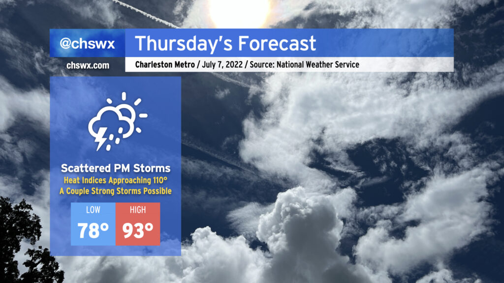
We’ve got another hot day on tap Thursday as heat indices soar well into the 100s, perhaps approaching 110° in the afternoon. (Never mind the fact that the lows will barely get below 80° inland and likely will stay in the 80-82° range at the coast.) Once again, isolated to scattered afternoon showers and thunderstorms will be possible along and ahead of the seabreeze, and we’ll be watching once more for the potential for a more organized thunderstorm complex to approach the area later in the evening, possibly bringing some gusty winds along with it. Overall, there will be plenty of fuel for any storms to work with, but shear remains light. Thus, if storms produce severe weather, it’ll likely be in the form of downburst winds. Frequent lightning and locally heavy rain could factor into any storm that gets going, too, so be aware of that if you’re out and about Thursday afternoon.
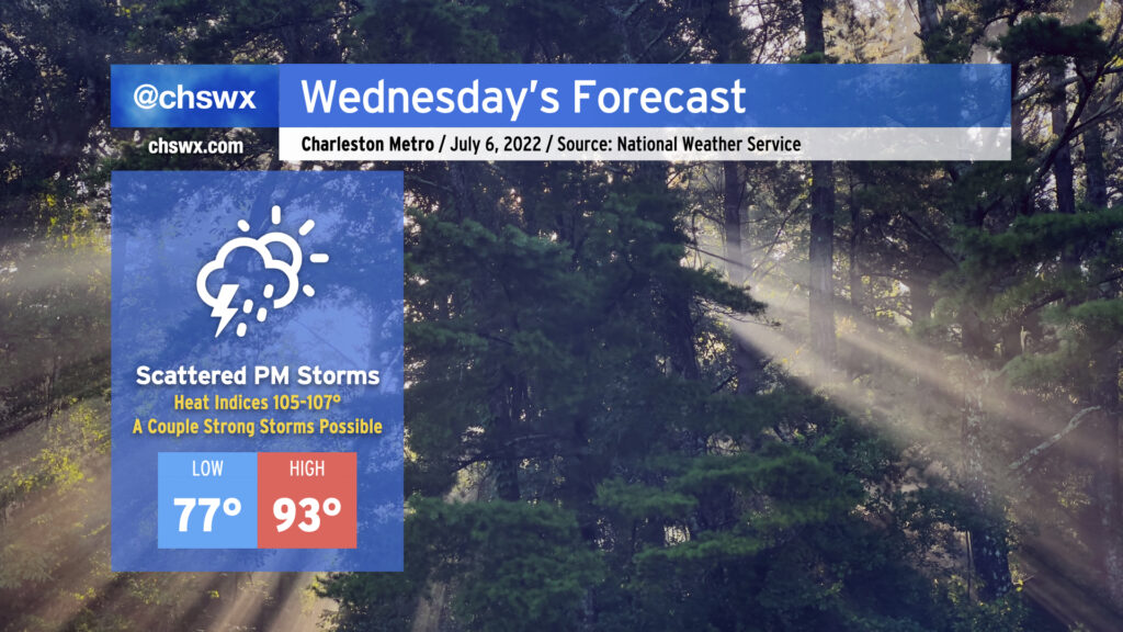
Wednesday will be another quite hot July day ahead of the usual round of scattered afternoon thunderstorms. After a very muggy start — lows in the upper 70s inland, probably not getting below 80° downtown and at the beaches — expect air temperatures to top out in the low-to-mid-90s across the area. Mix in dewpoints running in the mid-to-upper-70s and that’ll yield heat indices approaching 107° in the peak of the afternoon. You’ll definitely want to be taking frequent breaks and getting plenty of water if you’ll be outside for an extended period tomorrow. (Note that Heat Advisory criteria for July onward is heat indices at or above 110° for more than two hours, so while these heat indices would have garnered an advisory last month, they will not in this case.)
Showers and thunderstorms should once again develop along and ahead of the seabreeze in the afternoon. The atmosphere will be primed for a strong storm or two, with plenty of available energy for storms to tap into once the capping inversion erodes. Damaging wind gusts and maybe even some hail will be possible in the strongest storms, while all storms will be capable of locally heavy rain and frequent lightning. Not everyone will see severe weather, much less a storm at all — coverage looks scattered at best. But if you do, it could be a good one.
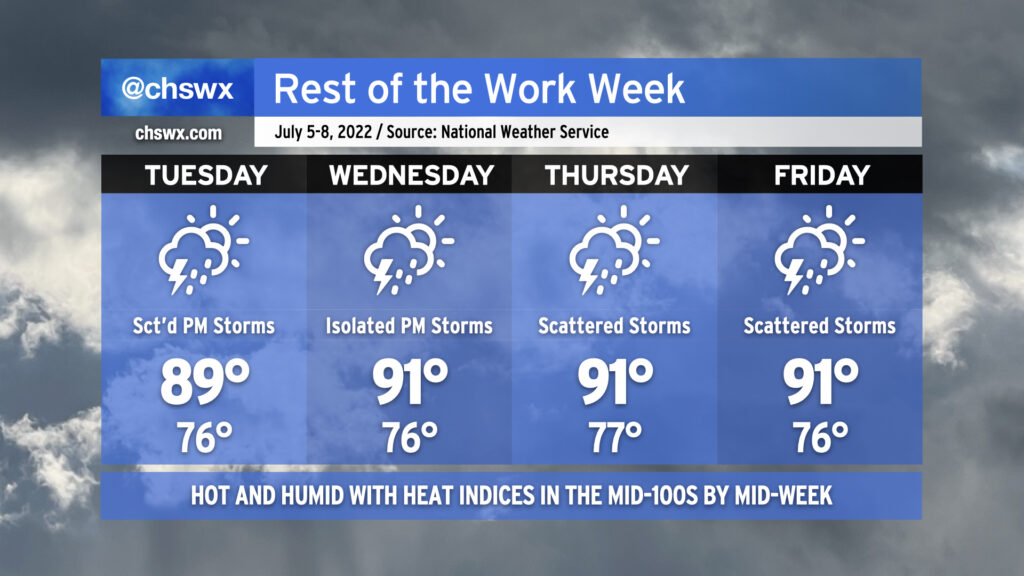
The rest of the work week will remain quite warm and steamy as a tropical airmass stays in the area for the next several days. Tuesday and Wednesday will feature more typical summertime popup showers and thunderstorms in the afternoons while heat indices soar into the 100s both days (with 105°+ heat indices possible Wednesday). As is typical, a stronger storm or two can’t be ruled out, and given the airmass in place, pockets of heavy rain could develop, perhaps causing some localized flooding. We’ll also want to keep an eye on any disturbances that develop and ride around the periphery of an upper ridge that’ll be centered to our west; both the NAM and GFS seem to be trying to sniff something out along these lines for late Wednesday/early Thursday. Only time will tell whether this is legit or not.
We’ll see an uptick in shower and storm coverage Thursday and Friday as the ridge retrogrades a little further west and atmospheric moisture increases. We could see precipitable water values in excess of 2.2-2.3″ as we close out the work week, which would be a ripe atmosphere for very heavy rain in any thunderstorms that can develop. Scattered coverage of afternoon thunderstorms appears probable. Temperatures will remain quite warm, with highs in the low 90s, lows in the mid-to-upper 70s, and heat indices probably running over 105° once again each afternoon before thunderstorms fire.
In other words: It must be July in the Lowcountry.
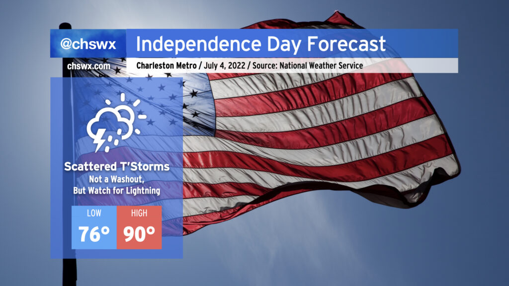
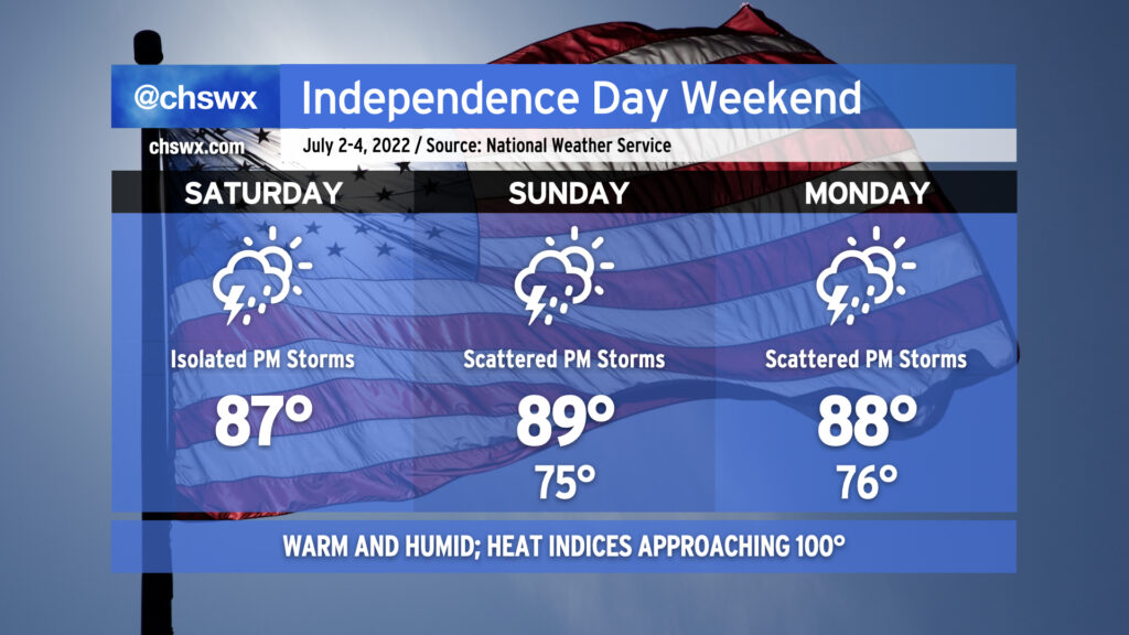
As is customary for the Lowcountry, heat and humidity will feature prominently in the Independence Day forecast, with some scattered afternoon and evening thunderstorms to cool some of us off. Before thunderstorms fire, we should see temperatures reach into the upper 80s to low 90s away from the somewhat cooler (but still quite humid) coastline. This warmth when combined with mid-70s dewpoints will yield heat indices in the low 100s for tomorrow. Be sure to get plenty of water and shady breaks if you’re outside for an extended period. (Don’t forget the sunscreen, either.)
By 1-2 PM, we should begin to see some showers and thunderstorms start to initiate along and inland of the seabreeze circulation. We’ll want to watch the 1-4PM period closely for the greatest risk for lightning to the beaches as there will be more than ample instability for strong updrafts to develop. (Remember: When thunder roars, go indoors!) Places that get caught under a thunderstorm will not see it move too terribly much during its lifecycle; with precipitable water values at or exceeding 2″, we could see some pockets of rather heavy rain in a short time in some spots. Wind shear is nearly nonexistent, so severe weather looks quite unlikely outside of the potential for a wet microburst somewhere. Severe potential aside, lightning makes all thunderstorms dangerous, so please do move indoors if you see lightning or hear thunder.
The good news, though, is that the Fourth of July will not be a complete washout. We should see storms begin to clear the Tri-County by early evening as the seabreeze progresses inland, and fireworks shows should be very much go for liftoff. Have a safe and fun holiday!
After what ended up being Tropical Storm Colin absolutely drenched us yesterday, we find ourselves with some drier air beginning to punch in on the southwest side of Colin’s circulation. This will help tamp down — but not totally eliminate — the risk for a few showers and thunderstorms this afternoon as temperatures look to rebound into the mid-80s (pending cloud cover eroding, anyway). It’ll still be muggy, though, with dewpoints running in the low 70s.
Thereafter, a more typical summertime pattern takes hold for the rest of the holiday weekend. Temperatures in the upper 80s to around 90° will be common; mix in dewpoints in the mid-70s and it’ll feel closer to 100°. Showers and thunderstorms will be possible each afternoon, with generally scattered coverage expected. A storm or two could be on the strong side with gusty winds on Sunday, so that’s something we’ll want to keep an eye on. Heavy rain will also be possible in any storm that fires up, and with precipitable water values generally returning to around 2″ this weekend, some localized flooding may be possible, especially in places that have been absolutely drenched over the past few days.
The bottom line, as it has been for the past few days, is to just make sure your outdoor July 4th plans have a solid indoor backup in case thunderstorms threaten. Severe or not, remember that every thunderstorm is dangerous because of the lightning it produces. (At least the tropical mischief will have long-since moved on!)
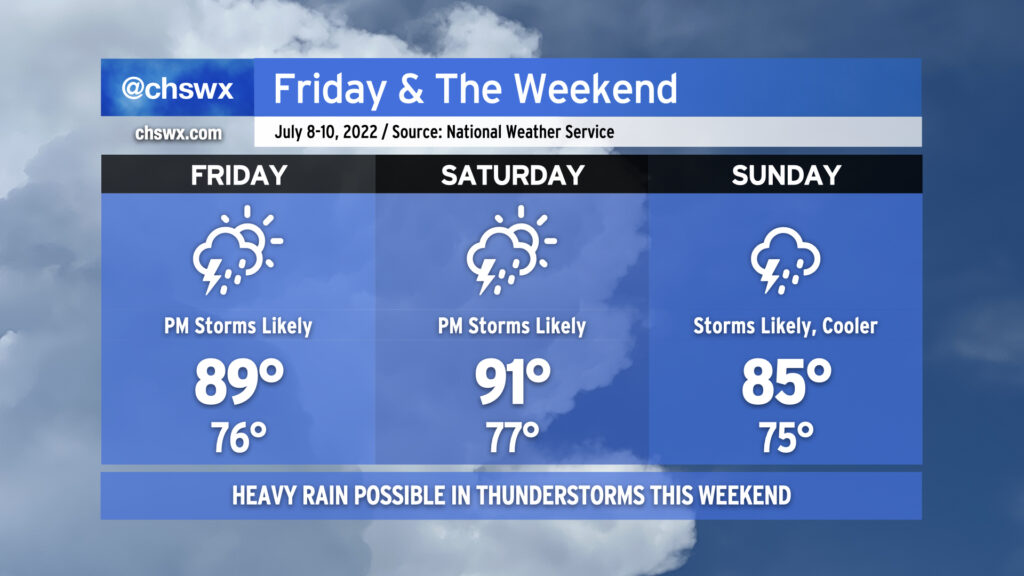
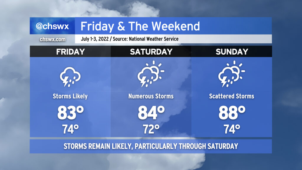
After some of us got a day to dry out, showers and thunderstorms look to resume possibly as early as late tonight as a disturbance aloft possibly spawns a little surface low in southeast Georgia. This possible low, if not the associated surface trough, will help to keep numerous showers and thunderstorms in the forecast for Friday and into Saturday as well. We could see storms ongoing Friday morning for the commute, so be ready to take it a little slower on the roads. Heavy rain and lightning will be the primary issues from any thunderstorms. The atmosphere remains juiced with plenty of moisture: precipitable water values (the amount of water you can wring out from a column of air) will continue to run very close to 2″. This moisture combined with ample instability will likely lead to some pockets of very heavy rain rates and a risk of minor flooding to go along with it. Also, it’s worth noting that high tide will peak around 10:17 AM in Charleston Harbor. Guidance does show some heavy downpours coming ashore ahead of and around this time, which could enhance the flood threat in coastal communities including downtown Charleston. With the prevalent storms and cloud cover, highs should top out in the mid-80s at best. It’ll be quite humid, though, and so heat indices could run up toward 90° especially if some sun peeks out.
Saturday looks like it could get off to a similar start as broad surface low pressure may be moving through the area during the morning. Additional showers and thunderstorms could then fire in the afternoon in the wake of the low depending on how well the seabreeze ultimately develops. Temperatures should stay capped in the mid-80s once again, owing to the unsettled weather that’s expected. Something tells me the details around Saturday will be refined some more, too, so stay tuned.
Sunday will be a little more summer-like in nature with more widely scattered thunderstorms, particularly in the afternoon. Temperatures will rebound from previous days into the mid-to-upper 80s.