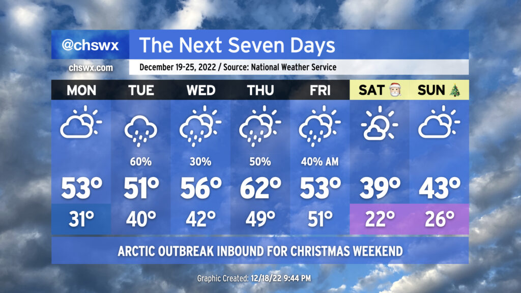
The week ahead will be primarily unsettled before an outbreak of Arctic air overspreads the area for Christmas weekend, bringing the coldest temperatures so far this season with potentially hazardous wind chills on Saturday morning.
Aside from a couple days in the middle of the week where we will be a little warmer ahead of a storm system, below-normal temperatures will generally be more the rule than the exception, especially as we head into the weekend in the wake of the aforementioned storm system and its associated cold front.
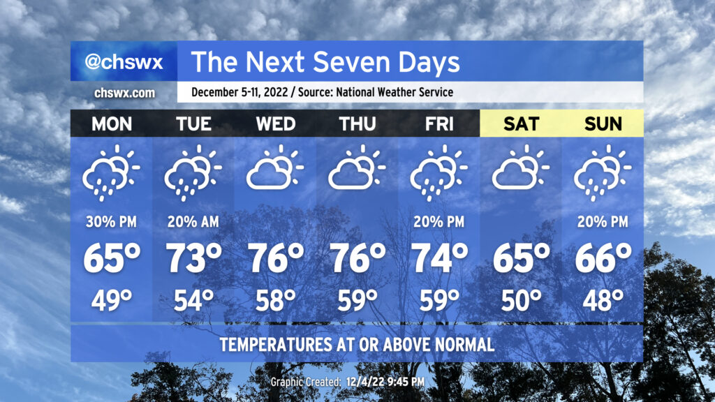
The main weather story of the week ahead will be how non-December-like it will feel, with highs running some 10°+ above normal for much of the work week as we sit between fronts.
Aside from some showers on Wednesday as a cold front moves through, this week looks pretty good weather-wise, offering up more in the way of sunshine than we’ve seen in the past couple weeks.
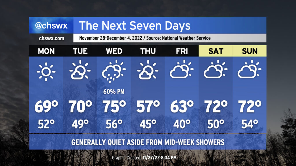
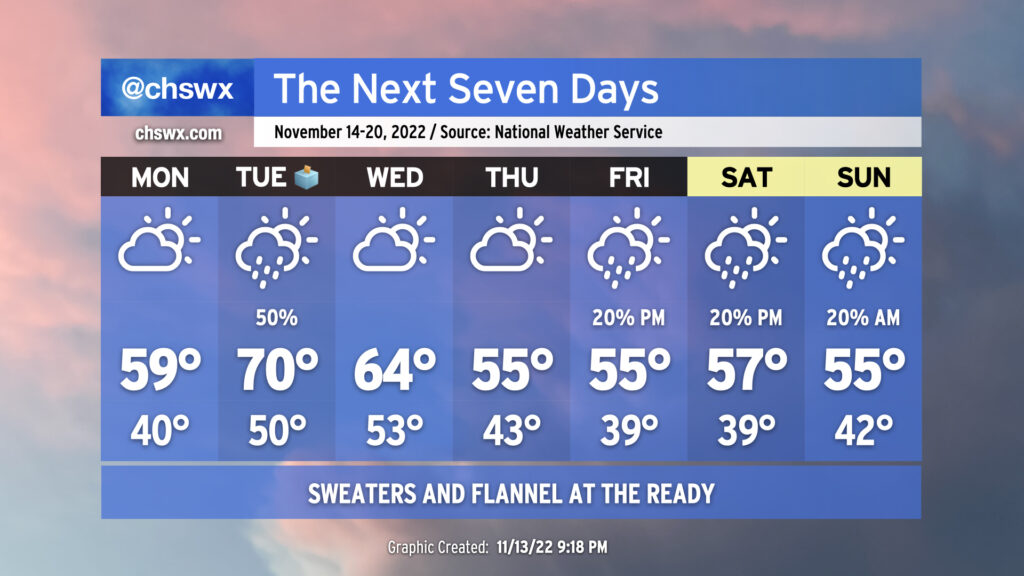
If you weren’t a huge fan of the winter-like chill that shaped the past week’s weather, here comes a somewhat more seasonable feel to the air for Thanksgiving week. (We’ll also have some showers and some tidal flooding to come along for the ride.)
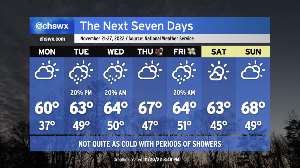
Well, the 80s are over (for at least a while, anyway). A cold front that came through Sunday morning ensured that our high of 68° would be set…at 1am. It was a somewhat chilly afternoon, and we have more of the same in store for the week ahead as well-below normal temperatures become the rule heading into the weekend before Thanksgiving.
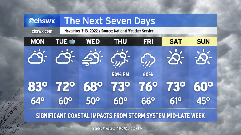
An unsettled week lies ahead, particularly for those of us near the coast, as a possible tropical or hybrid cyclone develops and moves toward Florida around mid-week before recurving with a cold front later in the week. After that front gets through, below-normal temperatures will arrive by Sunday.
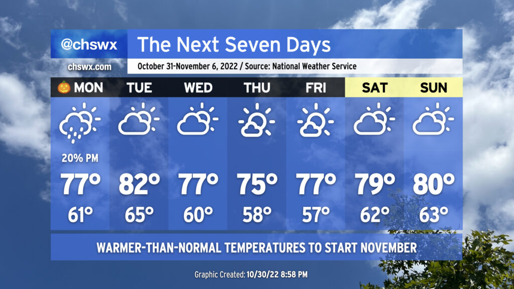
The week ahead will look a lot different from this past weekend as we cast away the gray in favor of more sunshine and warmer-than-normal temperatures to kick off November.
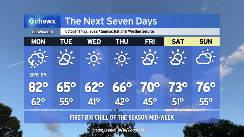
Temperatures are the main weather story this week as the first legitimate sweater weather of the autumn arrives Tuesday in the wake of a strong cold front. Highs on Monday will be in the low 80s for the last time for the foreseeable future; once the front is by, we begin a stretch of well-below normal temperatures. Highs top out only in the 60s for Tuesday through Thursday. Wednesday looks to be the coldest day since early April, with lows bottoming out around 40° and highs only topping out in the low 60s despite full, unfettered sunshine. From there, temperatures will moderate, with highs returning to the 70s by Friday into the weekend.
So far, there is a risk for scattered showers and thunderstorms Monday afternoon and evening as the front moves by. A stronger storm or two can’t be completely counted out given good wind shear and decent thermodynamics, but some dry air should limit coverage. If stronger storms do form, gusty winds and maybe some hail are the main threats. After that, we look to remain rain-free for much of the rest of the week.
The forecast for the weekend is complicated by some signals that a coastal low could develop and move northward, bringing us some unsettled weather. There’s a lot of model disagreement on where the low forms, if it even forms at all. For now, the NWS forecast is for a reasonably warm, rain-free weekend, but keep an eye on updates as more guidance comes in throughout the week as revisions are possible.