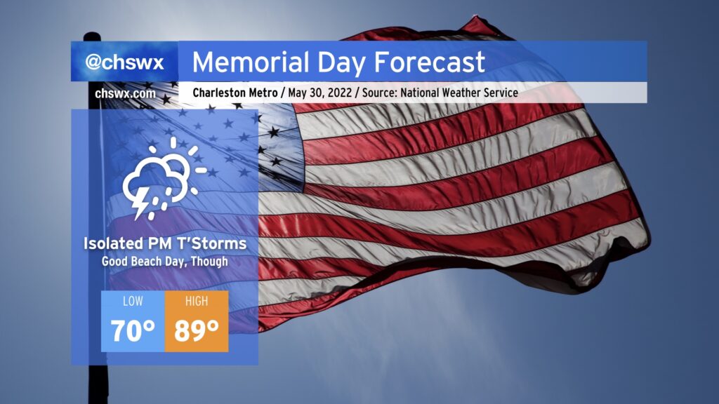
Memorial Day across the Lowcountry, while not nearly as springlike as last year’s, will feel appropriate as the unofficial start of summer. We’ll start the day in the low 70s away from the locally warmer coastline, heading into the upper 80s to near 90° away from the beaches by afternoon before the seabreeze rolls through. Temperatures at the beaches will top out in the low to mid-80s, making for a really good day to get some sun. (Just mind the high UV index and apply sunscreen liberally!)
There’s a tiny chance we could see a shower or storm in the morning as a little energy ripples on by, but that risk is rather low. The better — albeit still slight, all things considered — chance for showers and maybe a thunderstorm comes in the afternoon as we reach peak heating along and ahead of the seabreeze. Winds are onshore throughout a good bit of the atmosphere as surface high pressure remains offshore and a 585-588 decameter ridge remains centered over eastern North Carolina, so this should allow for the seabreeze to make good movement inland throughout the afternoon, limiting the risk for any thunderstorms near the beaches especially after 2PM. With limited to no wind shear to work with, thunderstorms will be pulse in nature and thus pop and subsequently collapse. All this to say, though, that the risk of any one location seeing storms is quite low — just be sure to have an indoor backup plan in case it’s needed briefly. Remember: When thunder roars, go indoors!
Temperatures will fall into the mid-70s in the evening, and any showers should be long gone by the time Nduduzo Makhathini takes the Cistern stage at Spoleto tomorrow night.
Finally, don’t forget to take a pause tomorrow to honor those we’ve lost in combat and their families. That’s why a lot of us are off, after all.
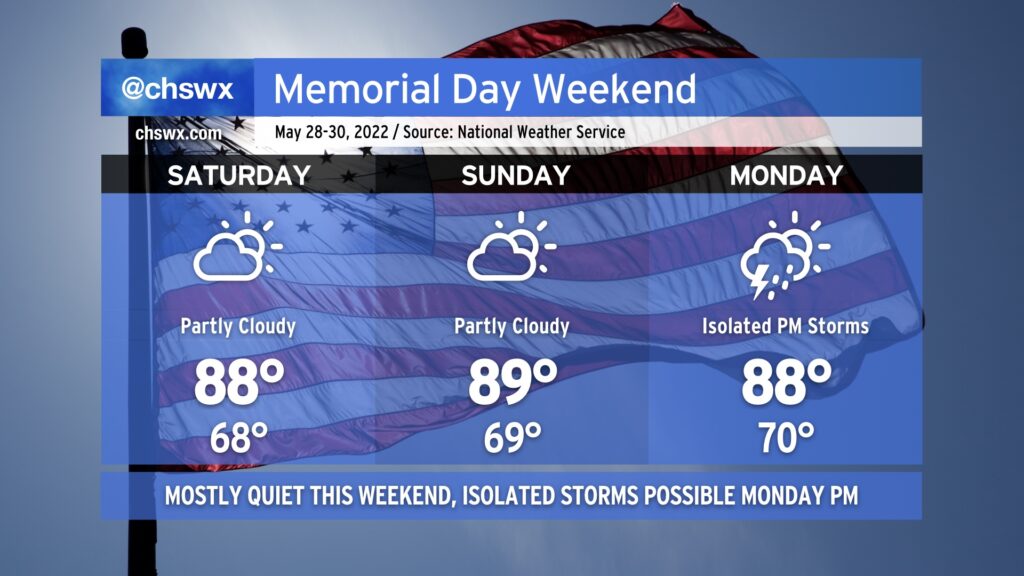
Memorial Day weekend in the Lowcountry looks quite seasonable — highs in the upper 80s, lows in the upper 60s, and partly cloudy skies for Saturday and Sunday as a front stalls offshore, but far enough offshore to keep us in some nicer weather. Indeed, we should stay mostly rain-free for the long weekend, though there will be a chance for a few isolated afternoon thunderstorms Monday as a little more moisture begins to work back into the area. All in all, though, things are looking pretty good to get outside.
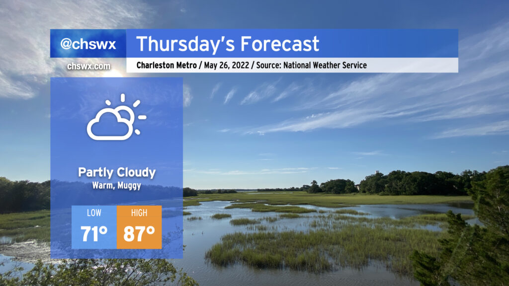
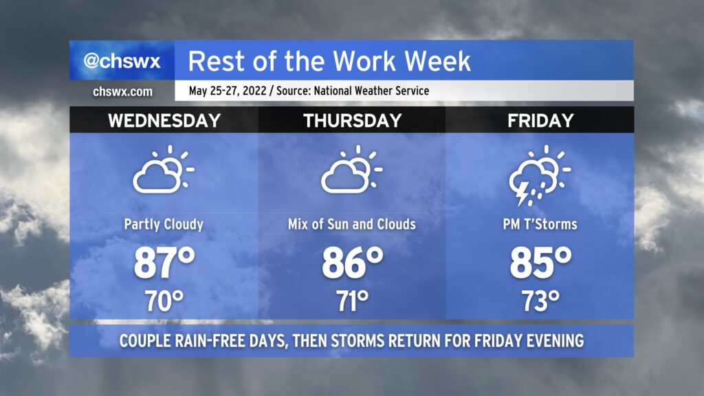
Thursday looks to be another warm and somewhat muggy day as onshore flow keeps humidity up a notch or two. Temperatures will top out a little warmer than they did today, ending up around on the higher end of the mid-80s away from the coastline; factor in the humidity and we’ll see heat indices running in the low 90s. We look to stay rain-free, though, as drier air aloft stays in place for one more day.
The forecast turns a touch quieter for a couple days as a front sags south across the area, capping the atmosphere off a bit and limiting shower and thunderstorm development. Expect partly cloudy skies for Wednesday and Thursday with highs topping out generally in the mid-80s. While you can never totally discount a shower or storm this time of year, strong capping on the atmosphere should prevent much in the way of storms.
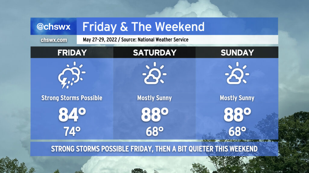
Rain chances return on Friday as a surface cold front, aided by a trough of low pressure aloft, approach the area. We’ll see plenty of moisture streaming into the area thanks to the upper-air configuration, which should aid numerous showers and thunderstorms heading into Friday afternoon and evening. (Not exactly great timing for the Spoleto opener.) The atmosphere will be pretty juiced, too, allowing for heavy rainfall to be an issue in some spots. We’ll want to keep an eye out for flooding as a result. We do need the rain, but perhaps not all at once! With the rain and cloud cover in the area, expect high temperatures in the mid-80s after starting in the low to mid-70s.
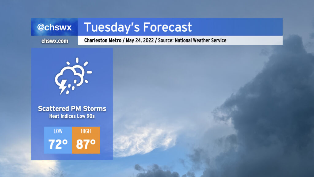
We remain warm and muggy on Tuesday as we remain on the warm side of a stalled frontal boundary to our north. Storm coverage should be a little lower for the afternoon, generally driven by daytime heating and the seabreeze, but a few spots may still yet get some heavy rain and even some gusty winds. Widespread severe weather is not anticipated, though. Highs in the afternoon top out in the upper 80s with heat indices in the low 90s.
Later in the evening, the aforementioned frontal boundary should get a bit of a move-on as low pressure heads eastward across North Carolina. Some of the convection-allowing models push the front into the area as early as 9-10 PM, accompanied by showers and maybe some thunderstorms. We’ll see how this ultimately pans out. Regardless, we should see the front — and some slightly drier air — at least temporarily poke into the area for Wednesday, stalling out over or just south of the Tri-County. Wait and see, but for now, we’ll continue to take the shots for beneficial rainfall, as long as the extra-curricular activity remains to a minimum.
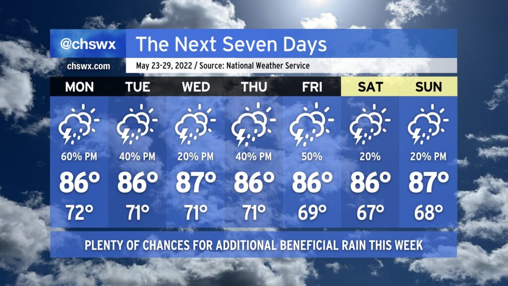
It rained today — really, really well, in fact — and that felt nothing short of miraculous. Quite a few gauges in the metro area recorded over 1” of rain from this morning’s thunderstorms. We’ll have additional shots at beneficial rainfall this week, especially at the beginning and the end, while temperatures generally remain around normal.
Showers and thunderstorms are expected to redevelop during the day Monday as slugs of tropical moisture from a disturbance in the Gulf — the first to gain the Hurricane Center’s attention this year, though development is unlikely — traverse the area and interact with a stalling cold front to our north. This should bring some more substantial rains to at least some of us by Monday afternoon. Temperatures will hold in the mid-80s given cloud cover and expected thunderstorm activity.
The stalled front hangs around Tuesday, though the Gulf disturbance will be departing the weather picture. There will still be plenty of moisture around, though, and that combined with the lingering front should help kick off additional showers and thunderstorms in the afternoon. Expect more of the same going into Wednesday, too, though showers and thunderstorms should be a little more isolated. Rain chances head back up for Thursday and Friday as a cold front pushes toward the area from the west. There’s still going to be plenty of moisture around, and some heavy rainfall will be possible from any storms that develop.
The cold front clears the area and stalls out offshore as we kick off the Memorial Day weekend. Rain chances could still hang around given the proximity of the front, but they’d be relatively slight. It should feel a touch less humid, too, which would be welcome news as Spoleto opens. Keep an eye on forecast updates as this will become more clear as the week goes on.
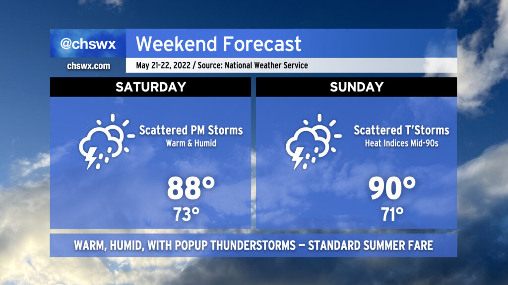
Our run of early summer weather continues into the weekend. While temperatures will be lower than we’ve seen recently — we hit 95° yesterday, and 94° today — we’ll be adding popup showers and thunderstorms back into the mix each afternoon, which is typically the other mode of summer weather we see around these parts.
The drill remains the same: No washout, but conditions could change quickly in the afternoon as thunderstorms develop. Expect storms to develop in the early afternoon around the Highway 17 corridor before moving inland with the seabreeze heading into the late afternoon and evening hours. A storm or two could turn strong to severe with damaging wind gusts and large hail, but an organized, widespread severe weather threat is not on the table here either day. Just be ready to move indoors if thunderstorms approach — remember, lightning makes every thunderstorm dangerous.
I know y’all are thirsty for rain, and this weekend represents a decent chance for many of us to see some much-needed precipitation. Keep in mind, though, that the scattered and cellular nature of these storms will mean that a few people could see quite a bit of rain, while others may not measure much if any. The good news is that we are heading into a more unsettled weather regime getting into next week, so many of us should see at least a little drought relief before the month is over.
Temperatures will run in the upper 80s to around 90 each afternoon after starting in the low 70s each day, still above normal for this time of year. We look to stay in this temperature regime heading into next week depending on how far south a cold front can get.
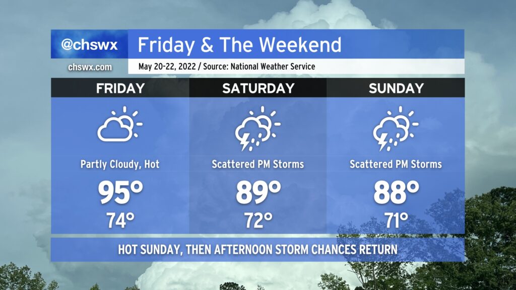
We hit 95° at the airport today, making it the warmest day of the year thus far in the Charleston metro area. As of this writing, the cap has held, too, and there are no thunderstorms to speak of. We should repeat this performance tomorrow under partly cloudy skies, with temperatures starting in the mid-70s in the morning to the low-to-mid-90s in the afternoon. Once again, a dearth of energy and a strong cap will keep thunderstorms at bay for Friday, so don’t count on any heat relief in that regard.
We start to see the high pressure ridge begin to shift away a little on Saturday, though, opening the door for afternoon showers and thunderstorms. They’ll be scattered about, so not everyone will see measurable rain. Where it does rain, though, it could be heavy. Highs top out in the upper 80s to around 90°, tempered by afternoon thunderstorms.
We should see similar weather on Sunday, with even more numerous showers and thunderstorms expected that afternoon. Again, though, some spots may see a downpour while others get little to no measurable precipitation. There also appears to be a risk for a few storms to be on the strong side with strong downburst winds and perhaps hail. Widespread severe weather, at this point, doesn’t appear likely, though.
Scattered showers and thunderstorms remain in the forecast each afternoon thus far next week, so if you miss out on the rain this weekend, there’s still plenty of chances to come.
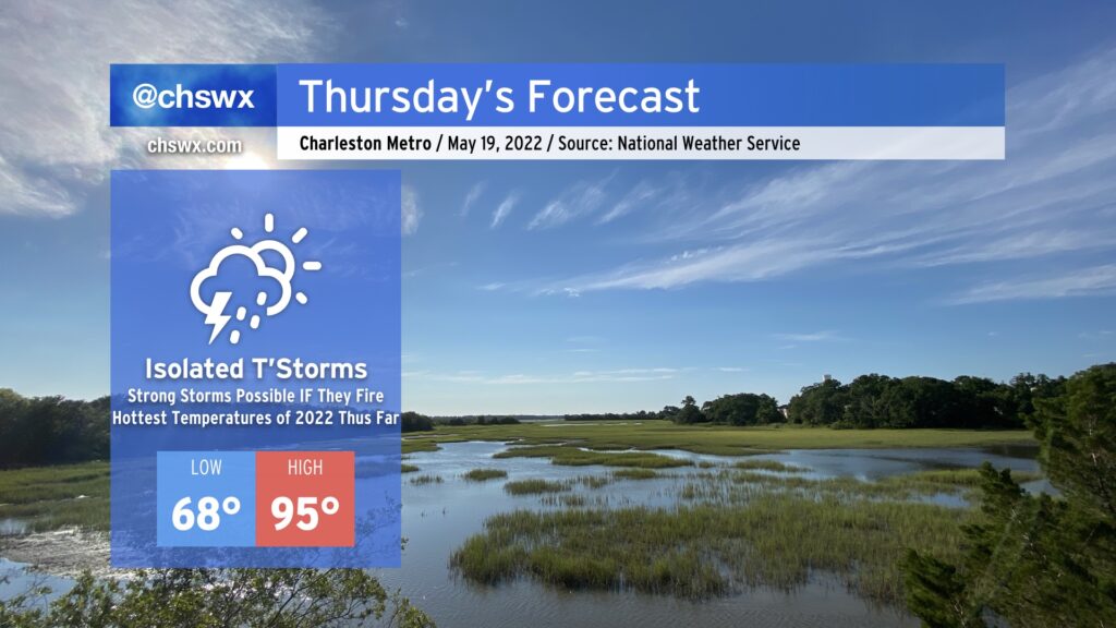
The hottest weather thus far in 2022 looks to arrive on Thursday. We’ll start the day in the upper 60s and warm well into the mid-90s in the afternoon. The record high of 96°, set in 1996, will be challenged under partly cloudy to mostly sunny skies. Heat indices could run close to 100° in the afternoon, so be sure to hydrate and take breaks accordingly.
As a series of mid-level disturbances ripple through the area, there will be a chance for showers and thunderstorms to fire off and move through in the late afternoon and evening hours. IF storms can fire — and this is a big IF — they could be on the strong to severe side. The thermodynamics certainly look good for storms to produce damaging wind gusts and large hail, but it remains to be seen if they can get going thanks to a strong cap on the atmosphere. Gonna be a game of wait, see, and watch the satellite and radar in the meantime.