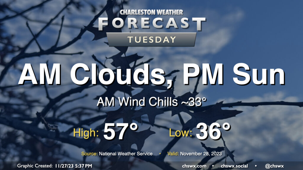
Tuesday will begin a string of a few chilly mornings across the metro area. Temperatures will start in the mid-30s; breezy northwest winds will make it feel closer to freezing, so bundle up accordingly. (There should be too much wind and too little moisture for frost formation, BTW.) Cloud cover will hang around for the morning before scouring out in the afternoon. Even so, highs will struggle to the mid-to-upper 50s as northerly winds continue to blow cold air into the region.
There will be a chance for a little salt water to creep up out of some drains around Lockwood as well as out of Gadsden Creek with Tuesday morning’s high tide, though it should peak just shy of coastal flood criteria. Still, you don’t want to drive through salt water if you can help it. High tide on Tuesday morning is expected to peak around 8:17am.
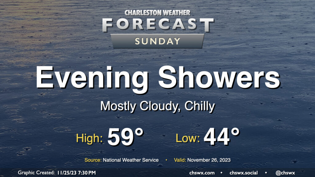
Sunday will feature more in the way of cloud cover as another disturbance affects the area. High pressure wedging southward will help keep things on the cool side as northeasterly winds continue to blow into the area. We start the day in the mid-40s and may not reach 60° in the afternoon thanks to the cloud cover. We should stay rain-free for the morning through early afternoon; from there, showers may begin to develop and move across the area. The best chance for showers will be in the evening as low pressure to the south makes the closest approach. Rainfall should generally be on the light side, but a few pockets of heavier rain certainly can’t be ruled out. Rain should clear the area by Monday morning as high pressure builds back into the area.
The other weather concern for Sunday will arrive early in the morning in the form of coastal flooding. Favorable northeasterly winds and astronomical effects the upcoming full moon will drive water levels into minor to possibly moderate flood stage around the 6:44am high tide Sunday. Salt water may close some roads as water levels approach 7.4-7.6′. If you have early-morning travel plans around the edges of the downtown peninsula, especially on the west side, prepare to reroute around flooded and closed roads.
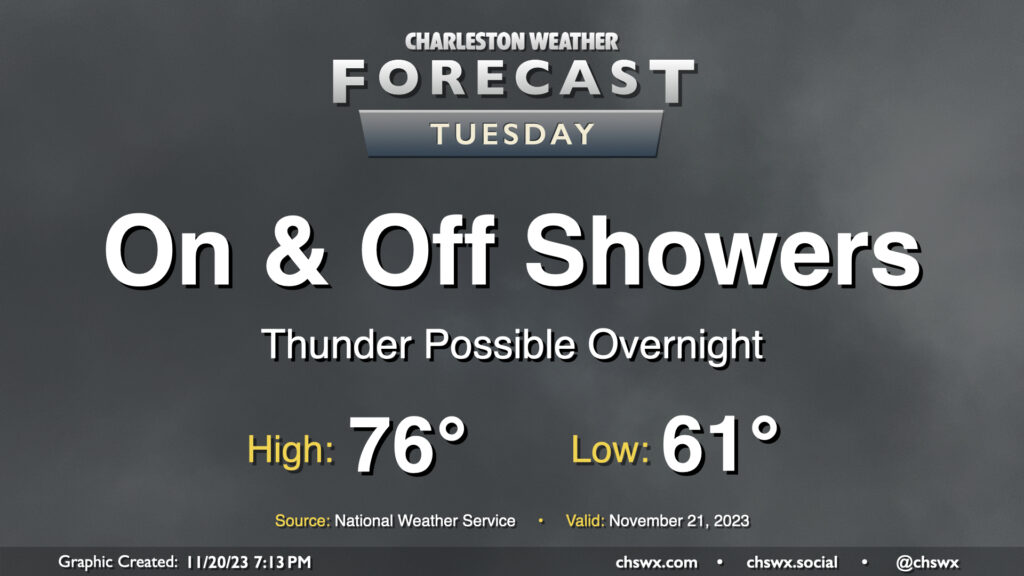
Tuesday’s forecast will be unsettled at times with periods of showers ahead of a cold front that’ll advance through the area on Wednesday. It’s going to be a warm and humid day, with lows around 60-61° warming to the mid-70s in the afternoon. Shower chances will increase as we get into Tuesday night and early Wednesday, and some rumbles of thunder may be possible as well. We need the rain and it looks like we could get a fair bit of it in spots. A half-inch of rain seems to be a decent bet in many locations, with locally heavier amounts possible as well.
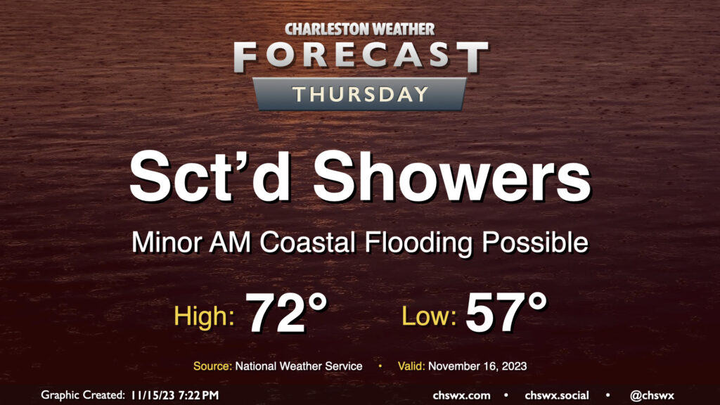
This week’s shower chances will peak Thursday as a disturbance moves across the Gulf Coast, spawning low pressure off the Florida coast. Expect shower activity to generally be scattered in nature, though, with some dry periods and maybe a few breaks in the clouds possible at times. Warmer air will make inroads as the wedge of high pressure which kept temperatures fairly well suppressed over the past few days begins to give way. Expect highs to top out in the low 70s in the afternoon as a result.
There will again be the risk for some minor coastal flooding with Thursday morning’s high tide, which is expected to peak around 9:33am. Much like Wednesday morning, water levels should reach 7-7.2′ again, which should be enough to put some salt water on the roads but not enough to begin to introduce widespread issues. Still, the vulnerable locations on the west side of the peninsula near The Citadel and Gadsden Green will likely take on salt water once again during the morning. Be ready to reroute around flooded roads.
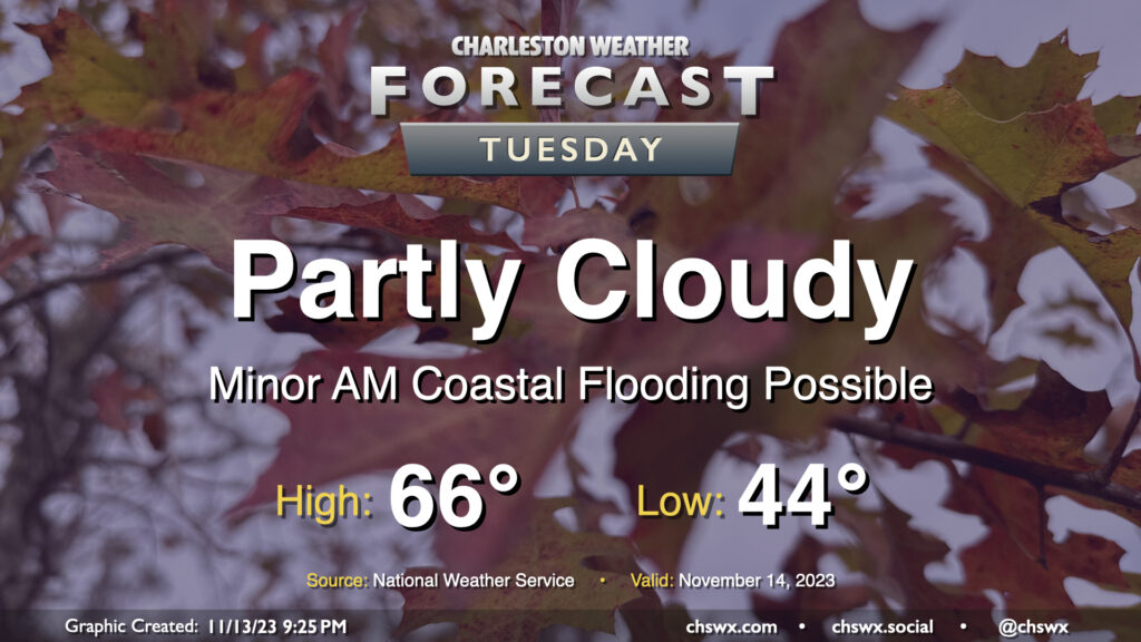
Another seasonably cool fall day awaits for Tuesday as we start to see an uptick in cloud cover portending more unsettled weather beginning later Wednesday into the rest of the work week. Temperatures start in the mid-40s before heading to the mid-60s in the afternoon, a couple clicks below normal but certainly very seasonally-appropriate. We’ll see ample sunshine, too, but as mentioned, cloud cover will begin to head up as we get into the evening.
High tide a little after 8am will be capable of producing some minor coastal flooding, with water levels generally approaching 7′ or so. It’ll be enough to put salt water on the most vulnerable roads — think around Hagood and Fishburne — but won’t cause widespread problems. Still, be ready to reroute around salt water-covered roads Tuesday morning.
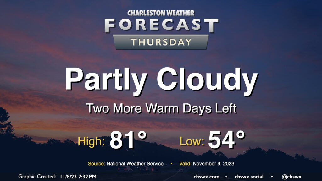
After narrowly missing a record high on Wednesday (the high was 84°, which approached the record of 85° set in 1986), we have another warm day on tap for Thursday. We start the day in the mid-50s before temperatures head to the low 80s in the afternoon under partly cloudy skies — yet another rain-free day as we start November. The rain-free streak looks to come to an end this weekend, though, as a cold front moves by and high pressure wedges southward.
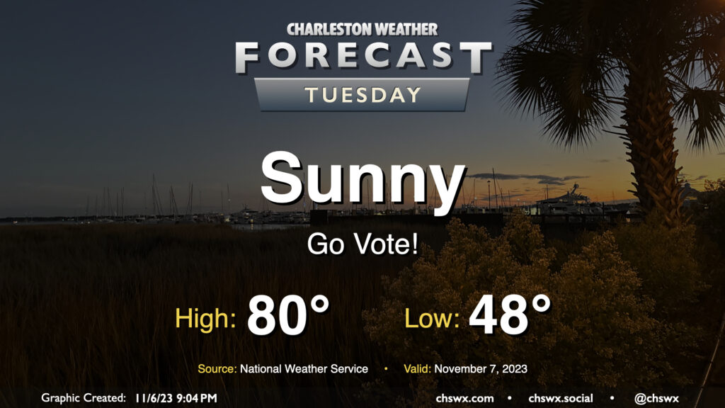
No concerns for Tuesday’s weather as we head to the polls for various local elections — not even any tidal flooding to speak of. We’ll start the day with a light jacket and shed it by midday as highs head to around 80° in the afternoon. Unfettered sunshine will be the rule with a light west to southwest breeze throughout the day.
Thursday gets off to the coldest start since March with lows expected in the mid-30s across much of the metro area. Further inland and in more sheltered locations, it’s quite possible that we’re going to see temperatures fall below freezing. A Freeze Warning is in effect for inland Berkeley and Dorchester for Thursday morning; be sure you’re protecting plants and pets. Add in winds around 5-10 MPH, and we’re talking wind chills in the 20s in many spots. Dress appropriately as you head out tomorrow morning!
From there, temperatures will head to the low 60s in the afternoon despite mostly sunny skies. It’ll ultimately be yet another sweater-worthy day across the area with a continued north to northeasterly breeze.
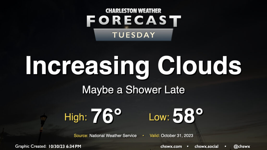
Changes are on the way on Halloween as a strong cold front moves across the area later in the day, bringing an uptick in cloud cover, maybe a shower or two, and a surge of the coldest air so far this season to start November. We start Tuesday in the upper 50s to around 60° with just a few clouds to start. From there, expect cloud cover to gradually thicken as the front gets closer. We should see it get through sometime mid-afternoon into the early evening; you’ll notice it when winds shift around more to the north.
Trick-or-treaters will want a light jacket as temperatures cool into the 50s throughout the evening. As mentioned, a shower or two will be possible, but the risk is quite low.
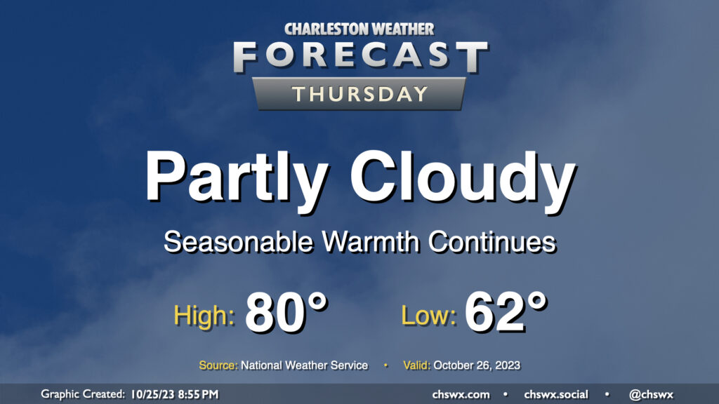
Rinse and repeat: More quiet and warm weather is on tap for Thursday (and beyond!) High pressure remains in control, and that’ll keep things rain-free and rather warm for late October. We start the day in the low 60s (for reference, the normal low for October 26 is 54°) and warm to around 80° in the afternoon. Much like Wednesday, we’ll see a few clouds amongst otherwise blue skies.
The only fly in the ointment will be the potential for some minor coastal flooding with the Thursday evening high tide. Water levels should peak between 7-7.2′ in the harbor, and this’ll cause some salt water to spill onto the typical trouble spots roughly an hour or two on either side of the 6:49 PM high tide. We’ll probably land a Coastal Flood Advisory during Thursday evening’s commute, so be ready to route around a little salt water especially around the Citadel and MUSC.