The week ahead: Warm and muggy conditions continue; turning more unsettled
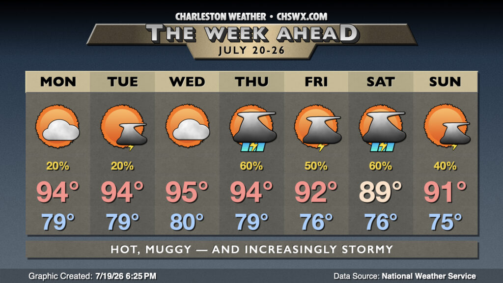
The week ahead will continue to feature warm and muggy conditions, with an uptick in rain chances as we get over the hump toward the weekend.
Read more »The week ahead will continue to feature warm and muggy conditions, with an uptick in rain chances as we get over the hump toward the weekend.
Read more »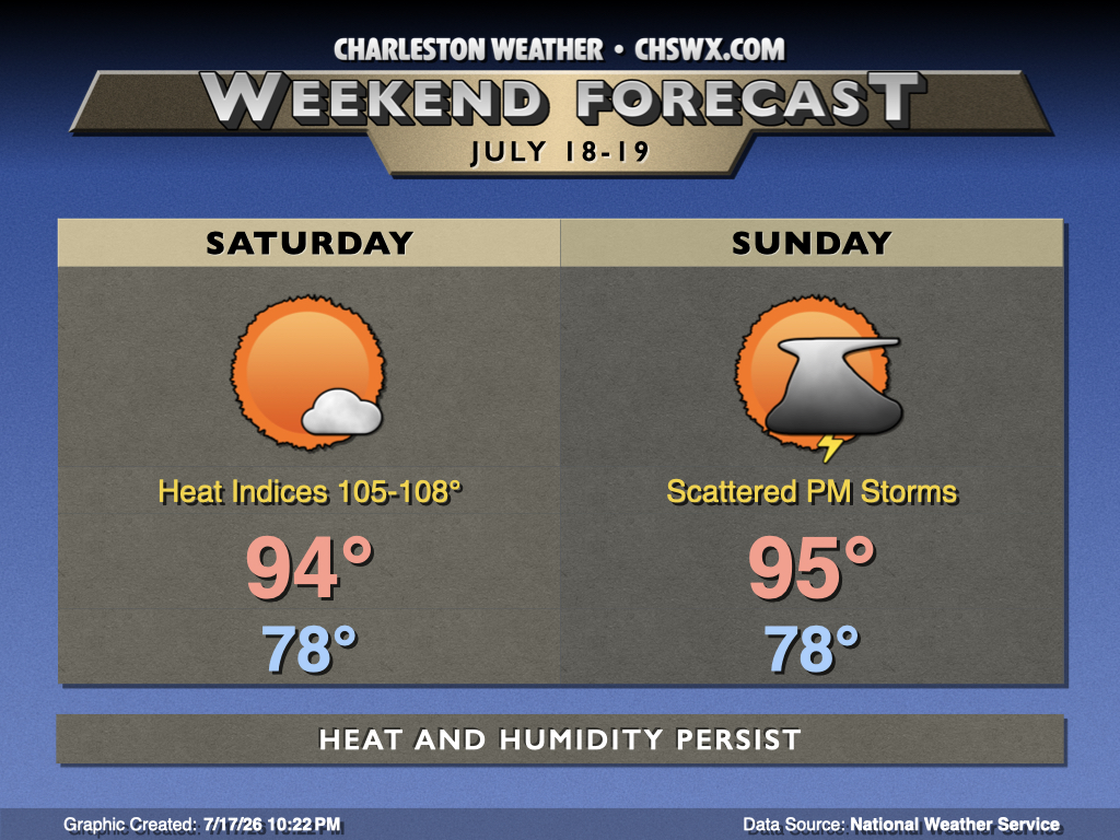
Midsummer heat and humidity will not relent this weekend with temperatures continuing to run above normal courtesy of Atlantic high pressure pumping warm and moist air into the area while high pressure remains resident aloft for a few more days.
Read more »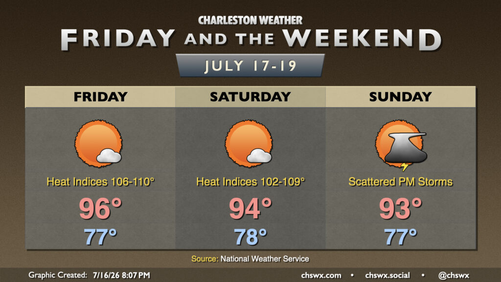
Heat and humidity continues for Friday and the weekend with high pressure aloft the main weather driver. Atlantic high pressure will continue to drive high dewpoints into the area, and that not only will drive heat indices well into the 100s, but it will keep us quite toasty at night, too. Expect lows in the upper 70s each day, perhaps not dropping below 80° closer to the coast and downtown.
Read more »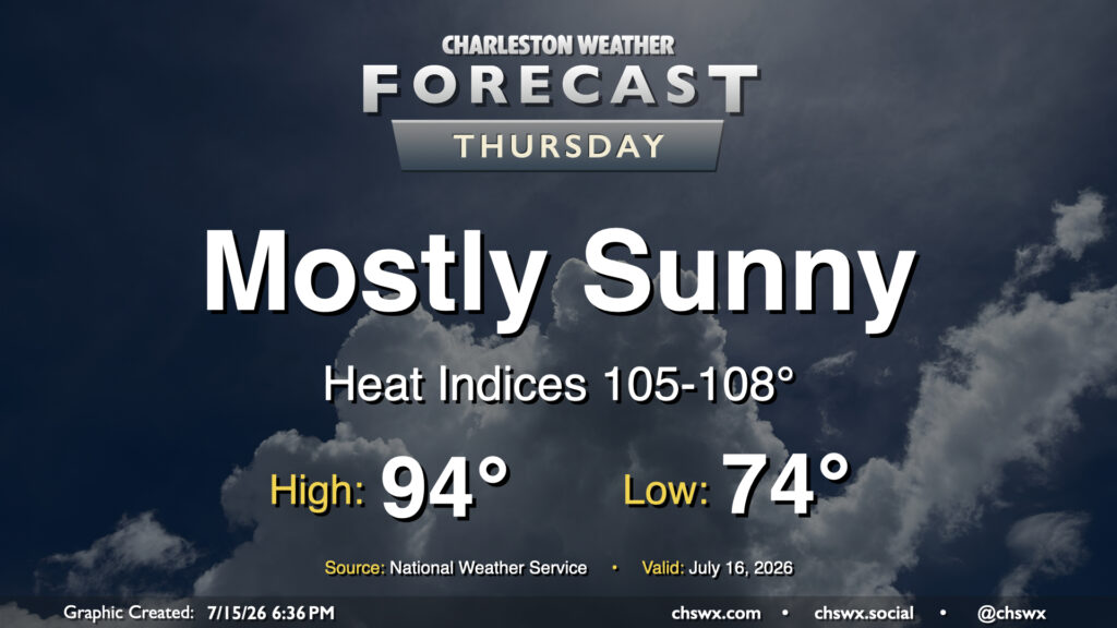
High pressure rebuilding aloft will bring more sunshine — but more heat, too. We’ll start Thursday in the mid-70s inland to upper 70s near the coast. From there, plenty of sunshine will drive highs into the mid-90s. Dewpoints will be fairly juicy — generally in the mid-to-upper 70s — and this will drive heat indices well into the mid-100s. Closer to the coast as well as in downtown, dewpoints near 80° will help drive the heat index up toward 108° for at least a brief period. Heat Advisory criteria is a heat index 108°-112° for two hours or more, and we certainly could be close in the coastal corridor. Regardless, be sure you’re taking frequent breaks in the shade with plenty of water if you’re working outside.
Read more »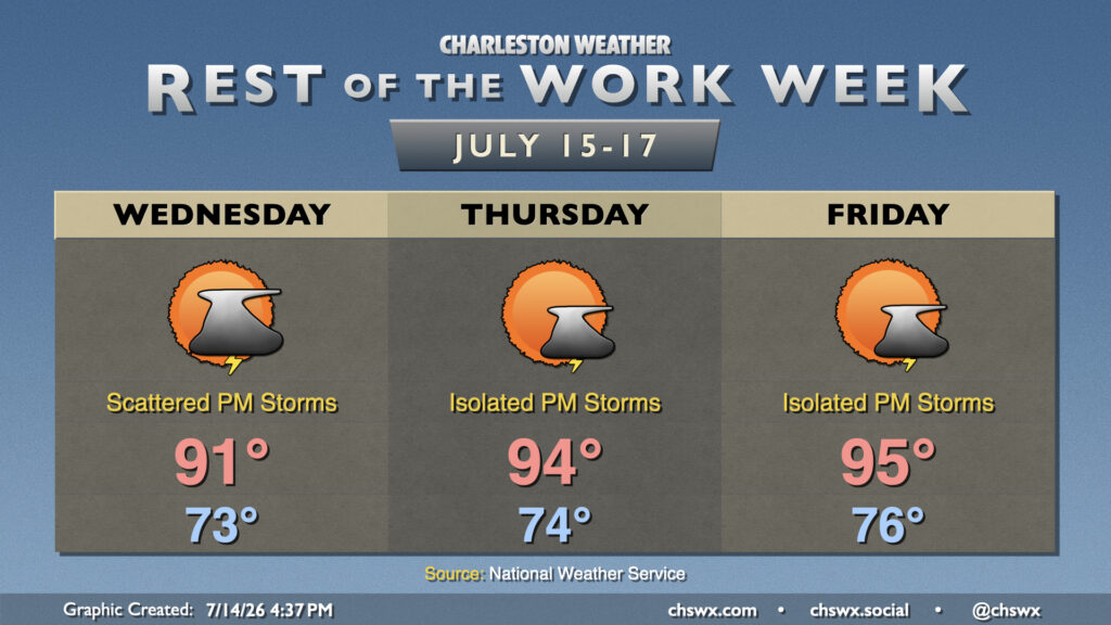
The pattern turns a little more settled as high pressure builds back in aloft. As a result, we will see more sunshine as the week progresses, though with that will come warmer temperatures, too, which could push Heat Advisory thresholds in spots.
Read more »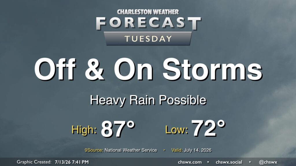
Showers and thunderstorms will feature prominently in the forecast on Tuesday as they develop around a stalled boundary lingering to the south. Periods of heavy rain will be possible, and an area or two of freshwater flooding can’t be totally ruled out. However, severe weather is unlikely, and this will largely be a beneficial rainfall event. Even better, highs should peak below 90° for the first time since June 24. So, even though there will be rain, it’ll be awfully nice to not be baking.
The main flooding concern arrives with the evening high tide; minor to moderate coastal flooding will be possible between 7-10 PM. We’ll need to monitor where the rain is carefully; any rain that coincides will cause issues downtown.
Read more »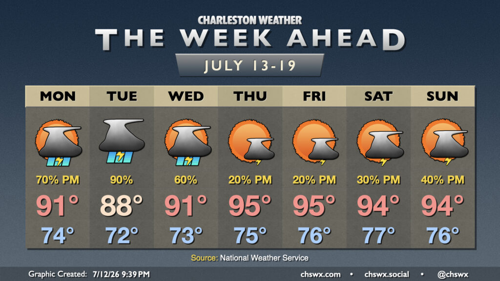
After a week of consecutive heat headlines, whether they be Heat Advisories or Extreme Heat Warnings, a front dropping in from the north — and the accompanying unsettled weather — will take the edge off the heat for at least a few days.
Read more »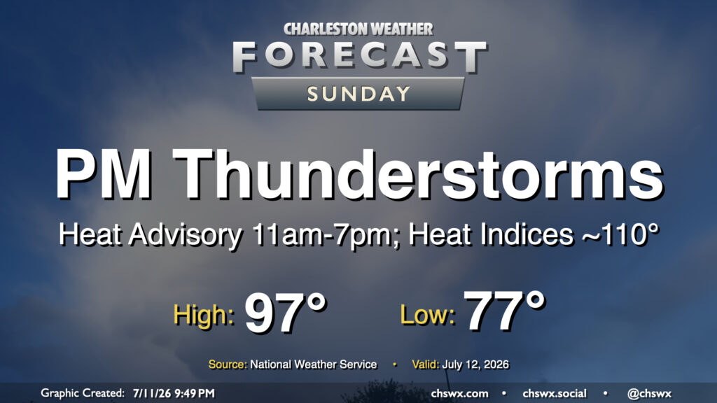
A slower frontal progression from the north will allow air temperatures to head back into the mid-to-upper 90s on Sunday, prompting another round of Heat Advisories and juicing up the atmosphere for another round of strong to potentially severe thunderstorms in the afternoon and evening.
Read more »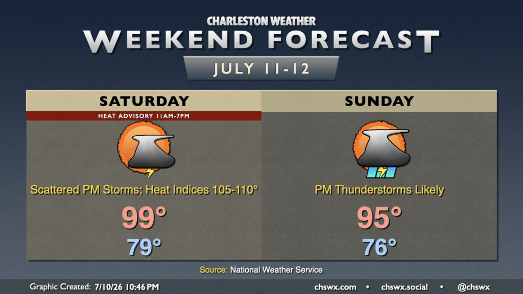
After another 99° day at the airport, we’ll take one more run at the century mark on Saturday before a front drops toward the area on Sunday, bringing about more unsettled weather that will keep temperatures a little more in check.
Read more »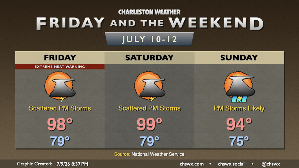
Charleston International Airport hit 100° today. It’s the first century-mark temperature reading there since May 29, 2019. There will be a couple more opportunities to get back there before the pattern changes to something more unsettled and cooler late this weekend into next week.
Read more »