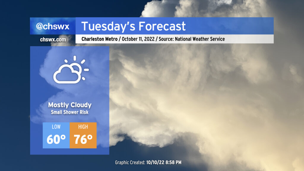
Not much weather to write home about for Tuesday as we get one more mostly dry day in ahead of a cold front which should bring the most substantial rain since Ian to the area for later Wednesday into Thursday. Cloud cover blanketing the area will help keep lows elevated to around 60° to start the day. Breezy onshore winds and continued cloud cover will keep high temperatures capped in the mid-70s. Much as we saw today, there is a small chance of a shower or two in the afternoon, but these won’t be horribly disruptive and should be short-lived if they do end up firing.
Another round of minor to moderate coastal flooding will be possible a couple hours around the predicted 9:40am high tide. Be ready to use alternate routes in case of flooded or closed roads in downtown Charleston.
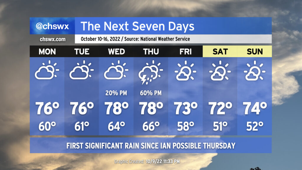
On balance, the week ahead will be primarily quiet weather-wise, with the exception of Thursday as a cold front presses through the area, bringing along some showers and thunderstorms. Highs through Thursday will remain a little below normal, generally running in the mid-to-upper 70s. Conversely, cloud cover and increased moisture will keep lows at or a little above normal through Thursday morning, with lows in the mid-60s expected Wednesday and Thursday right ahead of the front.
The weather on Thursday could bear watching for a few stronger storms depending on how much instability can develop. We’ll have good wind shear in place, but the instability — as is often the case as we head into the cool season — is going to be the main question mark. More likely, though, Thursday will represent the first significant rain for the area since Hurricane Ian, though amounts certainly won’t approach Ian-like numbers.
Once the front is through, we will see cloud cover decrease and temperatures once again head well below normal for Friday and the weekend, which is looking pretty good. Highs through this period will run in the low 70s, while lows will bottom out in the upper 50s Friday and the low 50s Saturday and Sunday, several degrees below normal for this point in the year.
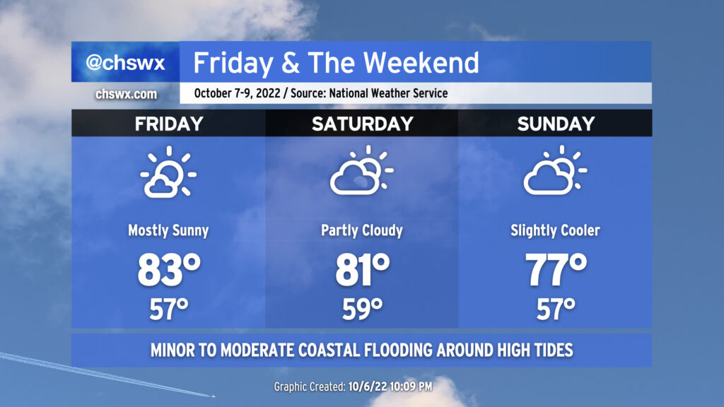
We stay seasonably warm for Friday & the weekend, even with a cold front swinging through later Saturday. Friday’s going to be the warmest day of the set with the most unencumbered sunshine and some compressional heating ahead of the cold front helping to drive highs to around the low to mid-80s. A few more clouds will mark the approach and passage of the front Saturday, but no rain is expected; expect temperatures back in the low 80s ahead of the front Saturday afternoon. Winds go northeasterly on Sunday and will help to cool things down a touch. Expect highs to run in the upper 70s, generally a few clicks below early-to-mid-October normals, but not quite the chill we saw in the immediate wake of Ian last week.
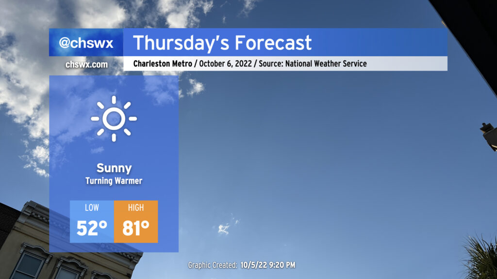
Thursday will be another nice weather day across the area with a seasonable chill to start and comfortable warmth to finish. Lows will once again start in the low-to-mid-50s away from the warmer coastline, but plentiful and virtually unobscured sunshine combined with winds generally out of the southwest will help temperatures reach the low 80s in the afternoon, right on the nose for early-October climatology. Should be a nice day for getting out and about!
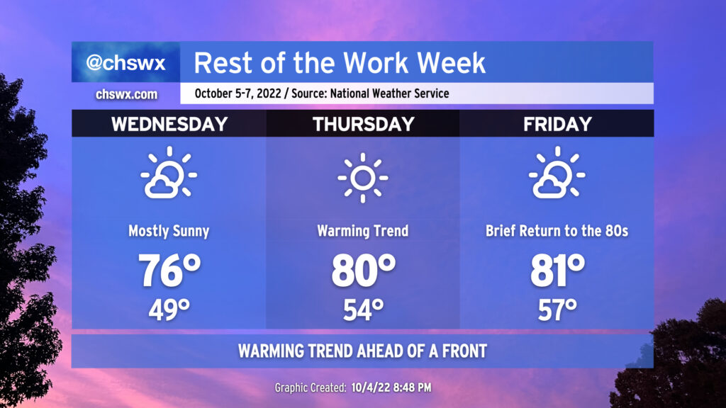
We’ve got another chilly start coming up on Wednesday morning as clear skies and light winds allow for good radiational cooling conditions. We should see temperatures take a dip back into the upper 40s by daybreak (away from the barrier islands and downtown, anyway). From there, a warming trend will commence as a pesky trough associated with the remnants of Ian (yes, really) finally begins to lift away from the area. High pressure will continue to build in from the west, and the resulting downslope flow will begin to help warm temperatures in earnest. Wednesday’s high will top out in the mid-70s under mostly sunny skies. The warming trend continues into Thursday and Friday, with lows bottoming out in the mid-50s and highs reaching around 80-81° each afternoon ahead of a cold front which will swing through Saturday, sending temperatures well back below normal for this point in October by Sunday and the following week. No rainfall is expected; indeed, quite the contrary as mostly sunny skies will continue to dominate.
The only weather hazard of note will be the potential for coastal flooding with the afternoon high tides particularly Thursday and again on Friday (and likely through the weekend) as the moon turns full. Southwesterly winds will keep any coastal flooding to a dull roar Wednesday and Thursday, but we may see water levels creep well into minor flood stage, perhaps approaching moderate flood Friday evening. As the front gets through on Saturday, winds turn northeasterly, which is a very favorable wind direction for coastal flooding, so we’ll need to continue to monitor evening high tides through the weekend for additional rounds of coastal flooding.
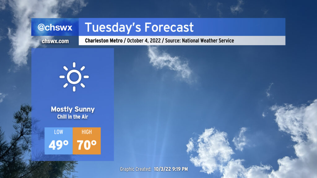
If you liked Monday’s temperatures but would prefer more sun, Tuesday will have you covered. Skies are clearing as I write this post, and we will have a much brighter day ahead. More clear skies will allow temperatures to fall into the upper 40s across much of the metro area away from the immediate coast. The NWS forecast will be around 49°; if that verifies, that would be the first sub-50° low since it was 46° on May 10. Temperatures will rebound only to about 70° despite nearly full sunshine as we sit on the southern periphery of a deep trough of low pressure aloft and a northerly breeze keeps cool air filtering in.
The only potential snag in tomorrow’s weather will be the potential for a little coastal flooding with the mid-afternoon high tide. We might see some salt water coming out of drains around Lockwood Dr. as well as on Hagood and Fishburne near the Joe and Johnson Hagood Stadium. However, a widespread tidal flooding event is not expected.
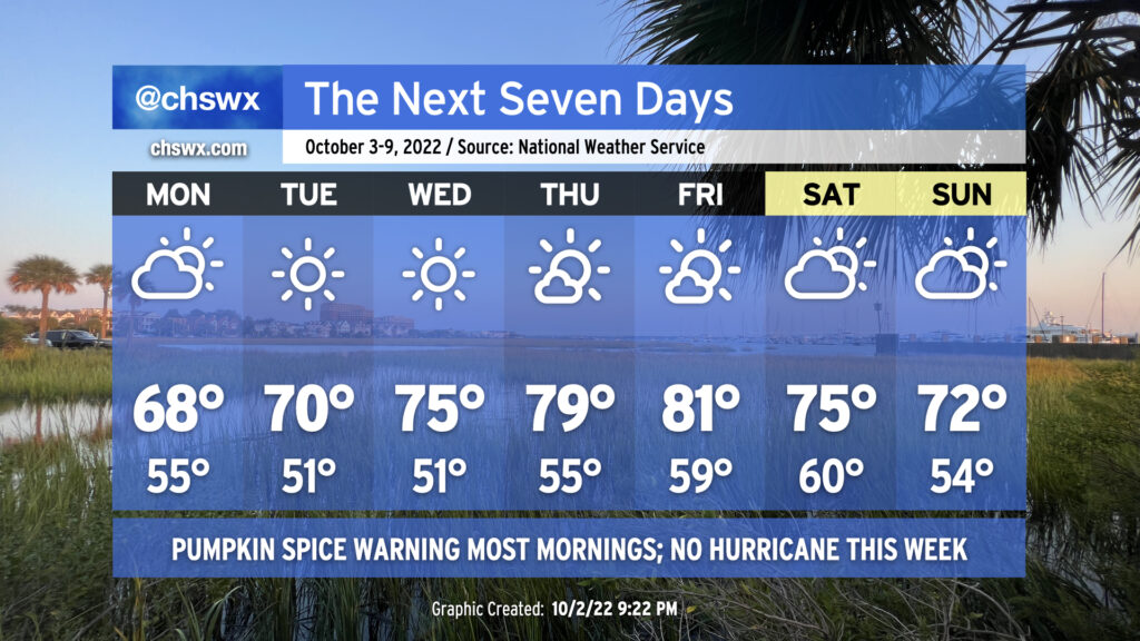
So first and foremost: There will be no hurricane this week. Quite the opposite, in fact: it should be a very nice week of weather, with a little something for everyone — sweater fans will love Monday in particular, while by mid-week we’ll be comfortably warm before a dry cold front knocks temperatures back over the weekend.
Cloud cover will be persistent on Monday (with a tiny chance of a shower), keeping temperatures perhaps limited to the upper 60s. Cloud cover should scour out by Tuesday as a warming trend takes hold under sunny skies. We’ll be in the upper 70s to low 80s by Thursday and Friday ahead of the frontal passage. The front will be moisture-starved as it passes through on Saturday, likely only being able to yield an increase in cloud cover for the weekend, but we look to remain rain-free. Saturday looks to run a little warmer than Sunday right now, but both days should be excellent to get outdoors.
The only weather concern of note will be the potential for minor coastal flooding with the afternoon high tides. The moon will be at perigee (passing closer to Earth) approaching a full moon on October 9, which will help increase the water levels during times of high tide. Northerly wind directions will help keep these tides from getting out of hand, though as high pressure wedges southward over the weekend and winds turn more northeasterly, we may see some higher water levels. Stay tuned as those details work out.
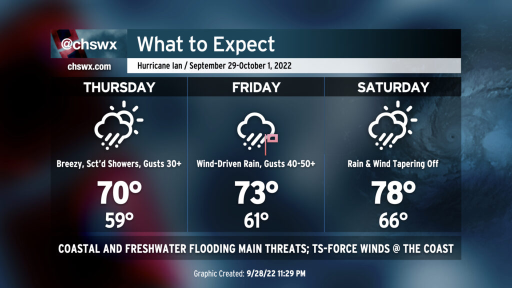
Ian’s impacts will be felt most on Friday as the center of the storm makes its closest approach to the Charleston metro area. Ian, once again a hurricane with 85 MPH maximum sustained winds, has seen several shifts in its forecast track throughout the day, moving the forecast landfall point from Beaufort this morning to Georgetown this evening. Charleston now sits on the western fringe of the error cone — a more southerly landfall cannot yet be ruled out — but it increasingly looks like we will spend time on the western side of the storm. This will reduce the tornado threat to nearly zero and should act to blunt the impacts of storm surge as well (but may not totally eliminate it, either). However, as Ian has started to take on a more hybrid structure — less of a tropical cyclone and more of a cold-core low — it is likely that the wettest and even windiest part of the storm may be the northwest side. So, while we might miss out on more of the severe storm surge impacts, the specter of more residence time with heavy rain certainly looms large.
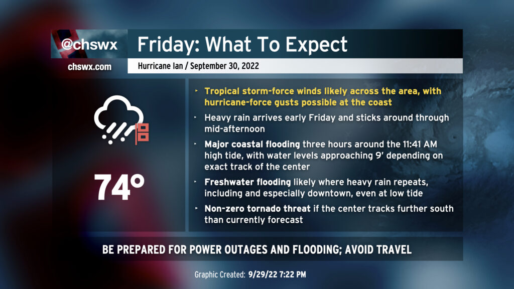
Based on the 11PM advisory, here’s what you can expect for Friday:
Heavy rain for much of the day, especially in the morning through early afternoon. Several inches of rain are anticipated, with the possibility of some unlucky spots exceeding 10″. This heavy rain should be enough to overwhelm drainage in downtown Charleston without much assistance from the tide. Heavy rain won’t be limited to the coast, either; be ready for freshwater flooding issues in places like Summerville and around Northwoods in North Charleston.
High tide around 11:41 AM should add salt water flooding to the mix. The extent is highly dependent on the center. For now, the NWS forecast is 9′ MLLW — it would be only the fifth time on record that the water level exceeds 9′ in the harbor — but given current trends, it is possible this may be revised downward. (The opposite is true if the landfall point once again looks to be a little further south.)
Ian’s massive wind field will produce tropical storm-force wind gusts for many of us especially as the center passes by, with sustained tropical storm-force winds possible for a few hours at the coast as well as in downtown Charleston and on barrier islands. The highest winds will be found at the coast, where hurricane conditions are possible. Generally speaking, prepare for 40-50 MPH wind gusts across inland areas, and gusts approaching 70-80 MPH at the beaches. This wind will certainly cause some power outage issues — be prepared for these to last a little while as winds could be too high for crews to come out until later.
The tornado threat across the Charleston area has diminished substantially. Unless the track shifts back southward, we should be tornado-free on Friday. 🎉
Overall, cautious optimism is key. If the center should shift back a little more southwestward toward our location, we could see an increase in these impacts, particularly when it comes to surge.
Ian will wind down quickly after landfall, and by Saturday dry air will be punching in, shutting off a vast majority of the rain (a shower or two can’t be ruled out) and bringing the sun back out, with highs in the upper 70s expected.
Bottom line: Hunker down tomorrow and hang in there — it’ll be over before you know it.
We are breezy but rain-free this evening as dry high pressure remains in control of our weather. It will hang on for a bit for the first part of Thursday, but a gradual deterioration in weather will begin in the afternoon. It’s a good time to finish gathering supplies for a rough period of weather beginning later Thursday through Saturday morning.
Wednesday will likely represent the last really decent weather day across the Lowcountry before winds begin to turn much more breezy as Ian approaches the area starting Thursday. (A Tropical Storm Warning is now in effect, too.) It’ll be a good day to bring things in from outdoors, check on your batteries, flashlights, and weather radios, and if in a flood-prone area, sandbag property appropriately if needed. We’re in for what might be a tricky few days…but it’s nothing we won’t be able to handle, either.
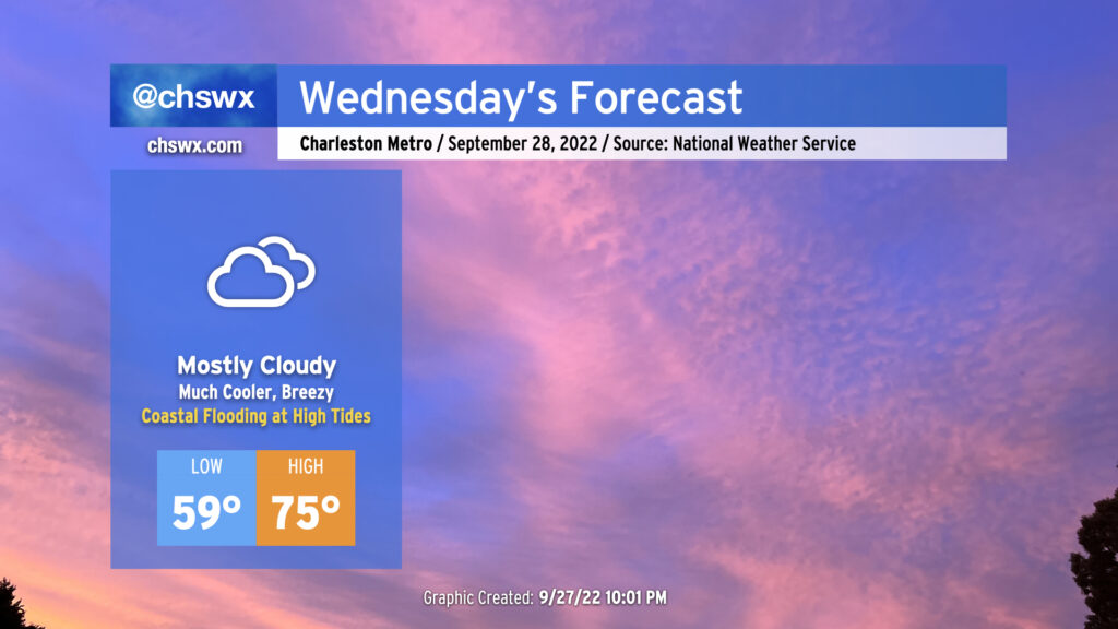
It’s gonna feel a lot cooler Wednesday, that’s for sure, as high pressure builds in from the north. Winds will turn northeasterly and be gusty at times, with gusts around 25-30 MPH possible, higher closer to the coast. Temperatures will start out in the upper 50s and stay cool, with mid-70s at best with thickening cloud cover ahead of Ian blanketing the skies. We stay rain-free thanks to a deep layer of dry air closer to the surface, however.
Minor coastal flooding will be a concern with the 10:07am and 10:17pm high tides as the northeasterly flow around high pressure to the north drives water levels higher. This could be enough to close a couple roads in the more vulnerable areas, such as around Gadsden Creek. Major disruptions to travel aren’t anticipated, however.